MyTopo
Montana Mountain Goat GMU 415 Map
Couldn't load pickup availability
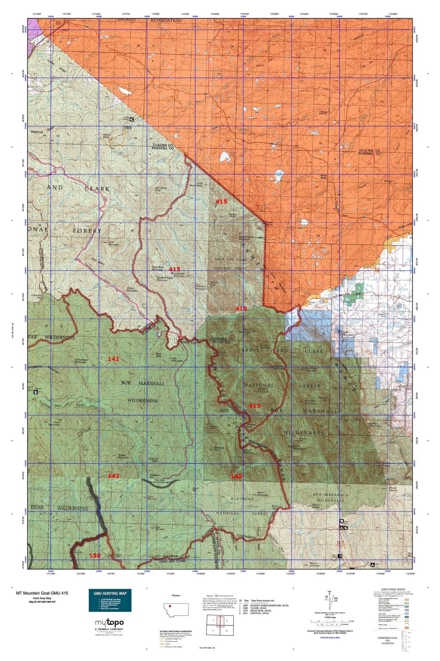
Hunting unit map of Montana Game Management Unit MG-415 with topographic lines and unit boundaries. This topo map features UTM / MGRS and Latitude/Longitude grids, plus public land ownership. It comes folded on waterproof paper. Be fully prepared for your hunt with a MyTopo GMU map!.
This map contains the following named places: 28N10W22DDCA01 Spring,30N09W17BADA01 Well,30N09W21CABB01 Well,30N11W25CABB01 Spring,30N12W13CCBB01 Well,31N11W36DCDB01 Well,Badger Guard Station,Badger Pass,Bear Peak,Beaver Lake,Bennie Creek,Bennie Hill,Big River Meadows,Big Spring Lake,Bighorn Mountain,Bite Coulee,Blackfeet Reservation West Division,Blind Creek,Bloody Hill,Blue Lake,Bowl Creek,Bowl Divide Trail,Bowl Mountain,Bruce Creek,Bruin Peaks,Bum Shot Mountain,Burnt Creek,Calbick Creek,Calbick Creek Trail,Canyon Creek,Cap Mountain,Circus Creek,Clack Creek,Clack Mountain,Cody Lake,Coon Creek,Corrugate Ridge,Cox Creek,Crazy Creek,Crooked Mountain,Crucifixion Creek,Cruiser Mountain,Curly Bear Mountain,Deep Creek,Deep Lake,Dog Gun Lake,Drumming Creek,Dry Creek,Eagle Creek,East Fork North Fork Teton River,East Fork Strawberry Creek,Elbow Creek,Elbow Mountain,Emerald Lake,Family Peak,Feather Woman Mountain,Field Creek,Fish Creek,Fish Lake,Fish Lake Dam,Fright Creek,Gable Peaks,Gateway Cabin,Gateway Creek,Gateway Gorge,Gateway Pass,Gateway Points,Goat Mountain,Goofy Gulch,Gooseberry Park,Green Lake,Green Lake Dam,Grimsley Creek,Grimsley Park,Grizzly Park,Half Dome Crag,Happy Creek,Hay Coulee,Haywood Creek,Heart Butte,Heart Butte Census Designated Place,Heart Butte Fire Department,Heart Butte Post Office,Heart Butte Public Schools,Hell Roaring Spring,Hidden Lake,Horn Lake,Howes Lakes,Hoy Gulch,Hungry Man Creek,Hurricane Mountain,Indian Health Service - Heart Butte Clinic,Jeff Creek,Judy Creek,Kid Creek,Killem Horse Creek,Killem Quick Creek,Kip Creek,Kiyo Crag,Kiyo Crag Lake,Lake Creek,Lee Creek,Limestone Creek,Little Badger Forest Service Station,Little Plume Peak,Lonesome Creek,Lookout Creek,Lookout Ridge,Lost Horse Camp,Lost Horse Creek,Major Steele Backbone,Middle Fork Birch Creek,Miller Ditch,Minnie White Horse Lake,Mitten Lake,Morningstar Mountain,Mount Baldy,Mount Drouillard,Mount Field,Mount May,Mount Patrick Gass,Mount Poia,Mount Richmond,Mount Sentinel,Mount Wright,Mowitch Basin,Muskrat Creek,Muskrat Creek Trail,Muskrat Pass,My Creek,Nanny Creek,North Badger Creek,North Badger-Elbow Creek Trail,North Fork Birch Creek,North Fork Little Badger Creek,North Fork Whitetail Creek,Pale Creek,Palookaville,Park Creek,Phillips Creek,Phone Creek,Pinky Creek,Pinto Creek,Pondera County Waterfowl Production Area,Post Creek,Potshot Creek,Punch Creek,Red Poacher Creek,Ringer Mountain,Round Lake,Runner Gulch,Saint Anne Cemetery,Saint Anne Parish,Sawmill Creek,Sawtooth Range,Scalp Creek,Scarface Mountain,Shin Creek,Slideout Peak,Slippery Hoof Creek,Slippery Hoof Lake,Small Creek,South Badger Creek,South Creek,South Fork Birch Creek,South Fork Blacktail Creek,South Fork Little Badger Creek,South Fork Trail Creek,South Fork Two Medicine River,South Fork Whitetail Creek,Spike Creek,Split Mountain,Spotted Eagle Mountain,Steedling Creek,Steep Creek,Strawberry Creek,Swift Dam,Swift Dam Trailhead,Swift Dike,Swift Reservoir,Swims Under School,Switchback Creek,Teton Pass,Trail Creek,Trapper Gulch,Trilobite Lakes,Trilobite Peak,Tubby Creek,Twin Lake Dam,Twin Lakes,Waddel Lakes,Walling Reef,Wapiti Park,Washout Creek,Whiterock Creek,Winter Creek,Winter Points


