MyTopo
Montana Moose GMU 125 Map
Couldn't load pickup availability
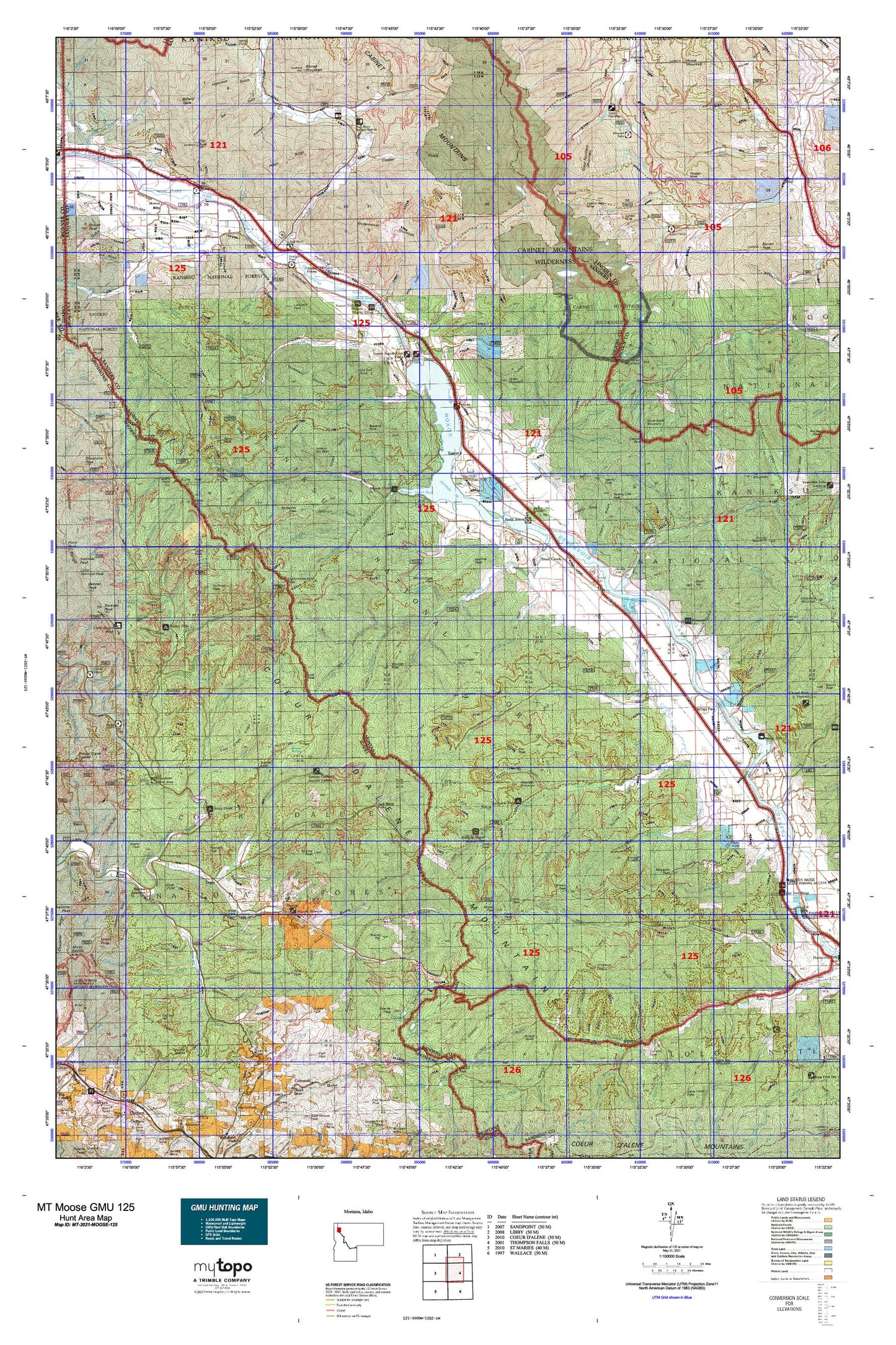
Hunting unit map of Montana Game Management Unit MOOSE-125 with topographic lines and unit boundaries. This topo map features UTM / MGRS and Latitude/Longitude grids, plus public land ownership. It comes folded on waterproof paper. Be fully prepared for your hunt with a MyTopo GMU map!.
This map contains the following named places: Alger,Andys Knob,Antimony Creek,Attlebury Creek,Avery Creek Picnic Area,Bald Eagle Peak,Baree Creek,Baree Lake,Baree Mountain,Basin Creek,Bear Creek,Bear Lakes,Beaver Lake,Beaver Peak,Beaver Station,Beecher Peak,Berlin Flats,Berry Lake,Big Beaver Creek,Big Cut,Big Eddy Creek,Billiard Table,Black Peak,Blacktail Creek,Bloom Peak,Blossom Lakes,Bobtail Peak,Bottle Point,Bramlet Creek,Bramlet Lake,Buck Lake,Bull River,Bull River Campground,Bull River Guard Station,Bull River Recreation Site,Burnt Bridge Creek,Burton Creek,Cabin Peak,Cabinet Gorge Reservoir,Cabinet Gorge RV and Recreation,Canyon Creek,Canyon Peak,Capital Hill,Carbon Center,Carney Peak,Cascade Creek,Caseys,Cataract Creek,Chicago Creek,Chicago Peak,Childs,Chimney Rock,Clear Peak,Cliff Lake,Cole Creek,Copper Lake,Daisy Creek,Deep Creek,Delta,Demont Creek,Devil Run,Dixie Creek,Dixie Peak,Dons Mountain,Driveway Peak,Duthie,Eagle,East Fork Bull River,East Fork McKay Creek,East Fork Trout Creek,East Lake,Eightmile Peak,Eighty Peak,Eightyseven Mile Peak,Elephant Peak,Elk Creek,Emma Creek,Emma Peak,Engle Lake,Engle Peak,Falls Creek,Ferguson,Fir Creek,Flat Top Mountain,Fourth of July Creek,Fulkerson Peak,Furlong,Galena Creek,Geiger Lakes,Gem Creek,Gem Peak,Gem Peak Lookout,Goat Creek,Goat Peak,Goose Peak,Government Creek,Government Mountain,Granite Creek,Granite Peak,Great Northern Mountain,Green Mountain,Haines Point,Halfway House Historical Site,Halfway House Historical SIte,Hawkseye Camp,Haystack Mountain,Helwick Peak,Hereford Restaurant Campground,Heron,Horseshoe Peak,Howard Creek,Howard Lake,Howard Lake Campground,Huckleberry Mountain,Hulliman Peak,Idaho Point,Iron Meadow Creek,Isabella Creek,Isabella Lake,Jack Pine Flats Campground,Jack Waite Forks,Jew Creek,Jew Peak,Johns Mountain,Kaniksu National Forest,Kings Point,Kismet Creek,Lake Creek,Lake Creek Campground,Larch Creek,Larch Point,Larchwood,Libby Lakes,Lion Creek,Little Baldy,Little Beaver Creek,Little Haystack,Little Trout Creek,Littlefield,Lone Cliff,Lost Branch,Lost Girl Creek,Lost Horse Mountain,Lost Peak,Loveland Peak,Maple Peak,Marten Creek,McKay Creek,McNeeley Creek,McNeeley Peak,Midas Point,Mill Creek,Miller Creek,Minton Creek,Minton Peak,Minton Peak Lookout Station,Moderie,Montana City,Mosquito Peak,Mountain House Historic Site,Murray,Murray Peak,Ninetythree Mile Lake,North Branch Marten Creek,North Creek,North Fork Clear Creek,North Fork McKay Creek,North Fork Miller Creek,North Fork Silver Butte Creek,North Shore Campground,Noxon,Noxon Rapids Reservoir,Noxon Reservoir,Noxon Siding,Ojibway Peak,Ozette Lake,Pony Peak,Prichard Peak,Proctor,Ramsey Lake,Raven,Revett Lake,Richards,Rock Island,Rock Lake,Rock Peak,Round Top,Russelville,Saint Paul Lake,Saint Paul Peak,Schulder,Sex Peak,Sex Peak Lookout Station,Shaw Mountain,Shoshone Camp Work Center,Shoshone Creek Guard Station,Shoshone Forest Camp,Silver Butte Mountain,Smead,Standard Lake,Star Peak,Star Peak Lookout Station,Stevens Peak,Sullivan,Sunset,Sunset Peak,Taylor Peak,Teeters Peak,The Rock Hill,Thiard,Thompson Falls-West End Division,Thompson Point,Trout Creek,Trout Creek Campground,Trout Creek Motel and RV Park,Trout Creek Ranger Station,Tuscor,Tuscor Hill,Twenty Odd,Twenty Odd Peak,Twenty Peak,Twentyfour Mile Creek,Twentythree Mile Creek,Twin Peaks,Ulm Peak,United States Forest Service Fire Station,Upper Bramlet Lake,Upper Lake,Wanless Lake,Water Hill,Weares Spur,White Pine,White Pine Station,Windfall Peak,Woodchuck Peak


