MyTopo
Montana Moose GMU 291 Map
Couldn't load pickup availability
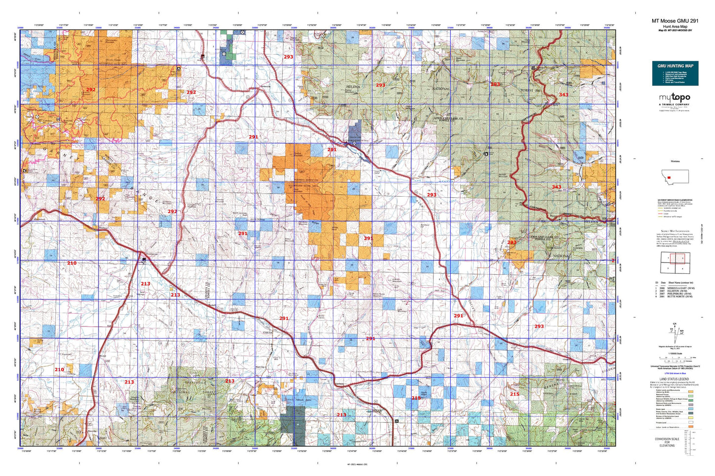
Hunting unit map of Montana Game Management Unit MOOSE-291 with topographic lines and unit boundaries. This topo map features UTM / MGRS and Latitude/Longitude grids, plus public land ownership. It comes folded on waterproof paper. Be fully prepared for your hunt with a MyTopo GMU map!.
This map contains the following named places: 59713,59731,59733,59832,59837,59843,Achegan Mine,Allen Dale Ditch,Allendale Ditch,American Gulch,Antelope Hill,Avon,Avon Rest Area,Avon-Elliston Division,Bailey Mountain,Ballarat Creek,Barnes Creek,Bear Creek,Beaver Pond,Bert Creek,Big Bend,Bilk,Black Bear Creek,Blackfoot City,Blackfoot Mine,Blum Creek,Boston Mine,Bradley,Bradman,Braziel Creek,Braziel Lake,Brock Creek,Byrne Creek,Campbell Mountain,Cardinal Mine,Carpenter Creek,Carten Creek,Chicken Creek,Chimney Creek,Chimney Lakes,Clear Creek,Conn Ranch,Cooper Creek,Cow Creek,Crevice Creek,Dalton Mountain,Dandy Mine,Davidson Creek,Davis Creek,Deer Creek,Devil Mountain,Dixie,Dooley Ditch,Douglas Creek,Douglas Creek Cabin,Douglas Creek Canal,Douglas Mountain,Drummond,Dry Cottonwood Creek,Dunkleberg Creek,Dutton,East Fork Brock Creek,East Fork Creek,East Fork Indian Creek,Echo Valley Campground,Elephant,Elevation Mountain,Elk Swamp Creek,Emmettsburg,Fields,Finn,Finn Creek,Fish Creek/Electrum Mine,Fivemile Creek,Flint Creek,Forest Rose Mine,Gallagher Creek,Gambler Creek,Garrison,Gaskill Creek,Georgia Creek,Gimlet Creek,Gimlet Mine,Gird Creek,Gleason Creek,Gold Creek,Goldberg Reservoir,Goldcreek,Goldleaf Mine,Gough Creek,Gould Helmville Trail,Grant Mine,Gravely Mine,Gravely Mountain,Griffin Creek,Halfway Creek,Halfway House,Hall,Hall Creek,Harparanda Mine,Haskell,Hell Gate,Helmville,Henderson Creek,Higgins Mine,Hoffmans,Hoodoo Mountain,Hoover Creek,Huckleberry Creek,Hurd Creek,Independence Creek,Indian Creek,Jackson Park,Jackson Park Mine,Jefferson Creek,Jefferson Gulch,Jens,Jones Mountain,Keiley,Kelley Creek,King Mountain,Lehson Mine,Lingenpolter,Little Baldy,Little Blackfoot River,Lloyd,Lone Tree Hill,Lost Cabin,Lost Creek,Lower Willow Creek,Luke Mine,Luke Mountain,Manley Ranch,Mannix,McDonald,McDonald Creek,McGillvary,McKay Creek,Meade Creek,Middle Fork Mine,Middle Fork Spotted Dog Creek,Miller Lake,Mitchell Creek,Morris Creek,Mountain Mine,Mud Creek,Mullen,Murray Creek,NE NW Section 21 Mine,NE Section 15 Mine,Nevada Lake,Nevada Mountain,New Chicago,No Name Creek,North Chimney Peak,Number Five Ditch,Ogden Mountain,Old Baldy Mountain,Ophir Creek,Orwell,Ozan,Pearl Fraction Mine,Pearl Mine,Perkins Creek,Phosphate,Pikes Peak,Pikes Peak Creek,Pioneer,Placer Mine,Placer Mines,Pole Creek,Powell County,Quigley,Randalls,Red Cloud Mine,Redrock Mine,Relyea Mine,Reynolds City,Rhea City,Riverfront RV Park,Rock Creek,Roselle Mine,Saddle Mountain,SE Section 12 Mine,SE Section 14 Mine,SE Section 15 Mine,Sharkeyville,Sheep Creek,Sheldon Creek,Sherryl,Shingle Mill Creek,Sixmile Creek,Smart Creek,Snowflake Mine,Snowshoe Creek,South Chimney Peak,South Fork Cottonwood Creek,South Fork Poorman Creek,South Fork Spotted Dog Creek,Southern Flint Creek Valley Historical Marker,Spotted Dog Creek,Springtown,Stone,Strickland Creek,Sturgeon Creek,Sturgeon Mountain,Sugarloaf,SW NW Section 26 Mine,SW SE Section 24 Mine,SW Section 14 Mine,SW Section 7 Mine,The Eyebrow,Threemile Creek,Tigh Creek,Top O'Deep,Town of Drummond,Treasure State Mine,Trout Creek,Valley of a Thousand Haystacks Historical Marker,Wall City,Warm Spring Creek,Warm Springs Creek,Wasa Mine,Washington Creek,Washington Creek Mine,Washington Gulch,West Fork Indian Creek,West Fork Wet Cottonwood Creek,Wet Cottonwood Creek,White Rocks Mountain,Wiggins Mine,Willow Creek,Wilson Creek,Windy Rock,Yamhill


