MyTopo
Montana Moose GMU 314 Map
Couldn't load pickup availability
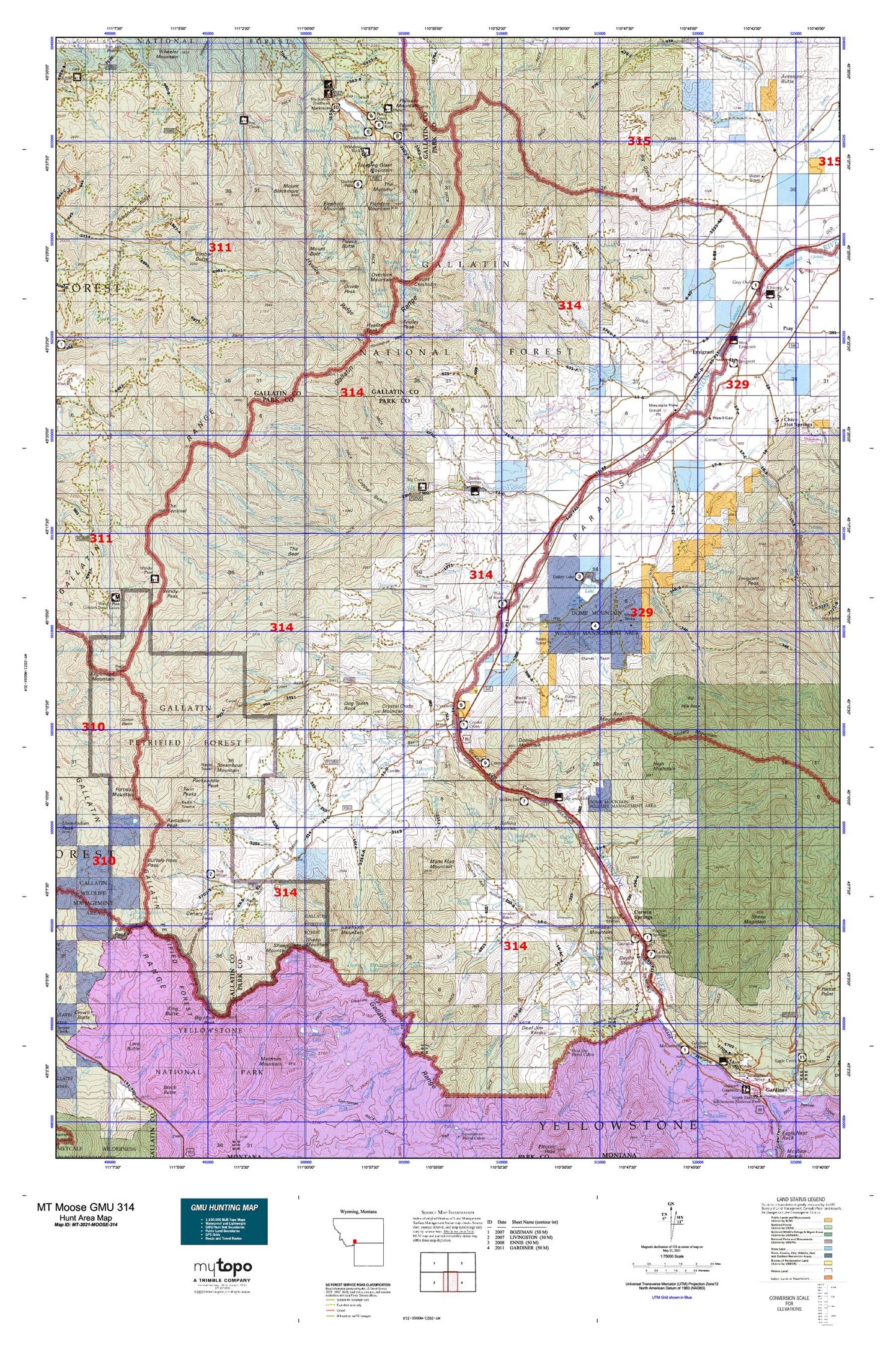
Hunting unit map of Montana Game Management Unit MOOSE-314 with topographic lines and unit boundaries. This topo map features UTM / MGRS and Latitude/Longitude grids, plus public land ownership. It comes folded on waterproof paper. Be fully prepared for your hunt with a MyTopo GMU map!.
This map contains the following named places: 59027,59065,Absaroka-Beartooth Wilderness Historical Marker,Aldridge,Aldridge Creek,Aldridge Lake,Alex Lowe Peak,Alpine Falls,Amber Butte,Apex Falls,Arch Falls,Arden Lake,Bark Cabin Creek,Bassett Creek,Bear Creek,Beatie Gulch,Big Bear Lake,Big Creek,Big Creek Station,Big Horn Peak,Big Pine Basin,Big Pine Creek,Black Mountain,Blackmore Campground,Blackmore Creek,Blackmore Lake,Bottlers Ranch,Butte Creek,Butte Meadows Camp,Butte Meadows Ranger Station,Canary Bird Peak,Canyon Creek,Carbella,Carbella Campground,Carbella Recreation Site,Cedar Creek,Champagne Falls,Chisholm Cabin,Chisholm Campground,Cinnabar,Cinnabar Basin,Cinnabar Creek,Cinnabar Mountain,Cliff Creek,Cooper Bench,Corwin Springs,Corwin Springs Fishing Access Site,Cottonwood Creek,Crag Lake,Crater Lake,Crescent Lake,Crystal Creek,Crystal Cross Mountain,Cupids Heart,Cutler Lake,Dailey,Dailey Basin,Dailey Lake,Dailey Lake Campground,Dailey Lake Fishing Access Site,Deaf Jim Creek,Deaf Jim Knob,Divide Creek,Divide Peak,Divide Trail,Dixon Creek,Dog Tooth Rock,Dome Mountain,Donahue Creek,Dry Creek,East Fork Hyalite Creek,Electric,Elephant Mountain,Emerald Lake,Emigant West Recreation Area,Emigrant,Emigrant Creek,Emigrant Fishing Access Site,Emigrant Gulch Historical Marker,Emigrant Peak,Emigrant Rest Area,Emigrant West Fishing Access Site,Evensdale,Ferrell Creek,Ferrell Lake,Fisher Creek,Flanders Creek,Flanders Lake,Flanders Mountain,Fox Creek,Fridley Creek,Fridley Lakes,Fridley Peak,Gallatin Petrified Forest,Glastonbury,Gold Prize Creek,Gold Run Creek,Golden Age Village Trailer Park,Goldmeyer Creek,Green Lake,Grizzly Creek,Heather Lake,Herron,High Lake,High Mountain,History Rock,Hood Creek,Hood Creek Campground,Hoppe Creek,Horse Creek,Horseshoe Basin,Hyalite Creek,Hyalite Lake,Hyalite Peak,Hyalite Reservoir,Jim Creek,Joe Brown Creek,Junior Hyalite Camp,King Butte,Kinor Peak,Kotke,LaDuke Spring Campground,LaDuke Springs,Lake Elsie,Lewis Creek,Lion Creek,Little Bear Creek,Little Donahue Creek,Little Joe Lake,Little Pine Creek,Little Trail Creek,Maid of the Mist Creek,Maid of the Mist Mountain,Maiden Basin,Mans Foot Mountain,Merrell Lake,Merriman,Middle Creek,Middle Fork Cottonwood Creek,Mill Creek,Mill Fork,Mill Mine,Miller Creek,Miner,Mist Creek,Moose Jaw Creek,Mount Blackmore,Mount Bole,Mount Chisholm,Mud Lake,Mulherin,Mulherin Creek,Needle Creek,Newton Camp,North Fork Cedar Creek,North Fork Cottonwood Creek,North Fork Eightmile Creek,North Fork Sixmile Creek,North Glastonbury,OTO Ranch,Overlook Mountain,Ox Yoke Ranch,Packsaddle Peak,Palace Butte,Palace Butte Campground,Palace Lake,Palisade Falls Picnic Area,Palisade Mountain,Pine Creek,Point of Rocks Fishing Access Site,Point Stupid,Pole Gulch Trail,Ramshorn Peak,Red Mountain,Red Rock Trail,Reeder Creek,Reese Creek,Rock Creek,Sand Spur,Sawtooth Mountain,Second Fork Cedar Creek,Sedge Lake,Shaft House Creek,Sharp Creek,Sheep Creek,Sheep Mountain,Shelf Lake,Shooting Star Lake,Shooting Star Mountain,Shower Creek,Sixmile Creek,Skully Creek,Sleeping Giant Mountain,Sliding Mountain,Slip and Slide Creek,Slip and Slide Fishing Access Site,Smokey Creek,Soldier Creek,South Fork Eightmile Creek,South Fork Swan Creek,South Glastonbury,Sphinx,Sphinx Creek,Sphinx Mountain,Spring Creek,Stands Basin,Steamboat Mountain,Steele Creek,Stoughten Creek,Sunlight Creek,Swim Lake,Tepee Creek,The Bear,The Mummy,The Sentinel,Timber Butte,Tom Miner Basin,Tom Miner Campground,Tom Miner Creek,Trail Creek,Trestle Ranch,Tulley and Lowrys Spur,Twin Lakes,Twin Peaks,Twin Peaks Creek,Walsh Creek,Wan-I- Gan,Wigwam Creek,Window Rock Station,Windy Pass Forest Service Station,Yankee Jim Campground and Picnic Area,Yankee Jim Canyon Point of Interest,Yankee Jim Lake,Yellowstone City,Yellowstone Edge RV Park


