MyTopo
Montana Moose GMU 415 Map
Couldn't load pickup availability
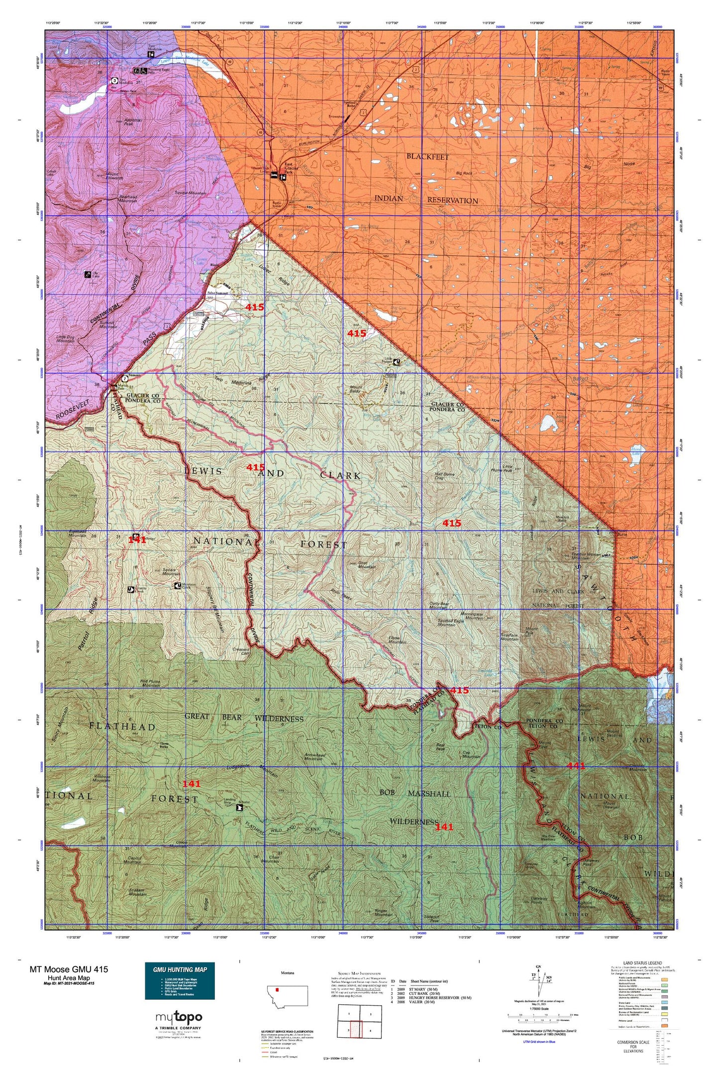
Hunting unit map of Montana Game Management Unit MOOSE-415 with topographic lines and unit boundaries. This topo map features UTM / MGRS and Latitude/Longitude grids, plus public land ownership. It comes folded on waterproof paper. Be fully prepared for your hunt with a MyTopo GMU map!.
This map contains the following named places: 30N11W25CABB01 Spring,30N12W13CCBB01 Well,31N11W24DCAA01 Spring,31N11W36DCDB01 Well,32N12W34CBCD01 Spring,32N12W36ADCC01 Spring,Arrowhead Mountain,Badger Guard Station,Badger Pass,Bald Hill,Bear Peak,Beaver Lake,Benson Creek,Big Lodge Mountain,Big Rock,Big Spring Lake,Bison,Bison Creek Ranch,Bison Mountain,Blind Creek,Blue Lake,Bore Creek,Box Creek,Bruin Peaks,Brushshack Creek,Buffalo Lakes,Bullshoe Mountain,Burnt Creek,Calbick Creek,Calbick Creek Trail,Calf Robe Mountain,Cap Mountain,Cataract,Challenge Cabin,Challenge Creek,Chapel of the Ascension,Coon Creek,Coonsa Creek,Cox Creek,Crescent Cliff,Crescent Creek,Crucifixion Creek,Curly Bear Mountain,Dancing Lady Mountain,Dawson Falls,Deep Creek,Dodge Creek,Dog Gun Lake,Dolly Varden Creek,Drumming Creek,Dry Creek,East Fork Strawberry Creek,East Fork Woods Creek,East Glacier Park,East Glacier Park Branch Library,East Glacier Park Cemetery,East Glacier Park Post Office,East Glacier Park School,East Glacier Park Village,East Glacier Park Village Census Designated Place,East Glacier Park Volunteer Fire Department,Elbow Creek,Elbow Mountain,Elk,Elk Creek,Elkcalf Mountain,Emerald Lake,False Summit,Family Peak,Feather Woman Mountain,Firebrand Campground,Firebrand Pass,Firebrand Pass Trail,Flattop Mountain,Fortymile Creek,Fortyone Mile Creek,Glacier Park,Glacier Park Autumn Creek Trail,Glacier Park Lodge Golf Course,Goat Mountain,Goofy Gulch,Granite-Morrison Trail,Green Lake,Half Dome Crag,Hall Creek,Helmet Point,Hyde Creek,Judy Creek,Killem Horse Creek,Killem Quick Creek,Kip Creek,Kiyo Crag,Kiyo Crag Lake,Lake Creek,Lee Creek,Lena Lake,Limestone Creek,Little Badger Forest Service Station,Little Plume Peak,Lodgepole Creek,Lodgepole Creek Trail,Lodgepole Mountain,Lonesome Creek,Lookout Creek,Lookout Ridge,Lost Horse Camp,Lost Horse Creek,Lost Shirt Creek,Lower Two Medicine Dam,Lower Two Medicine Lake,Lubec Lake,Lubec Post Office,Lubec Ridge,Magee Lake,Magee Ranch,Mettler Coulee,Midvale Creek,Midvale Creek Bridge,Miner Creek,Minnie White Horse Lake,Mitten Lake,Morning Eagle Lake,Morningstar Mountain,Morrison Creek,Mount Baldy,Mount Field,Mount Henry Trail,Mount Pablo,Mount Poia,Mowitch Basin,Muskrat Creek,Muskrat Creek Trail,Muskrat Pass,North Badger Creek,North Badger-Elbow Creek Trail,North Fork Little Badger Creek,Palookaville,Pike Creek,Pike Post Office,Pool Creek,Porter Creek,Punch Creek,Puzzle Creek,Puzzle Hills,Railroad Creek,Red Eagle-Two Medicine Campground,Red Plume Mountain,Red Plume Trail,Red Poacher Creek,Rising Wolf,Rising Wolf Resort,Rowe Creek,Runner Gulch,Running Crane Mountain,Running Owl Mountain,Sawmill Creek,Scarface Mountain,Scenic Point,Schafer Creek,Schafer Meadows,Schafer Ranger Station,Schafer/USFS Airport,Scott Lake,Sears Motel and Campground,Sidney Creek,Sign Creek,Skyland-Morrison Creek Trail,Skyland-Puzzle Creek Trail,Slippery Bill Mountain,Slippery Hoof Creek,Slippery Hoof Lake,Small Creek,Smileys RV Park,South Badger Creek,South Fork Little Badger Creek,South Fork Two Medicine River,Spike Creek,Spotted Eagle Mountain,Spotted Robe,Square Mountain,Stands Alone Woman Peak,Star Creek,Steep Creek,Summit Creek,Surprise Creek,Swims Under School,Tent Mountain,The Head,Three Forks,Three Forks Pack Bridge,Townsend Creek,Trapper Gulch,Tumbler Creek,Two Medicine Creek,Two Medicine Falls,Two Medicine Ridge,Two Medicine-Elk Calf Mountain National Recreation Trail,Wapiti Park,Whistler Creek,Whiterock Creek,Woods Creek,Y Lazy R RV Park


