MyTopo
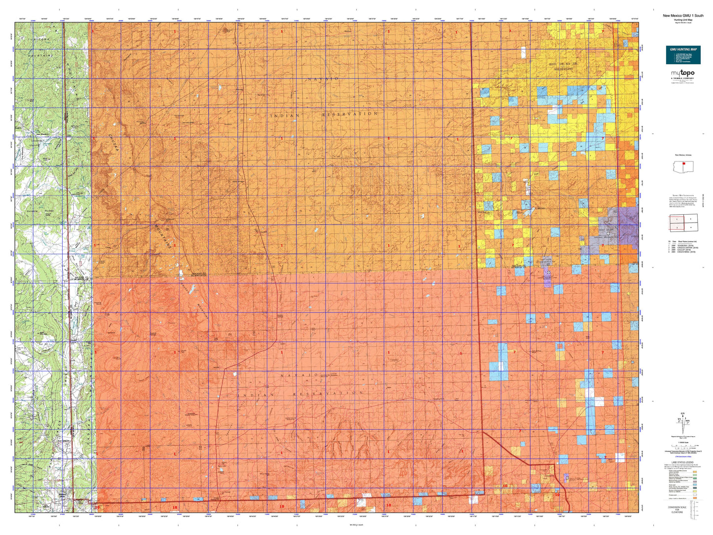
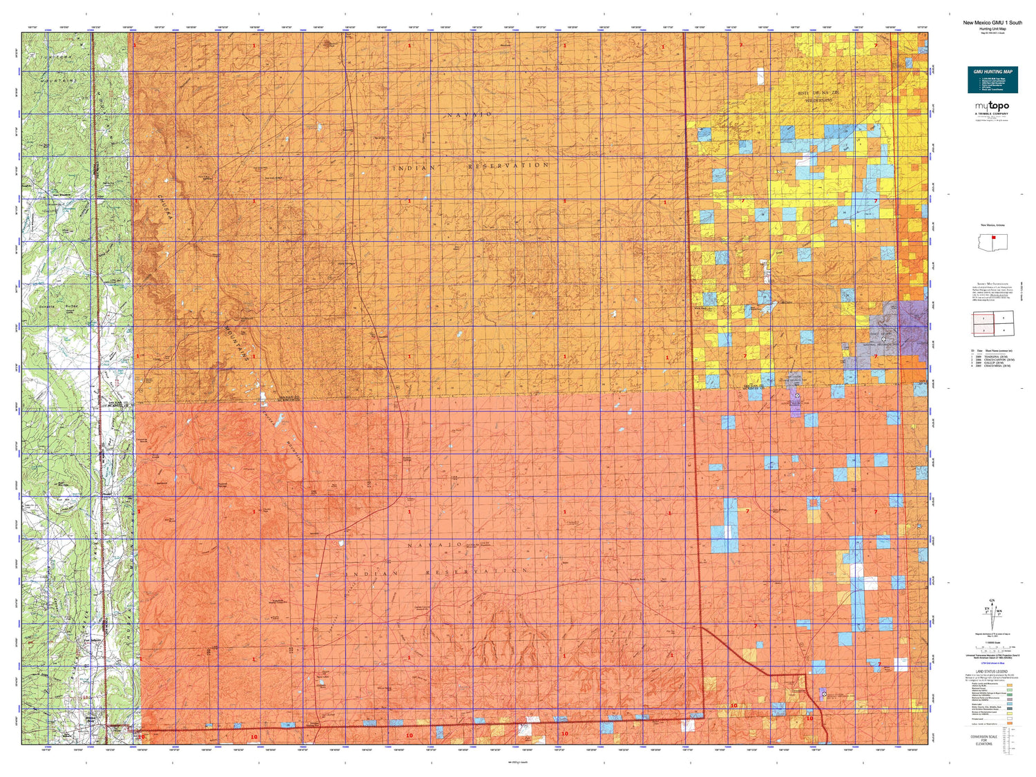
New Mexico GMU 1 South Map
Couldn't load pickup availability
Hunting unit map of New Mexico Game Management Unit 1-South with topographic lines and unit boundaries. This topo map features UTM / MGRS and Latitude/Longitude grids, plus public land ownership. It comes folded on waterproof paper. Be fully prepared for your hunt with a MyTopo GMU map!.
This map contains the following named places: 86504,86515,87310,87313,87320,87325,87328,87364,87375,Ah-shi-sle-pah Wash,Alamo Mesa,Alamo Wash,Antelope Lookout Mesa,Bass Lake,Becenti Chapter,Becenti Chapter House,Becenti Lake,Beelzebub,Benally,Berland Lake,Bisti Badlands,Bisti Clinic,Bisti Trading Post,Bisti/De-Na-Zin Wilderness,Black Creek,Black House,Black Lake,Black Rock,Black Springs Wash,Bonita Trading Post,Bonito Creek,Bowl Canyon Creek,Bowl Lake,Bowl Lake Campground,Brimhall Nizhoni,Buell Mountain,Buell Park,Buell Wash,Buffalo Springs,Burnham Chapter,Captain Tom Reservoir,Casa de Estrella Site Historic Site,Catron Wash,Cattail Wash,Chaco Wash Pit,Chee Dodge Ranch,Chuska Lake,Chuska Mountain,Chuska Peak,Chuska Wash,Coal Creek,Cold Spring Wash,Corral,Coyote Canyon,Coyote Canyon Chapter,Coyote Wash,Crownpoint,Crownpoint Chapter,Crystal,Crystal Chapter,Crystal Creek,Dalton Pass Chapter House,Dalton Pass Historic Site,Dalton Pass Trading Post,Damon Lake,Day Mesa,Deer Springs Creek,Deer Springs Wash,De-na-zin Wash,Deza Bluffs,Dodge Brothers,Dog Eye Pond,Dry Hill,Duclos Mine,Dye Brush Wash,Dzil Nda Kai Mountain,Figueredo Wash,Figuredo Wash,Flat Lake,Flat Top Hill,Fort Defiance,Fort Defiance Chapter,Fort Defiance Trading Post,Gallup Pumping Station,Gando Coal,Gossip Hill,Great Bend,Green Knobs,Grey Mesa,Hunter Wash,I K Ranch,Indian Creek,Jack Johnson,Jack Johnson Mine,Juans Lake,Kim-me-ni-oli Ruins,Kim-me-ni-oli Wash,Kin Klizhin,Kin Klizhin Wash,Kin Ya-ah,Lake Valley,Lake Valley Chapter,Lake Valley Chapter House,Lake Valley Historic Site,Leh-tso-bii-to Wash,Little Ear Mountain,Little Water Creek,Little Whiskey Creek,Little White Cone,Little White Cone Lake,Long Lake,Lower Wheatfields,Manuelito Plateau,McKinley Mine,Mexican Spring Wash,Mexican Springs,Mexican Springs Chapter,Mexican Springs Weather Station,Milk Lake,Milkwater,Muddy Wash,Nahodishgish Chapter,Nakaibito,Naschitti,Naschitti Chapter,Naschitti Division,Naschitti Wash,Navajo,Navajo Indian Reservation Historical Marker,Navajo Nation Division,Newcomb,Norcross Wash,North Fork Catron Wash,Nose Rock,Oak Creek,Palisade Creek,Piney Hill,Piney Hill Creek,Prairie Dog Valley,Quartzite Wash Reservoir,Red Butte,Red Hill,Red Lake,Red Lake Chapter,Red Pond,Red Water Pond,Red Willow Wash,Rock Wash,Rodeo Ground Corral,Sage Lake,Salt Springs Wash,Sawmill,Sawmill Chapter,Sawmill Trading Post,Sehili,Separate Hill,Seven Lakes Wash,Sheep Springs,Sheep Springs Chapter,Sheep Springs Pit,Sheep Springs Wash,Shillingburg,Shillingburg Mine,Sitting Coyote Mesa,Slick Rock,Slick Rock Wash,Sloping Meadow,Soft Water Wash,Sonsela Buttes,South Fork Bonito Creek,South Fork Catron Wash,Split Mesa,Squirrel Springs Wash,Standing Rock,Standing Rock Chapter,Standing Rock Pumping Station,Standing Rock Wash,Sterrett Mesa,Tanner Lake,Tiger Walkup Mesa,Toadlena,Toadlena Lake,Tocito Wash,Todacheene Lake,To-dil-hil Wash,Tohatchi,Tohatchi Chapter,Tohatchi Lookout,Tohatchi Village Site,Tohatchi Weather Station,Tohatchie Mine,Tohatchih Pit,Tohdildonih Wash,Toh-Ni-Tsa Lookout,Toyee,Trotz Construction Pit,Tsaile Butte,Tsaya,Tsaya Trading Post,Tse Bonito Campground,Tseanazti Creek,Tsin-nas-kid,Tuntsa Wash,Twin Buttes,Twin Buttes Wash,Twin Lakes,Twin Lakes Chapter,Two Grey Hills,Two Grey Hills Chapter,Umbrella Butte,Upper Wheatfields,Washington Pass Radar Site,Wheatfields,Wheatfields Lake,Whiskey Creek,Whiskey Lake,Whiskey Reservoir,White Clay Spring Wash,White Cone,White Rock,White Rock Chapter,Wilcoxon,Willow Wash,Windmill Number 2,Windmill Number 3,Windmill Number 4,Windmill Number 5,Windmill Number 6,Window Rock,Window Rock Coal Mine,Woolly Tommy Mine,Yellow Adobe Historic Site,Yellow Valley,Zilditloi Mountain,Zilditloi Wash


