MyTopo
Nevada GMU 043 Map
Couldn't load pickup availability
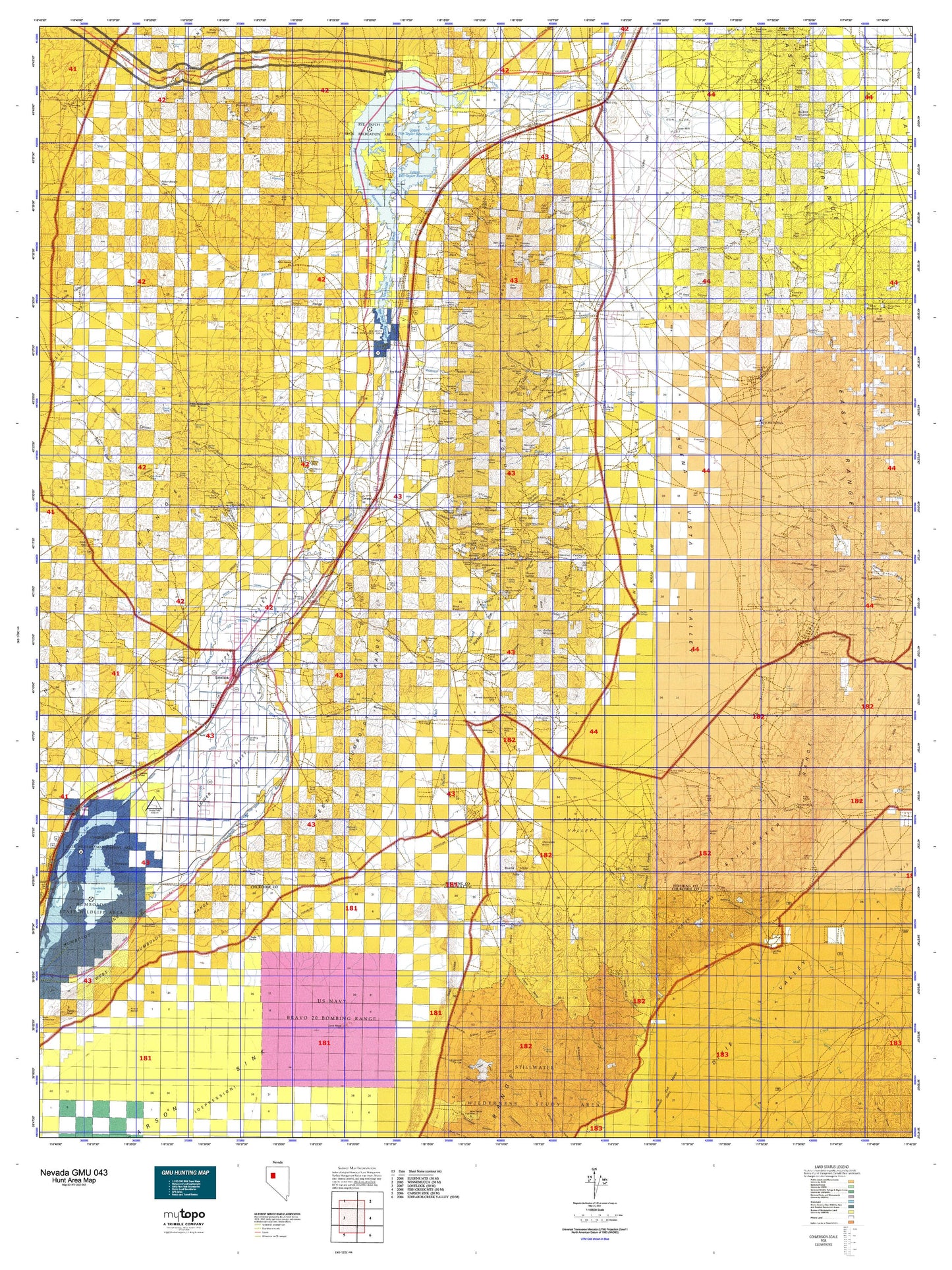
Hunting unit map of Nevada Game Management Unit 043 with topographic lines and unit boundaries. This topo map features UTM / MGRS and Latitude/Longitude grids, plus public land ownership. It comes folded on waterproof paper. Be fully prepared for your hunt with a MyTopo GMU map!.
This map contains the following named places: American Canyon,Anderson Ranch,Antelope Creek,Antelope Mining District,Antelope Springs Mining District,Arabia,Arabia Mining District,Arobio Ranch,Atoka,Auld Lang Syne Mill,Bar A-3 Ranch,Barbers Creek,Batavia and Pacific Mill,Belle Claims,Big Five Reservoir,Big Meadow Ranch,Big Slough,Black Knob,Black Knob Mining District,Black Rock Springs,Bolivia,Bonnie Briar,Boyer,Boyer Ranch,Buck and Charlie Mill,Buena Vista Hills,Buena Vista Windmill,Buffalo Mountain,Buffalo Station,C and M Ranch,Callahan Bridge,Cavanaugh Wash,Cedar Springs,Central Rochester,Cerini Ranch,Cherry Creek,Chocolate Butte,Circle L Ranch,City of Lovelock,Clarksville,Clemens,Colado,Cole Ranch,Congress Creek,Cooks,Cooper Kettle Mining District,Cornish Camp,Cornish Peak,Cottonwood Creek,Cottonwood Ranch,Coyote Creek,Coyote Ranch,Creek Hill,Crystal Lakes Trout Farm,Dad Lees,Davidson Ranch,Dixie,Dixie Valley Mining District,Dun Glen Creek,East Rochester,Eastside Picnic Area,Etna,Fairview Stage Station,Fencemaker Camp,Fitting,Floyd Canyon,Flying M Ranch,Folsom Ranch,Foltz,Fossil Hill,Frendesen Ranch,Gemville,Gold Butte Mining District,Gold Mountain,Golden Gate Hill,Golden Jacket Mines,Granite Mountain,Granite Peak,Granite Point,Halfway House,Hayden Ranch,Horse Canon Creek,Humboldt,Humboldt City,Humboldt Creek,Humboldt House,Humboldt Lake,Humboldt Queen,Humboldt Siding,Humboldt State Wildlife Management Area,Imlay,Imlay Division,Imlay Mining District,Independence Hill,Indian Creek,Indian Ikes Point,Indian Mining District,Indian Peak,Jacobs Well,Junction House,Junction Station,Kennedy Mining District,Kodak,Kyle Hot Springs,Lake Mining District,Lake Township,Lancaster,Lander City,Lee Peak,Lees Creek,Lima,Limerick,Limerick Wash,Lincoln Hill,Little Black Knob,Logan Peak,Lone Mountain,Lone Rock,Looney Mill,Loring,Lovelock,Lovelock Division,Lovelock Indian Colony,Lower Pitt-Taylor Reservoir,Lower Rochester,Lucky Lager Ranch,Majuba Mountain,Marble Creek,Mill City,Mineral Basin Mining District,Mineral Point,Mud Spring Creek,Munk Ranch,Murphys Station,Muttlebury Mining District,Nenzel Hill,Neptune City,Nevada Almaden Mines,Nevada Nile Copp Ranch,O'Neil Canon Creek,Oreana,Organ Peak,Packard,Packard Mill,Packard Wash,Pallens Wells,Panama,Pershing County,Perth,Phelps Creek,Pine Mountain,Pitt-Taylor Cove Boat Launch,Poker Brown,Poker Brown Camp,Poker Brown Crossing,Poker Brown Wash,Prince Royal,Red Hill,Relief,Rileyville,Ringling Ranch,River Campground,Rochester,Rochester Heights,Rochester Mines Company Mill,Rochester Mining District,Rockhill,Rockhill Mountain,Rockwell Station,Ruby,Rye Patch,Rye Patch Mining District,Rye Patch Ranch,Rye Patch Reservoir,Rye Patch State Recreation Area,Sacramento Mining District,Sacred Point,Saint Marys,Salinas Ranch,San Jacinto Mining District,San Joaquinto,Sanborn,Santa Clara,Sheba Mill,Sheppard Ranch,Sierra Mining District,Sooner Creek,Spring Branch,Spring Creek,Spring Valley Mining District,Star City,Star Creek,Star Creek Ranch,Star Mining District,Star Peak,Stevensville,Straub,Strief Ranch,Sunflower Hill,Table Mountain,Table Mountain Mining District,Thacker Camp,Thackers Ranch,Thornton Ranch,Thunder Mountain,Torreytown,Toulon,Toulon Lake,Trinity,Trinity Mining District,Tule Ranch,Twain,Unionville,Unionville Mining District,Upper Pitt-Taylor Reservoir,Uppertown,Valery,Van Zant Peak,Vanderwater,Weaver Hill,Westside Boat Launch,Westside Day Use Area,Wild Horse Mining District,Willard Mining District,Willow Creek,Willow Creek Mining District,Willow Creek Ranch,Willow Spring,Willow Springs,Woolsey,Yahi Knob,Yana Point,Young Ranch,Zimmershed Ranch,Zola


