MyTopo
Nevada GMU 046 Map
Couldn't load pickup availability
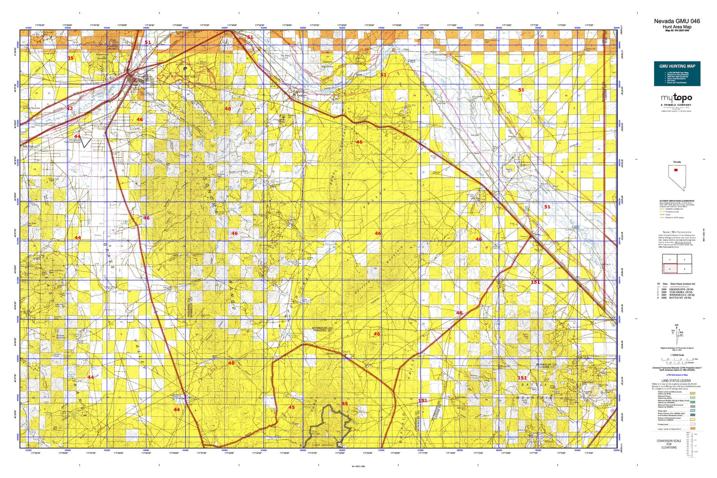
Hunting unit map of Nevada Game Management Unit 046 with topographic lines and unit boundaries. This topo map features UTM / MGRS and Latitude/Longitude grids, plus public land ownership. It comes folded on waterproof paper. Be fully prepared for your hunt with a MyTopo GMU map!.
This map contains the following named places: Adelaide,Adelaide Crown Mines,Adelaide Mine,Ames Spring,Antler Peak,Auburn Mine,Auld Lang Syne Gulch,Auld Lang Syne Mill,Auld Lang Syne Mine,Auld Lang Syne Peak,Bacon Canyon,Badger Canyon,Barber Canyon Mine,Barbersville,Bardmass Pass,Barrel Spring,Battle Mountain,Benin,Big Squaw Valley,Bill Majors Canyon,Black Diablo Mine,Black Diablo Mining District,Black Hole Mine,Black Rock Mine,Blackhawk Mine,Bonnie Briar,Borrel Spring,Broad Gulch Creek,Buckbrush Spring,Buffalo Mountain,Buffalo Valley,Buffalo Valley Mine,Buffalo Valley Mining District,China Canyon,China Creek,City of Winnemucca,Clear Creek,Clear Creek Ranch,Clearwater Canyon,Cottonwood Creek,Cumberland,Cumberland Creek,Cumberland Mine,Cumberland Spring,Devils Canyon,Dolly Hayden Spring,Dry Canyon,Dun Glen Peak,Eason Gomez Smelser Mine,East Fork Clear Creek,East Fork Pole Creek,East Range,Eclipse Mine,Edna Mountain,Elbow Canyon,Ellison Ranch,Emigrant Canyon,Fairview,Floyd Canyon,Floyds Shaft,Four Sisters Mine,Garden Canyon,Gem Creek,Gem Mine,Gemville,George Baine Meadows,Golconda,Golconda Census Designated Place,Golconda Mill,Golconda Mine,Golconda Mining District,Golconda North Station,Golconda Summit,Gold Run,Gold Run Mining District,Gold Run Township,Gold Summit Mine,Goldrun Creek,Grand Trunk Canyon,Grand Trunk Spring,Granite Canyon,Granite Hill Reservoir,Granite Hills,Granite Spring,Grass Valley,Grass Valley Census Designated Place,Grass Valley Ranch,Great Basin,Gregg Canyon,Harmony Canyon,Harmony Mine,Harmony Mining District,Harry Kaul Spring,Hayden Pass,Hayden Ranch,Hendra Mines,Herrin,Herschell Ranch,Hidden Canyon,Highrock Canyon,Highrock Spring,Holts Quartz Mill,Honeycomb Mine,Horseshoe Canyon,Horton Mercury Mine,Hot Springs Ranch,Hunter Ranch,Iron Hat Mining District,Iron Point,Iron Point Mining District,Jackrabbit Canyon,Juniper Ridge,Kent Ranch,Kent Spring,Kluncy Canyon,Knight,Kramer Hill,Krum,Layson Creek,Little Jupiter Mine,Little Squaw Valley,Lone Tree Hill,Lower Grand Trunk Reservoir,Manganese Spring,Marigold Mine,Mayflower Mine,McCann Canyon,McElhany Spring,Midway Group Mine,Mill Canyon,Mill Creek,Mud Spring,Mullen Canyon,Mustang Spring,Natchez Pass,Nelson Ranch,North Fork Thomas Creek,North Fork Trout Creek,North Peak,Organ Peak,Osburns Canon,Oyarbide Ranch,Plank Spring,Point Spring,Pole Creek,Polkinghorne Canyon,Polkinghorne Ranch,Pumpernickel Dam,Pumpernickel Reservoir,Ragan Creek,Railroad Canyon,Raleys Plaza,Rawhide Canyon,Rawhide Spring,Ridge Spring,Ridge Top Spring,Robber Creek,Rock Creek,Rock Creek Ranch,Rockhill,Rockhill Mountain,Rose Creek,Rose Creek Mine,Rose Creek Mining District,Rose Creek Mountain,Rose Spring,Ryegrass Ranch,S Thomas Ranch,Santa Rosa Creek,Schmellzer Farm,Sheep Ranch,Sheep Ranch Canyon,Sheep Ranch Flat,Sibbald Corral,Sierra Mining District,Silver Coin Mine,Silver King Mine,Smelser Pass,Sonoma Canyon,Sonoma Creek,Sonoma Lake,Sonoma Peak,Sonoma Ranch,Sonoma Range,South Fork Emigrant Canyon,South Fork Thomas Creek,Spanish Basin,Squaw Valley Creek,Stall Dam,Stone House,Stone House Railroad Station,Stonehouse,Stonehouse Spring,Stony Basin,Straub,Summit Spring,Sweet Mine,T Nelson Ranch,Telluride Mine,Thacker Camp,The Dike,Thomas Canyon,Thomas Creek,Timber Canyon,Tipton Ranch,Treaty Hill,Trenton Canyon,Trenton Creek,Trenton Mine,Twin Dome Mine,Twin Springs,Valley Ranch,Valley View Shopping Center,Valmy,Valmy Census Designated Place,Washiki Group Mine,Washiki Mining District,Washoke Canyon,Water Canyon,Westmoreland Ranch,White House Ranch,Whites Creek,Wild Horse Basin,Williams Station,Willow Creek Mines,Willow Spring,Willow Springs Canyon,Wilson Creek,Winnemucca Cemetery,Winnemucca Indian Colony,Winnemucca Municipal Airport,Winnemucca Rodeo Grounds,Yellowstone Canyon,Yellowstone Mine,Yellowstone Spring


