MyTopo
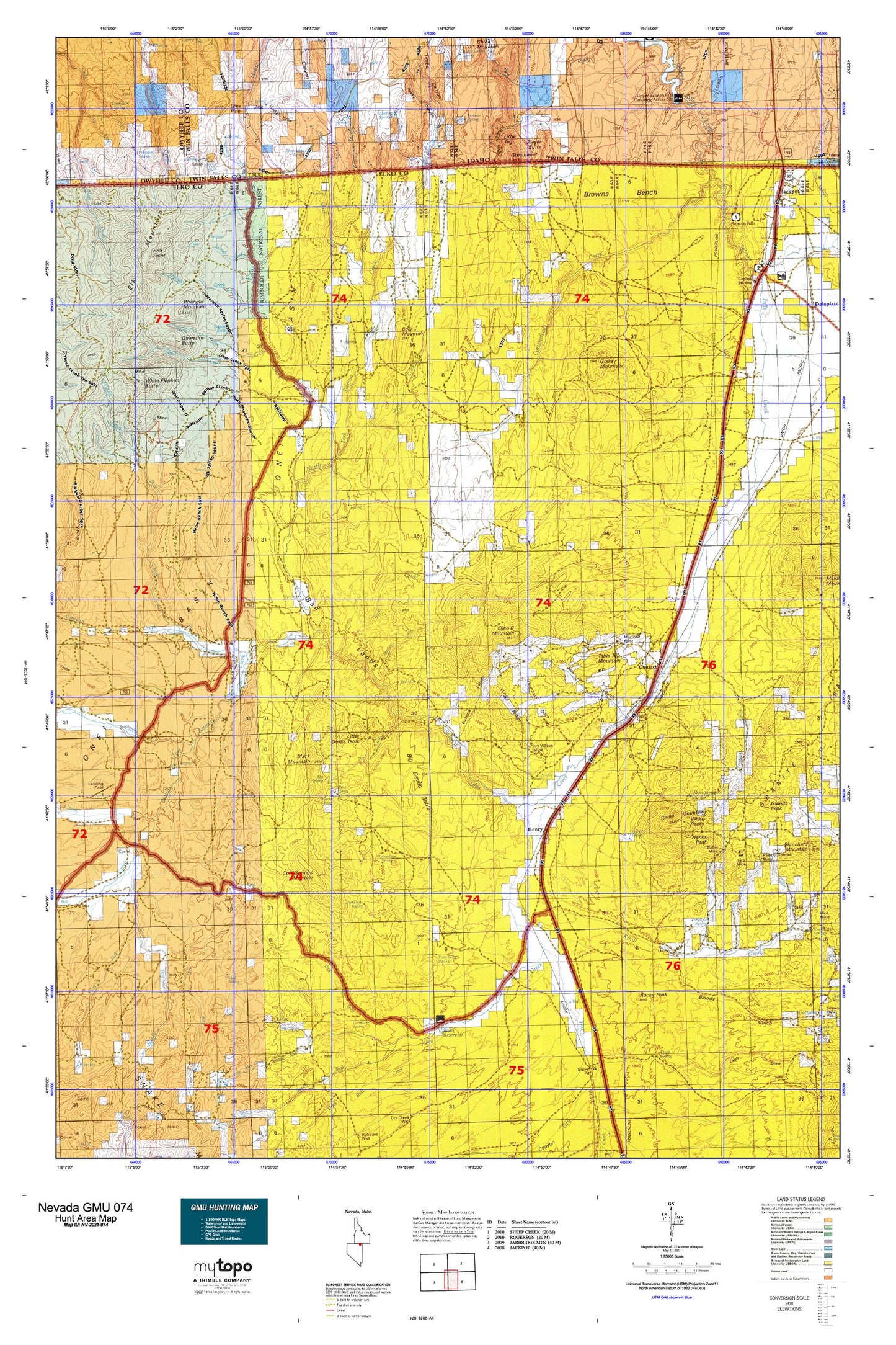
Nevada GMU 074 Map
Couldn't load pickup availability
Hunting unit map of Nevada Game Management Unit 074 with topographic lines and unit boundaries. This topo map features UTM / MGRS and Latitude/Longitude grids, plus public land ownership. It comes folded on waterproof paper. Be fully prepared for your hunt with a MyTopo GMU map!.
This map contains the following named places: 89825,Alabama,Antelope Mine,Antelope Spring,Apollo Five Mine,Arizona Mine,Babel,Babel Mine,Barbour Creek,Barbour Spring,Bear Creek,Bear Mountain,Bear Spring,Bellevue Mine,Big Devils Table,Black Mountain,Bloody Gulch,Bloody Gulch Dam,Blue Bird Mine,Blue Jay Creek,Blue Jay Gulch,Boies Ranch,Boies Reservoir,Bonanza Canyon,Bonanza Mine,Brooklyn Mine,Browns Bench,Browns Bench Ranch,Buckhorn Pasture,Bull Camp,Bull Camp Spring,Burnt Creek Spring,Burnt Meadow,Camp Creek,Can Creek,Canyon Creek,Chicken Spring,Chimney Creek,China Mountain,China Mountain Spring,Chinaman Mine,Choke-A-Man Draw,Cold Spring,Cold Springs Creek,Cold Springs Mountain,Contact,Contact Mining District,Contact Post Office,Contact School,Copper King Mine,Copper Shield Mine,Corner Reservoir,Corral Spring,Cottonwood Canon,Cottonwood Creek,Cottonwood Field,Dead Bull Creek,Deer Creek,Delano Mine,Devil Creek,Dry Creek,Dry Fork Jakes Creek,Duncan Place,Dynamite Spring,East Fork Deer Creek,Elk Meadows,Elk Mountain,Elk Mountain Mining District,Elk Mountains,Elk Spring,Ellen D Mountain,Granite Peak,Granite Spring,Grassy Mountain,Guerry Corral,Gully Ranch,Hanks Creek,Hanks Mine,Hanks Peak,Hawes Creek,Headgate Dam,Henry,High Ore Mine,Hillside Spring,Hubbard,Hubbard Basin,Hubbard Ranch,Ivy Wilson Mine,Jack Walker Draw,Jackpot Township,Jakes Creek,Jakes Creek Dam,Knoll Creek,Knoll Creek Experimental Station - University of Nevada,Leo Spring,Lime Creek,Lime Creek Basin,Little Devils Table,Little Tug,Lone Pine,Lower Alabama,Lower Hubbard Basin,Mahogany Basin,Mahogany Elephant Butte,Mammoth Mine,Marshall Mine,McDuffy Gulch,Meadow Creek,Meadow Springs,Middle Fork Deer Creek,Middle Fork Jakes Creek,Middle Stacks Ranch,Miller Canyon,Mineral Hot Spring,Monkey Creek,Mud Spring,Nevada Bellevue Mine,North Creek,North Fork Jakes Creek,North Fork Salmon Falls Creek,Ohio Gulch,O'Neil,O'Neil Creek,O'Neil Post Office,O'Neil Ranch,Palo Alto Mine,Pinkston Spring,Player Butte,Player Canyon,Player Creek,Player Place,Pole Creek,Quartzite Butte,Quilici Creek,Red Elephant Butte,Red Point,Riverside,Riverside Depot,Robinette Mine,Rocky Canyon,Rocky Peak,Rose O'Connell Mine,Rutherford Cabin,Sagehen Spring,Salmon River Range,San Jacinto Ranch,San Jacinto Ranch Spring,Scott Creek,Shack Creek,Shell Creek,Shoshone Creek,Silver Circle Mine,South Fork Jakes Creek,South Fork Salmon Falls Creek,Stanley Cabin,Steamboat,Strawberry Spring,Sun Creek,Tabletop Mountain,The Trap,Thompson Gulch,Timber Canyon,Townsend Creek,Trout Creek,Turo Mine,Twin Ledge Spring,Twin Meadows,Twin Meadows Ranch,Upper Maggie Spring,Vineyard Ranch,War Eagle Mine,West Fork Deer Creek,White Elephant Butte,White Peaks,White Ridge,Willow Creek,Willow Spring,Wilson Creek,Wrangle Mountain,Wrist Spring


