MyTopo
Nevada GMU 079 Map
Couldn't load pickup availability
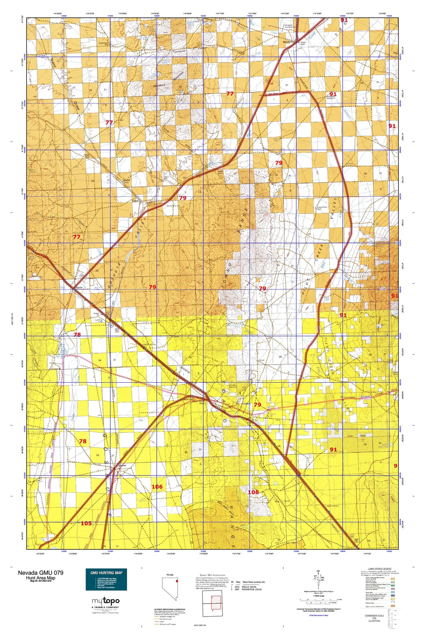
Hunting unit map of Nevada Game Management Unit 079 with topographic lines and unit boundaries. This topo map features UTM / MGRS and Latitude/Longitude grids, plus public land ownership. It comes folded on waterproof paper. Be fully prepared for your hunt with a MyTopo GMU map!.
This map contains the following named places: 89830,89883,Arnold,Baker Mine,Bar O Ranch,Bauvard,Bauvard Post Office,Boyd Spring,Buckhorn Creek,Castle Park Well,Cliffside Well,Clifside,Cobre,Cobre Post Office,Cobre Well,Cobrecite Mine,Collar and Elbow Basin,Collar and Elbow Dam,Collar and Elbow Spring,Cummings Ranch,Debbs Creek,East Squaw Creek,Eightyfoot Well,Gath,Granite Springs,Gravel Pit Spur,Hardy Creek,Highway Well Number Seventy-eight,Hoppie Creek,Icarus,Immigrant Canyon,Immigrant Creek,Iron J Mine,Ives Pass,Jim Thomas Well,Johnson Well,Leach Ranch,Loray,Loray Campground,Loray Draw,Loray Mining District,Loray Reservoir,Lost Hope Mine,McDonald Creek,Montello,Montello Census Designated Place,Montello Creek,Montello Division,Montello Elementary School,Montello Post Office,Montello Well Number One,Montello Well Number Two,Murdock Mountain,Murdock Springs,Nanny Creek,Nick Del Duke Mine,Noble,Noble Well,North Pass,Oasis,Oasis Census Designated Place,Omar,Patterson Gulch,Pilot Mountain Ranch,Pilot Peak Historical Marker,Pilot Well,Proctor,Proctor Mining District,Shafter,Shafter Post Office,Silver Hoard Mine,Silver Zone,Silver Zone Basin,Silver Zone Pass,Silver Zone Post Office,Silver Zone Well,Sixmile Creek,Small Spring,South Spring,South Well,Squaw Creek Ranch,Squaw Flat Well,Stockland Reservoir,Tecoma Township,Tecoma Township Volunteer Fire Department,The Loop,Tioga,Toano,Toano Number Thirteen Spring,Toano Post Office,Toano Range,Ullin,Valley Pass,Valley Well,Window Rock