MyTopo
Nevada GMU 171 Map
Couldn't load pickup availability
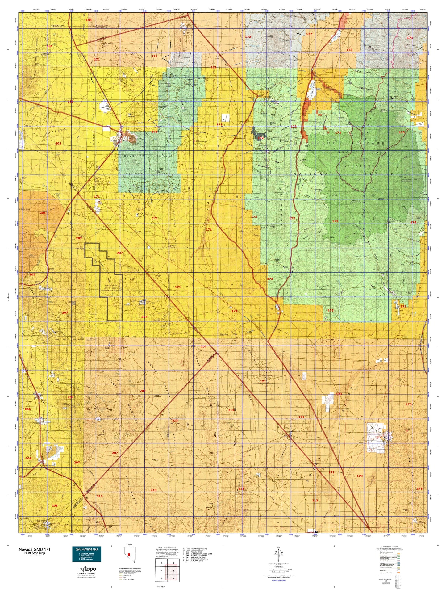
Hunting unit map of Nevada Game Management Unit 171 with topographic lines and unit boundaries. This topo map features UTM / MGRS and Latitude/Longitude grids, plus public land ownership. It comes folded on waterproof paper. Be fully prepared for your hunt with a MyTopo GMU map!.
This map contains the following named places: 89409,American Mining Corporation,Ames Camp,Antone Station,Antone Wash,Arc Dome,Arc Dome Wilderness,Arthur Salt and Borax Placer Mine,Athens,Athens Mining District,Atwood,Bakeoven Creek,Bald Mountain,Barney Meadows Creek,Barrett,Basic,Beason Creek,Becker Creek,Belcher Basin,Bell Mining District,Belleville Mine,Bells Ranch,Belmont and Sodaville Stage Route,Berlin,Berlin-Ichthyosaur State Park,Big Sawmill Creek,Black Butte,Black Mountain,Black Spring,Black Spring Mining District,Blue Bird Mine,Bonita,Brandon Mine,Broken Hills,Broken Hills Mine,Broken Hills Mining District,Brucite,Bruner,Bruner Mining District,Buckeye Mine,Buffalo Mountain,Centennial Mine,Cinnabar Mine,Cipac Mine,Cirac Mill,City of Gabbs,Clear Creek,Cloverdale,Cloverdale Creek,Cloverdale Mining District,Cloverdale Ranch,Columbine Campground,Corral Wash,Cottonwood Creek,Cow Canyon Trailhead,Craig Station,Crescent Dunes,Crow Springs,Crow Springs Mining District,Deep Well Station,Derringers Blacksmith Shop,Desert Scheelite Mine,Dierringer Ranch,Downeyville,Dry Lake,Duluth,Dunham Mill Site,Dunlap Mine,Eddyville,Ellsworth,Ellsworth Mining District,Everett Mine,Fairplay Mining District,Fairview Peak,Farrington Ranch,Finger Rock Station,French Peak,Gabbs,Gabbs Division,Gabbs Mining District,Gabbs Mountain,Gabbs Township,Gabbs Wash,Garfield Salt and Borax Placer Mine,Glen Hamilton,Golden,Golden Wash,Goldyke,Good Hope Mine,Goodings Ranch,Grantsville,Green Springs,Hall Mine,Horse Creek,Huntley Mine,Idlewild,Illinois Creek,Indian Creek,Indian Springs,Indian Valley Ranch,Ione,Ione Summit,Jett,Jett Mining District,Kaiser Mine Camp,Keough Ranch,Klondike,Knickerbocker,Knickerbocker Mill,Knickerbocker Wash,Ledbetter Administrative Site,Liberty,Lindsey Mine,Little Jett Creek,Little Meadows Forest Service Facility,Little Pilot Peak,Little Sawmill Creek,Llama Mountain,Lodi,Lodi Mining District,Lodi Tanks,Lost Steers Mine,Lower Corral,Mahogany Hill,Mahogany Mountain,Malapie Hill,Marble,Marble Falls,Marsh Falls,Meadow Creek,Midas,Midway Station,Milletts Ranch,Milton,Milton Ranch,Mina,Mohawk Administrative Site,Monte Cristo Valley,Mount Ardivey,Mount Diablo Reduction Works,Mud Springs,Muller Mountain,North Fork Clear Creek,Nun Mine,Omco,Omco Wash,Ophir,Ophir Tungsten Mill,Ophir Wash,Orizaba,O'Toole Ranch,Pactolus,Pactolus Mine,Paradise,Paradise Peak,Peavine,Peavine Canyon Trailhead,Peavine Forest Service Facility,Peavine Forest Service Recreation Site,Peavine Mountain,Peavine Ranch,Penelas,Petes Cabin,Petrified Wash,Pilot Mountains Mining District,Pilot Peak,Pine Tree Mine,Pioneer Mill,Potomic,Quartz Mountain,Rainier Mountain,Rawhide Ranch,Reese River,Reese River Ranger Station,Reese River State Game Refuge,Republic,Rhodes,Rhodes Marsh Mining District,Rhodes Marsh Station,Rhodes Salt Marsh,Richmond Hill,Royston,Royston Mining District,San Antone Mining District,San Antonio,San Antonio Companys Quartz Mill,San Antonio Mine,San Antonio Mountain,San Antonio Ranch,San Antonio Smelting Works,San Rafael Mine,Sand Wash,Santa Fe Mining District,Secret Basin,Seyler Peak,Shamrock,Sherman Peak,Sierra Magnesite Camp,Simon,Simon Mountain,Slys Ranch,Sodaville,South Fork South Twin River,South Shoshone Peak,South Toiyabe Peak,South Twin Pasture Administrative Site,South Twin Trailhead,Southeast Summit,Stewart Creek,Stewart Creek Trailhead,Stone Cabin,Stone Cabin Administrative Site,Sullivans Camp,Sunnyside Creek,Table Mountain,Toiyabe Dome,Toiyabe Dome Southeast Summit,Toms Canyon Trailhead,Tonopah Junction,Toyah,Trail Creek,Twin River Mining District,Union,Union Mine,Union Mining District,Upper Corral,Upper Peavine Ranch,Volcano Peak,Warners Ranch,Weeks Canyon Trailhead,Welchs Ranch,Werdenhoff Pasture Administrative Site,Western Metals Mine,White Pine Mine,Yomba Reservation


