MyTopo
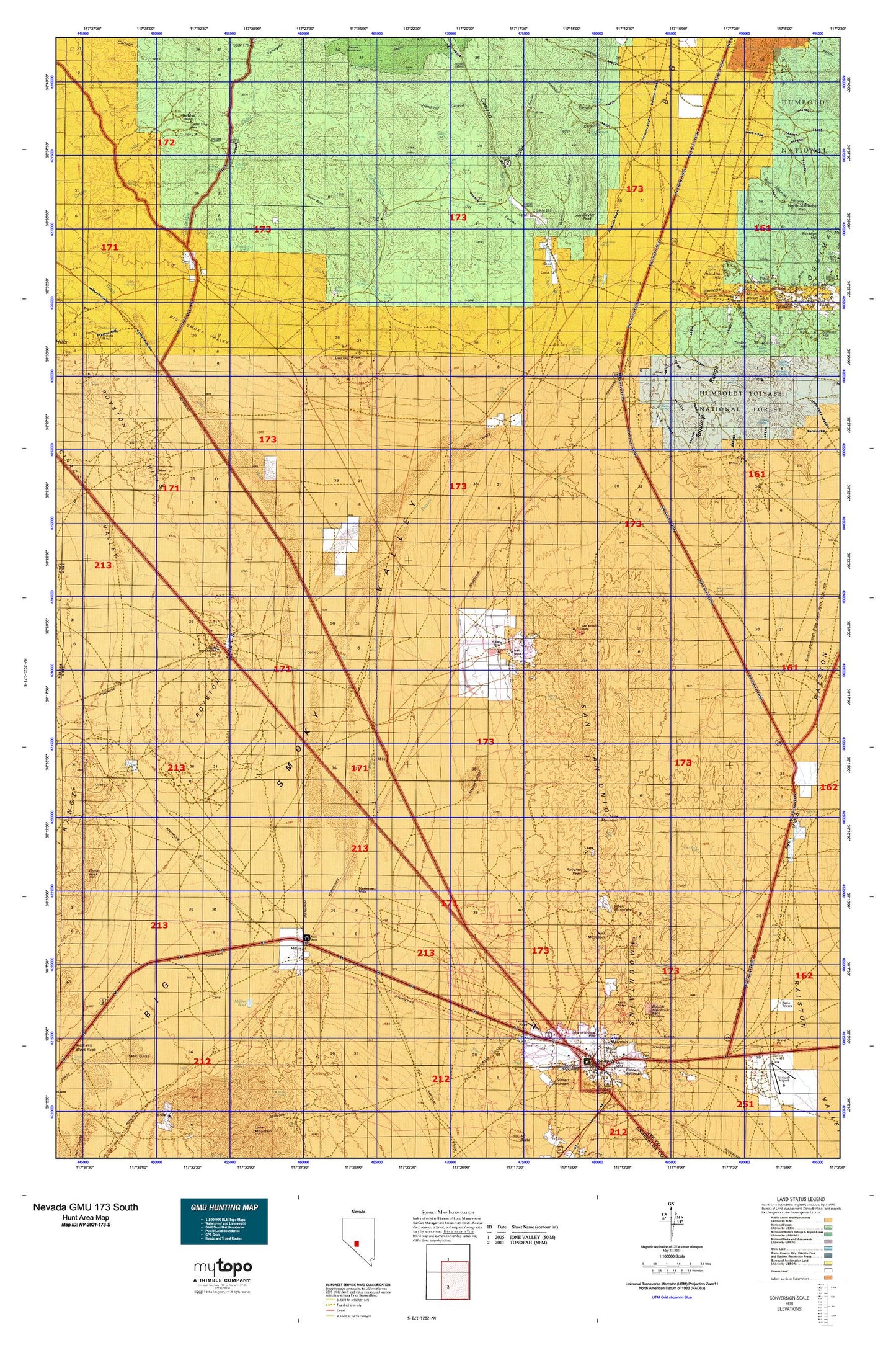
Nevada GMU 173 South Map
Couldn't load pickup availability
Hunting unit map of Nevada Game Management Unit 173-S with topographic lines and unit boundaries. This topo map features UTM / MGRS and Latitude/Longitude grids, plus public land ownership. It comes folded on waterproof paper. Be fully prepared for your hunt with a MyTopo GMU map!.
This map contains the following named places: Antelope Canyon,Antelope Creek,Antelope Spring,Ararat Mountain,Averill Spring,Bald Mountain Canyon,Bank Spring,Barrel Spring,Baxter Camp,Baxter Spring,Baxter Springs,Belle of Tonopah,Belmont and Sodaville Stage Route,Black Mammoth Gulch,Black Mammoth Hill,Black Mountain,Black Rock Well,Booker Mountain,Boyd Canyon,Boyd Canyon Spring,Boyd Creek,Bridge Well,Buckeye Belmont Mine,Butte Tonopah,Campbell and Kelly Shaft,Cash Boy Mine,Central,Central Post Office,Cicero Mine,Cimarron Mine,Cinnabar Mine,Cirac Valley,Cloverdale,Cloverdale Creek,Cloverdale Mining District,Cloverdale Post Office,Cloverdale Ranch,Columbia Junction,Cottonwood Creek,Coyote Hole Spring,Crescent Dunes,Crow Springs,Crow Springs Mining District,Davids Well,Desert Power and Milling Company Mill,Dollar Mine,East Golden Mine,Ferguson Hill,Fitzpatrick Spring,Florence Mine,Fourmile Spring,Foy Betts Shaft,Frazier Wells,Fraziers Well,Gale Spring,Garibaldi Mine,Glass Gulch,Gold Hill,Golden,Golden King Mine,Golden Post Office,Golden Spring,Golden Summit,Goldfield Junction,Hall Mine,Handcuff Canyon,Henrys Well,Highland Park,Hooper Well,Horse Canyon,Horse Canyon Mine,Horse Creek,Ice Plant Spring,Idlewild Creek,Indian Spring,Indian Springs,Ione Wash,Jim Butler Mine,Keough Spring,King Tonopah,Lambertucci Airstrip,Lea Mine,Lee Mine,Liberty,Liberty Mine,Liberty Pit,Liberty Springs,Lime Mountain,Main Line Junction,Mainline Well,Manhattan Gulch,Manhattan Mining District,Manhattan Ore and Milling Company Mill,Manhattan Placer,Mariposa Canyon,Mariposa Creek,Merrimac Mine,Midway Mine,Midway Station,Millers,Millers Pond,Millers Post Office,Millers Rest Area,Mississippi Springs,Montezuma Wells,Mount Moriah,Mount Moriah Cemetery,Mud Spring,Mustang Hill,Mustang Spring,Nellie Gray Mine,Nye County Sheriff's Office Substation,Old Manhattan Gulch,Palistine Mine,Palo Alto,Palo Alto Hill,Palo Alto Spring,Peavine,Peavine Canyon,Peavine Creek,Peavine Forest Service Facility,Peavine Forest Service Recreation Site,Peavine Post Office,Peavine Ranch,Peavine Well,Potomic,Potomic Mine,Rainier Mountain,Rays,Rays Wells,Red Mountain,Red Spring,Reese River State Game Refuge,Republic,Republic Mines,Rescue Eula Mine,Rhyolite Peak,Rogers Well,Rojo Spring,Royal Blue Mining Company,Royston,Royston Hills,Royston Mines,Royston Mining District,Rye Patch Pumping Station,Saint Elmo,San Antone Mining District,San Antonio,San Antonio Companys Quartz Mill,San Antonio Mine,San Antonio Mountain,San Antonio Post Office,San Antonio Ranch,San Antonio Smelting Works,San Antonio Well,Secret Basin,Seyler Peak,Seyler Reservoir,Seyler Reservoir Dam,Seyler Spring,Silver Queen Mine,Silver Rim Elementary School,Slaughterhouse Spring,Slime Wash,Sloppy Gulch,Spanish Mine,Stanley A Tanner Well,Stevens Spring,Stray Dog Mine,Timber Hill,Tonogold,Tonopah Beacon,Tonopah Belmont Mill,Tonopah Belmont Mine,Tonopah Census Designated Place,Tonopah Extension Mill,Tonopah Merger Mine,Tonopah Mining District,Upper Peavine Ranch,Walker Shaft,Wall Creek,War Eagle Mill,West Willow Spring,Willow Spring,Willow Springs,Wolftone Point,Wood Canyon,Yellow Spring


