MyTopo
Nevada GMU 205 Map
Couldn't load pickup availability
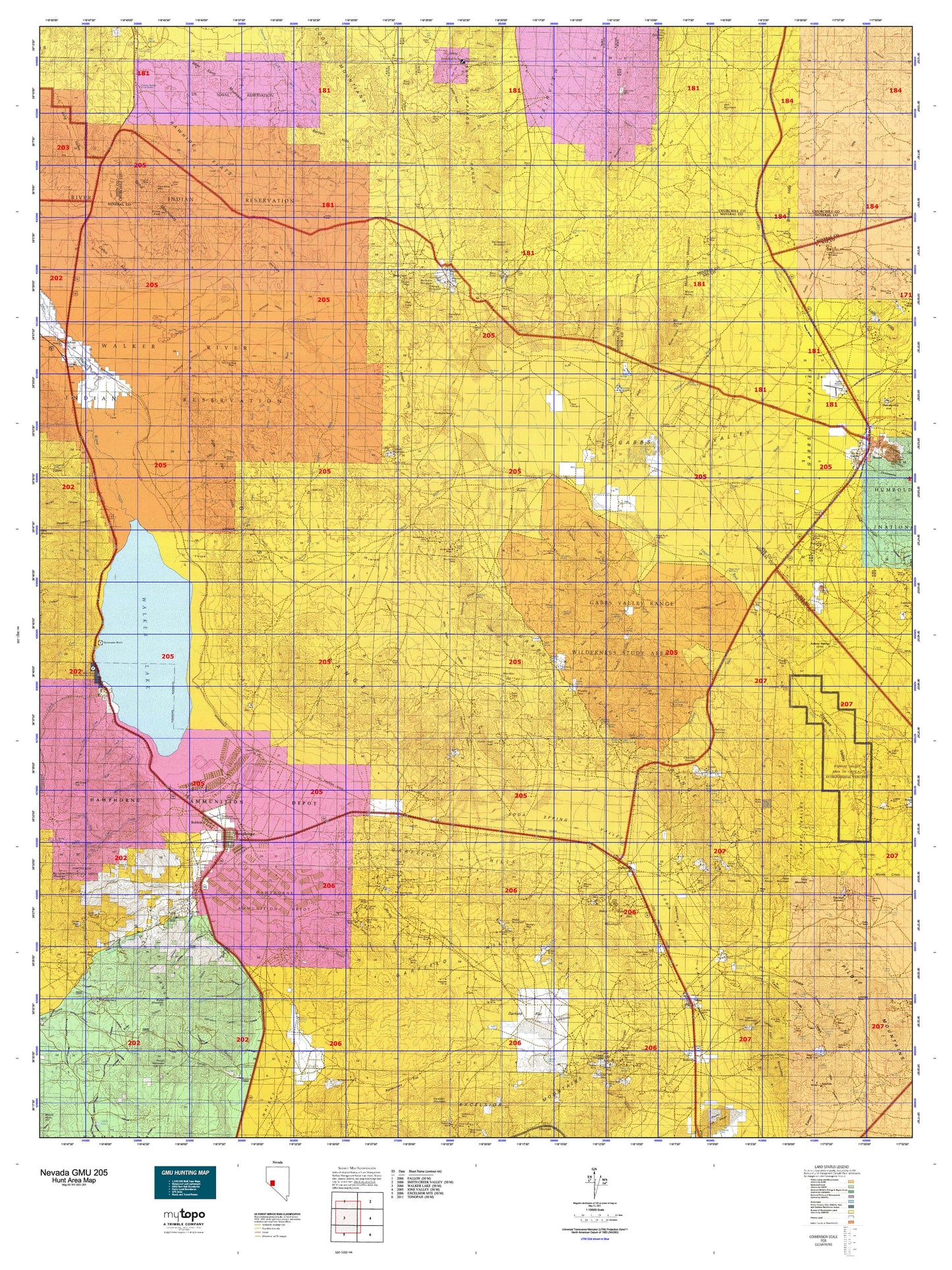
Hunting unit map of Nevada Game Management Unit 205 with topographic lines and unit boundaries. This topo map features UTM / MGRS and Latitude/Longitude grids, plus public land ownership. It comes folded on waterproof paper. Be fully prepared for your hunt with a MyTopo GMU map!.
This map contains the following named places: 89409,89415,89420,89427,Acme,AEC Test Site,Alum Creek,American Flag Mine,Antone Station,Antone Wash,Avalon,Babbitt,Balloon Hill,Basalt Peak,Bell Mountain,Bell Mountain Mine,Big Indian Mountain,Big Kasock Mountain,Birch,Black Beauty Reservoir,Black Butte Mine,Black Dyke Mountain,Black Eagle Hill,Black Hills,Blue Ribbon Mine,Bluelight Mine,Bluff Mine,Borus,Bovard,Bovard Mining District,Broken Hills,Broken Hills Mine,Broken Hills Mining District,Brown Knob,Buckley Camp,Buckley Mining District,Buckskin Mountain,Buller Mountain,Camp Terrill,Canyon,Car Frame Windmill,Cat Creek,Cat Creek Reservoir,Central Mine,Chicago Mountain,City of Gabbs,Copper Hill,Copper Mountain,Copperfield,Cory Creek,Cory Peak,Coryville,Cottonwood,Cottonwood Creek,Cox Station,Crazy Hill,Deadhorse Wells,Deep Hollow,Deep Well Station,Double Springs Marsh Mining District,Dover Siding,Drain Number One,Dry Creek,Dutch Creek,Eagle Valley,Eagle Wash,Eagleville,Eagleville Mining District,Evening Star Mine,Finger Rock Station,Finger Rock Wash,Fitting Mining District,Fortuna Mine,Gabbs,Gabbs Mountain,Gabbs Valley,Gabbs Valley Ranch,Gabbs Wash,Garfield,Garfield Creek,Garfield Mill,Garfield Mining District,Gem Mine,Gillis,Gillis Camp,Gillis Station,Gold Bar Mine,Gold Bug Mine,Gold Coin Mine,Gold Coin Number Two Mine,Golden Bomber Mine,Golden Eagle Mine,Golden Pen Mine,Good Hope Mine,Grutt Hill,Gundaker Hill,Gundaker Reservoir,Hawthorne,Hawthorne Division,Hawthorne Mining District,Hawthorne Speedway,Hawthorne Township,Hidden Wash,Holy Cross Mining District,Hooligan Hill,House Creek,Hu-Pwi Wash,Indian Head Peak,Iron Rock,Jaggersville,Jeep Mine,Kaiser Mine Camp,Kay Mine,Kincaid Reservoir,King Mine,Kinkaid,Kinkead Mill,Klinker Mill,Klondike,La Panta,La Panta Mine,Lady Bird Park,Lake Peak,Lateral Two-A,Lateral Two-B,Lateral Two-D,Lateral Two-E,Lazy Man Mine,Little Squaw Creek,Llama Mountain,Lorena,Lucky Boy,Lucky Boy Holding Corral,Lucky Boy Ranch,Luning,Luning Station,Mable Mountain,Magnus,Malapie Hill,Martinez Hill,Mecca,Middle Fork Cat Creek,Midway,Mina,Mineral County,Mizpah Mine,Modoc Siding,Monte Cristo,Mount Anna,Mount Annie,Mount Diablo Reduction Works,Mount Ferguson,Mount Grant,Mount Grant Lodge,Mount Grant Mining District,Mud Springs,Mud Windmill,Muller Mountain,Murray Hill,National Mill,National Mill Reservoir,Navy Beach,Nevada Scheelite Camp,Nevada Scheelite Mill,New Boston,New Boston Mill,Nolan,North Canyon Creek,North Fork Cat Creek,North Fork Hu-Pwi Wash,Nugent Wash,Nun Mine,October Mine,Omco Wash,One Thousand Nine Hundred Five Mine,Oro City,Pamlico,Pelican Point,Petrified Wash,Phillips Wash,Pilot Cone,Pilot Mountains Mining District,Pilot Peak,Powell Creek,Project Shoal Monument,Quartz Mountain,Queen Mill,Rand,Rawhide,Rawhide Ranch,Regent,Regent Mining District,Rose Creek,Rose Creek Reservoir,Roys Point,Sand Springs Range Cairn,Santa Fe Mining District,Sargent Well Spring Holding Corral,Schweer Housing Area,Sierra Magnesite Camp,Slate Mountain,Soda Spring Valley,Sodaville,South Fork Cat Creek,South Fork Hu-Pwi Wash,Sportsmans Beach,Squaw Creek,Squaw Peak,Station,Stucky Ditch,Sullivans Camp,Sulphide Mining District,Summit,Summit Station Holding Corral,Table Mountain,Tamarack Point,Thorne,Togo,Virginia,Volcano Peak,Walker,Walker Lake,Walker Lake Boat Harbor,Walker Lake Recreation Area,Walker Lake State Park,Walker River,Walker River Division,Walker River Reservation,Walker River Valley,Whiskey Flat Reservoir,Whiskey Spring,Willow Creek,Win Wan Flat,Woodruffs,Wovoka Wash


