MyTopo
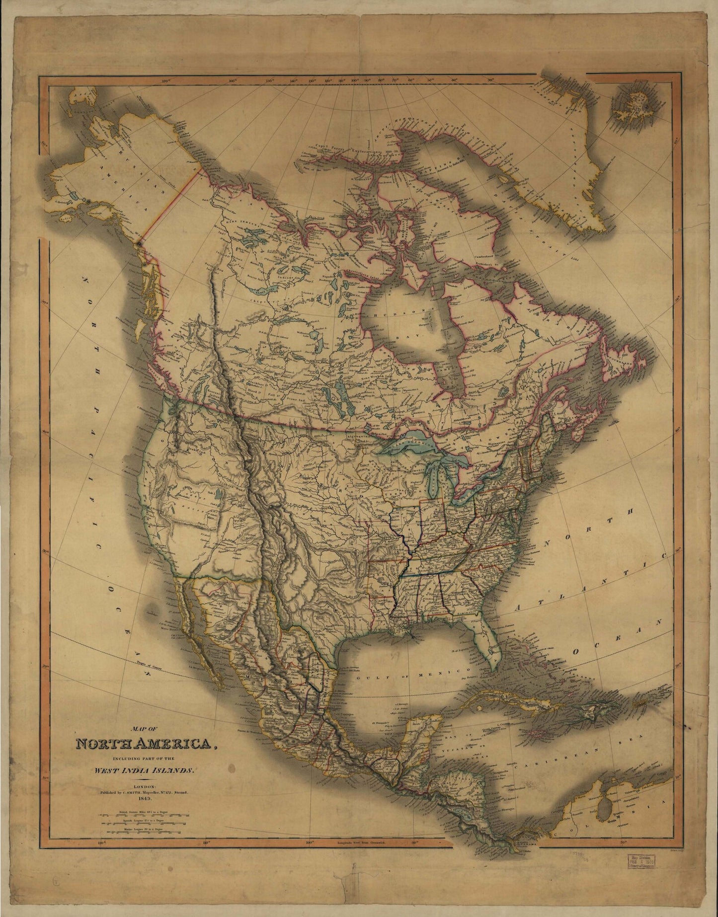
1849 Historic Map of North America
Regular price
$99.00
Regular price
Sale price
$99.00
Unit price
per
Couldn't load pickup availability
A beautiful map print from MyTopo, perfect for framing or wall hanging!
- Map size: 27" x 35"
- Year: 1849
- Scale: Unknown
- Paper: Waterproof banner
Map of North America including part of the West India Islands. Published by C. Smith, Mapseller, London, 1849. Colors are used to outline boundaries. (Reproduction.)