MyTopo
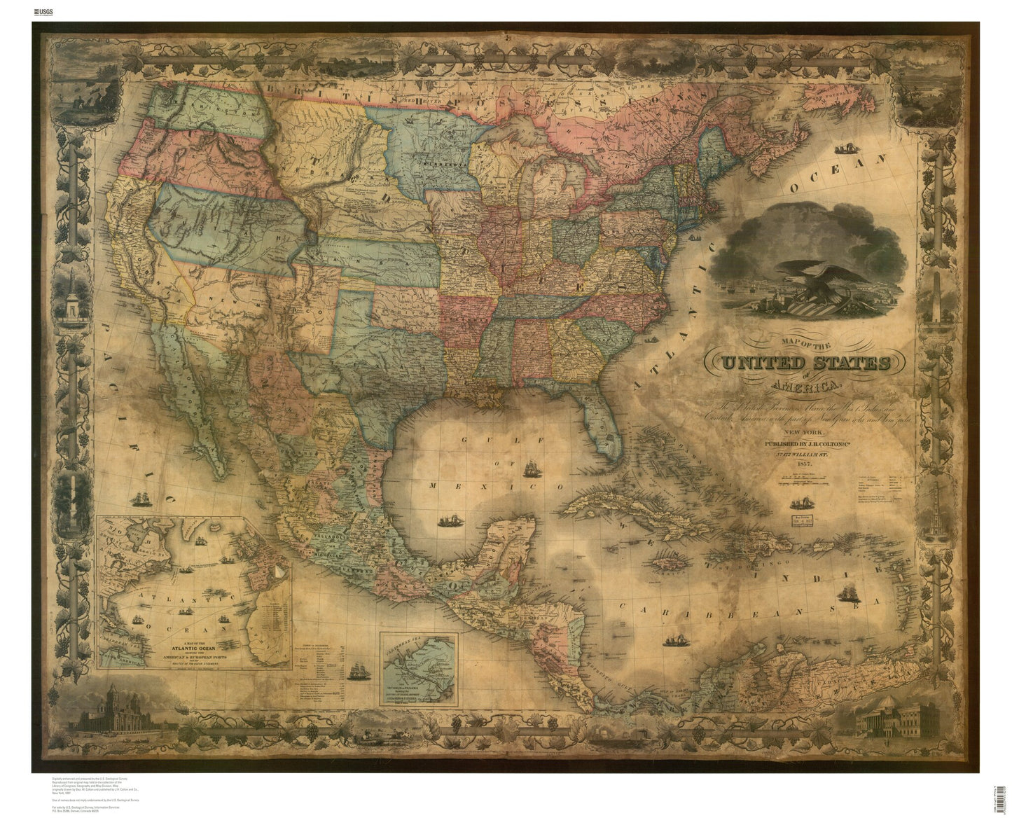
1857 Historic Map of the United States
Regular price
$99.00
Regular price
Sale price
$99.00
Unit price
per
Couldn't load pickup availability
A beautiful map print from MyTopo, perfect for framing or wall hanging!
- Map size: 47" x 38"
- Year: 1857
- Scale: Unknown
- Paper: Waterproof banner
Map of the United States of America, The British Provinces, Mexico, The West Indies and Central America with part of New Grenada and Venezuela. Published by J.H. Colton and Co., New York, 1857. Two insets show: A map of the Atlantic Ocean showing the American and European ports; The Isthmus of Panama. (Reproduction.) This is a digital reproduction from a scanned image, the resolution will be lower than the previous printed edition.