MyTopo
Madrid Alabama US Topo Map
Couldn't load pickup availability
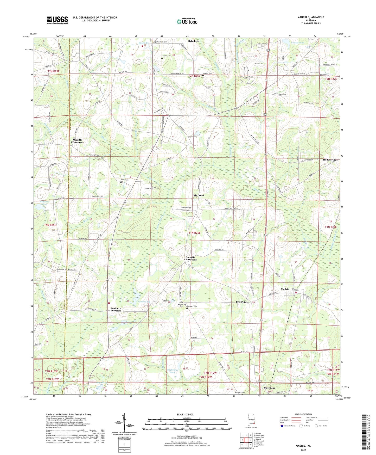
2024 topographic map quadrangle Madrid in the state of Alabama. Scale: 1:24000. Based on the newly updated USGS 7.5' US Topo map series, this map is in the following counties: Houston, Geneva. The map contains contour data, water features, and other items you are used to seeing on USGS maps, but also has updated roads and other features. This is the next generation of topographic maps. Printed on high-quality waterproof paper with UV fade-resistant inks.
Quads adjacent to this one:
West: Slocomb
Northwest: Malvern
North: Dothan West
Northeast: Dothan East
East: Cottonwood
Southeast: Sills
South: Campbellton
Southwest: Graceville
This map covers the same area as the classic USGS quad with code o31085a4.
Contains the following named places: Antioch Church, Big Branch, Big Creek, Big Creek Church, Box Branch, Chestnut Branch, Chipola Creek, City of Dothan Cypress Wastewater Treatment Plant, Cooleys Pond, Coopers Bay, Coopers Bay Creek, Cypress Creek, David West Dam, David West Lake, Dothan National Golf Club, Double Bridges Creek, Five Points, Garretts Crossroads, Harkin Branch, Houston County Distribution Park, Kirkland Branch, Lassiter Cemetery, Limestone Creek, Madrid, Madrid Baptist Church, Madrid Division, Madrid Junior High School, Madrid Volunteer Fire Department, Merritts Crossroads, Midway School, Mount Enon Church, New Hope Church, New Providence Church, Olympia Spa Country Club, Open Pond, Pleasant Grove Church, Pratt Landing, Registers Cemetery, Registers Pond, Rehobeth, Rehobeth Church, Rehobeth Volunteer Fire and Rescue, Saint Marys Church, Saint Peters Church, Saint Phillips Cemetery, Sanders, Sanders Cemetery, Sanders Spur, Singletarys Pond, Smith Cemetery, Smithville Church, Southern Junction, Southern Junction Volunteer Fire Department, State Line, Town of Madrid, Town of Rehobeth, Underwood Mill