
MyTopo
Pine Apple North Alabama US Topo Map
Couldn't load pickup availability
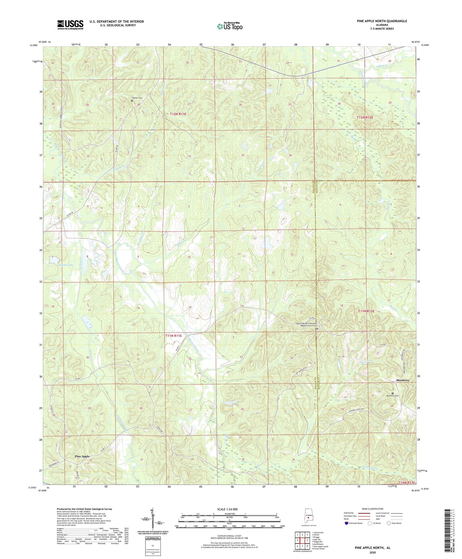
2024 topographic map quadrangle Pine Apple North in the state of Alabama. Scale: 1:24000. Based on the newly updated USGS 7.5' US Topo map series, this map is in the following counties: Wilcox, Butler. The map contains contour data, water features, and other items you are used to seeing on USGS maps, but also has updated roads and other features. This is the next generation of topographic maps. Printed on high-quality waterproof paper with UV fade-resistant inks.
Quads adjacent to this one:
West: Oak Hill
Northwest: Carlowville
North: Minter
Northeast: Braggs
East: Ridgeville
Southeast: Forest Home
South: Pine Apple South
Southwest: McWilliams
This map covers the same area as the classic USGS quad with code o31086h8.
Contains the following named places: Arkadelphia Church, Beaver Creek, Beech Grove School, Brestwork Creek, Cedar Grove church, Copeland Dam, Copelands Pond, Donald Lake, E G Donald Lake Dam, Faith Temple, Friendship Church, Gaines Chapel, Hills Creek, Hopewell Church, Indian Creek, Monterey, Monterey Cemetery, Monterey Church, Mount Moriah, Mount Moriah Baptist Church, Mount Moriah Fellowship Baptist Church Cemetery, Mount Moriah Post Office, Palmer Cemetery, Peters Church, Pleasant Hill Church, Rock Springs, Saint Peters Church, Starling Church, Thurston Adams Dam, Thurston Adams Pond, Turkey Creek, Wardlaw Creek, Wildcat Creek, Windhams Store, Wolf Creek, Womacks Post Office


