MyTopo
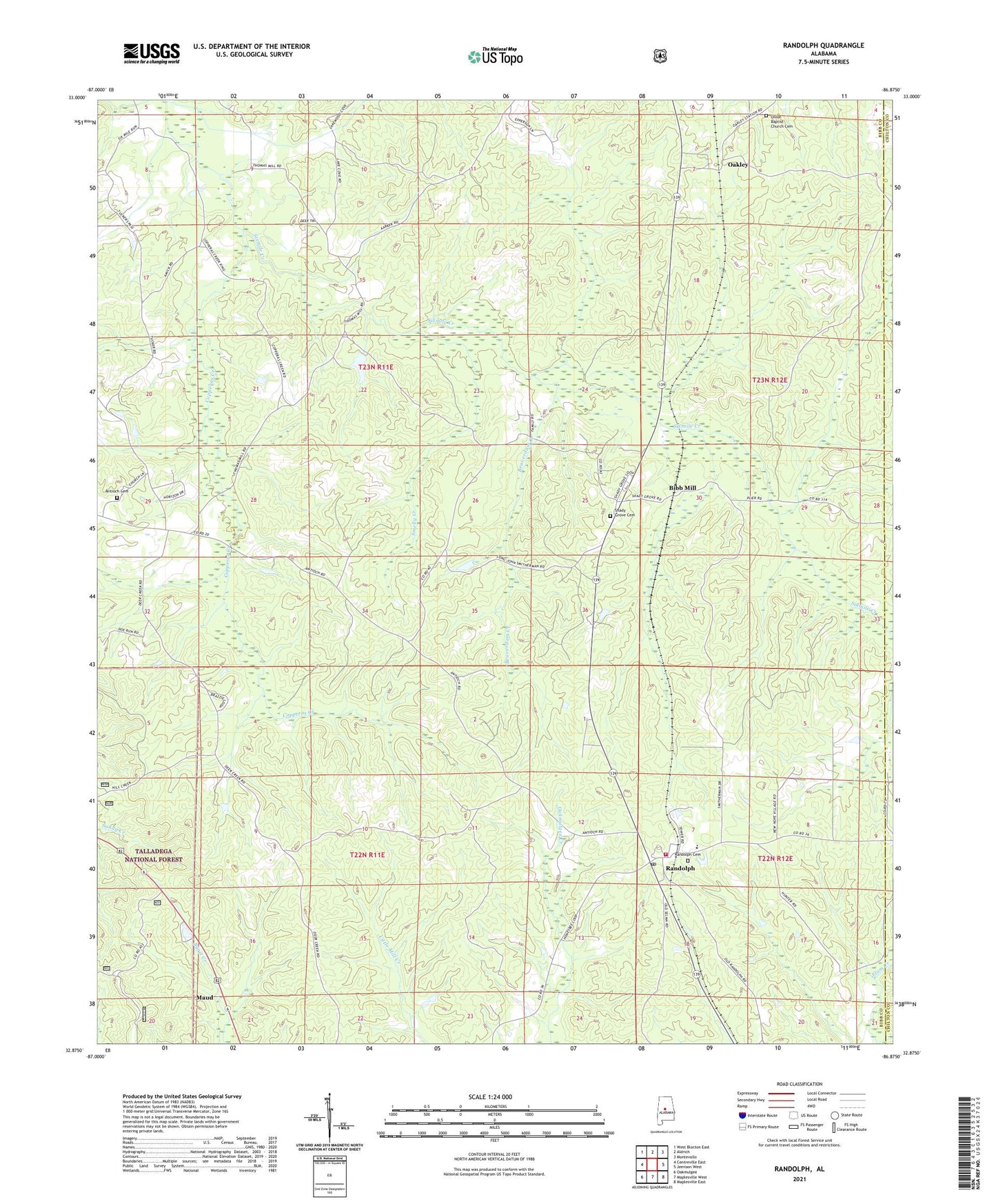
Randolph Alabama US Topo Map
Couldn't load pickup availability
Also explore the Randolph Forest Service Topo of this same quad for updated USFS data
2024 topographic map quadrangle Randolph in the state of Alabama. Scale: 1:24000. Based on the newly updated USGS 7.5' US Topo map series, this map is in the following counties: Bibb, Chilton. The map contains contour data, water features, and other items you are used to seeing on USGS maps, but also has updated roads and other features. This is the next generation of topographic maps. Printed on high-quality waterproof paper with UV fade-resistant inks.
Quads adjacent to this one:
West: Centreville East
Northwest: West Blocton East
North: Aldrich
Northeast: Montevallo
East: Jemison West
Southeast: Maplesville East
South: Maplesville West
Southwest: Oakmulgee
This map covers the same area as the classic USGS quad with code o32086h8.
Contains the following named places: Allen P Howison Elementary School, Antioch, Antioch Cemetery, Antioch Missionary Baptist Church, Beaverdam Creek, Bibb Mill, Bibb Old County Hall, Copperas Creek, Hammermill Paper Company Lake, Hammermill Paper Company Lake Dam, Maud, Mills Church, New Hope Baptist Church, New Prospect Methodist Church, Oakley, Pleasant Sabine Baptist Church, Randolph, Randolph Baptist Church, Randolph Cemetery, Randolph Post Office, Randolph Volunteer Fire Department, Shady Grove Cemetery, Shady Grove Missionary Baptist Church, Smelly Creek, Thomas Mill, Tucker, Union Baptist Church, Union Baptist Church Cemetery, Union School, ZIP Code: 36792