MyTopo
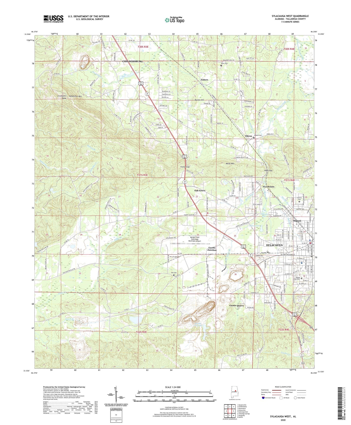
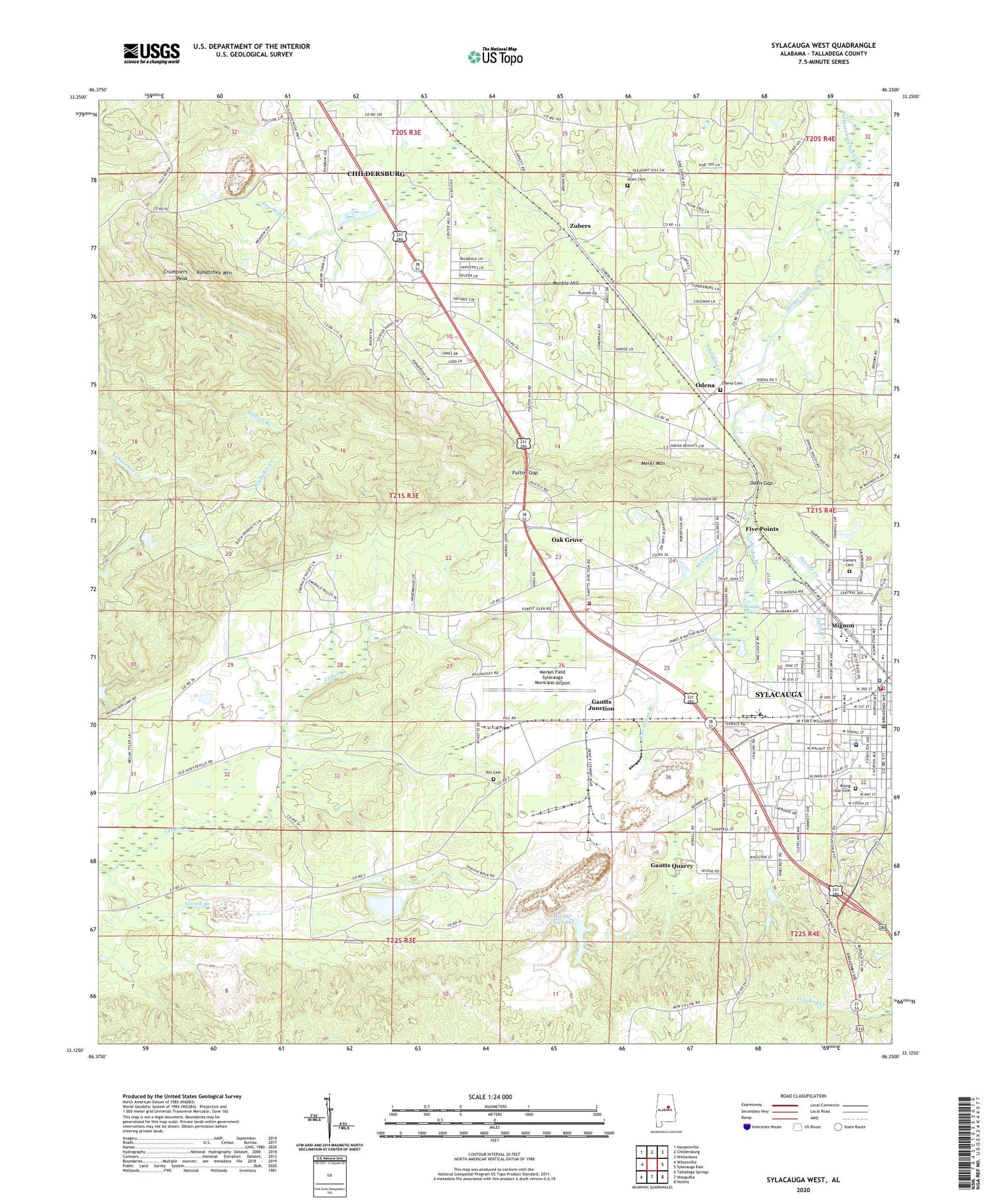
Sylacauga West Alabama US Topo Map
Couldn't load pickup availability
2024 topographic map quadrangle Sylacauga West in the state of Alabama. Scale: 1:24000. Based on the newly updated USGS 7.5' US Topo map series, this map is in the following counties: Talladega. The map contains contour data, water features, and other items you are used to seeing on USGS maps, but also has updated roads and other features. This is the next generation of topographic maps. Printed on high-quality waterproof paper with UV fade-resistant inks.
Quads adjacent to this one:
West: Wilsonville
Northwest: Harpersville
North: Childersburg
Northeast: Winterboro
East: Sylacauga East
Southeast: Hollins
South: Weogufka
Southwest: Talladega Springs
This map covers the same area as the classic USGS quad with code o33086b3.
Contains the following named places: Alabama Marble Quarry, Allen Cemetery, Avondale School, B B Comer High School, Bluff Springs Church, Calvary Church, Cedar Creek School, Center Hill, Center Hill Church, Center Hill School, Childersburg Quarry, City of Sylacauga, Comer Elementary School, Comerdale, Comers Cemetery, Coosa Valley Medical Center, Crumplers Peak, Darby Branch, Drummond Fraser Hospital, Early Rose Baptist Church, First Assembly of God Church, First Baptist Church of Oak Grove, First Baptist Church of Sylacauga, First Church of God, First Church of the Nazarene, First Presbyterian Church, Five Points, Five Points Baptist Church, Fort William Shopping Center, Fulton Gap, Gantts Junction, Gantts Quarry, Gooch Branch, Hatfield, Hill Cemetery, Hill Springs, Joiner Dam, Joiner Lake, Kahatchee Lookout Tower, Kahatchee Mountain, King, Lake Louise, Lipsey, Marble City Baptist Church, Marble City Christian School, Marble City Lake, Marble City Quarry, Marble Hill, McClungs Creek, Memorial Hospital, Merkel Field Sylacauga Municipal Airport, Merkl Mountain, Mignon, Mignon Baptist Church, Mignon Census Designated Place, Mignon United Methodist Church, Mountain View Baptist Church, New Hope Baptist Church, Oak Grove, Oak Grove Volunteer Fire Department, Oden Gap, Odena, Odena Cemetery, Odens Mill, Ogletree Creek, Ogletree Plaza Shopping Center, Pine Grove Church, Pinecrest School, Pleasant Hill, Pleasant Hill Church, Rising Star Baptist Church, Rising Star Cemetery, Rocky Mount Methodist Church, Saint Andrews Church, Saint Andrews Episcopal Church, Saint Joe Church, Saint John Baptist Church, Saint Jude Catholic Church, Sanford Creek, Shelving Rock Baptist Church, Shelving Rock School, Shirtee Creek, Sylacauga, Sylacauga Church of Christ, Sylacauga City Hall, Sylacauga Division, Sylacauga Fire Department Station 1, Sylacauga High School, Sylacauga Police Department, Sylacauga Post Office, Sylacauga Shopping Center, Sylavon Baptist Church, Sylavon Elementary School, Talladega County Sheriff's Office, Tar Water Branch, Thomas Hill, Thomas Lake, Town of Gantts Quarry, Town of Oak Grove, Walco, Waterview Station, West Side Church, Westview Baptist Church, Wynette, Wynette Post Office, Zubers


