
MyTopo
West Greene Alabama US Topo Map
Couldn't load pickup availability
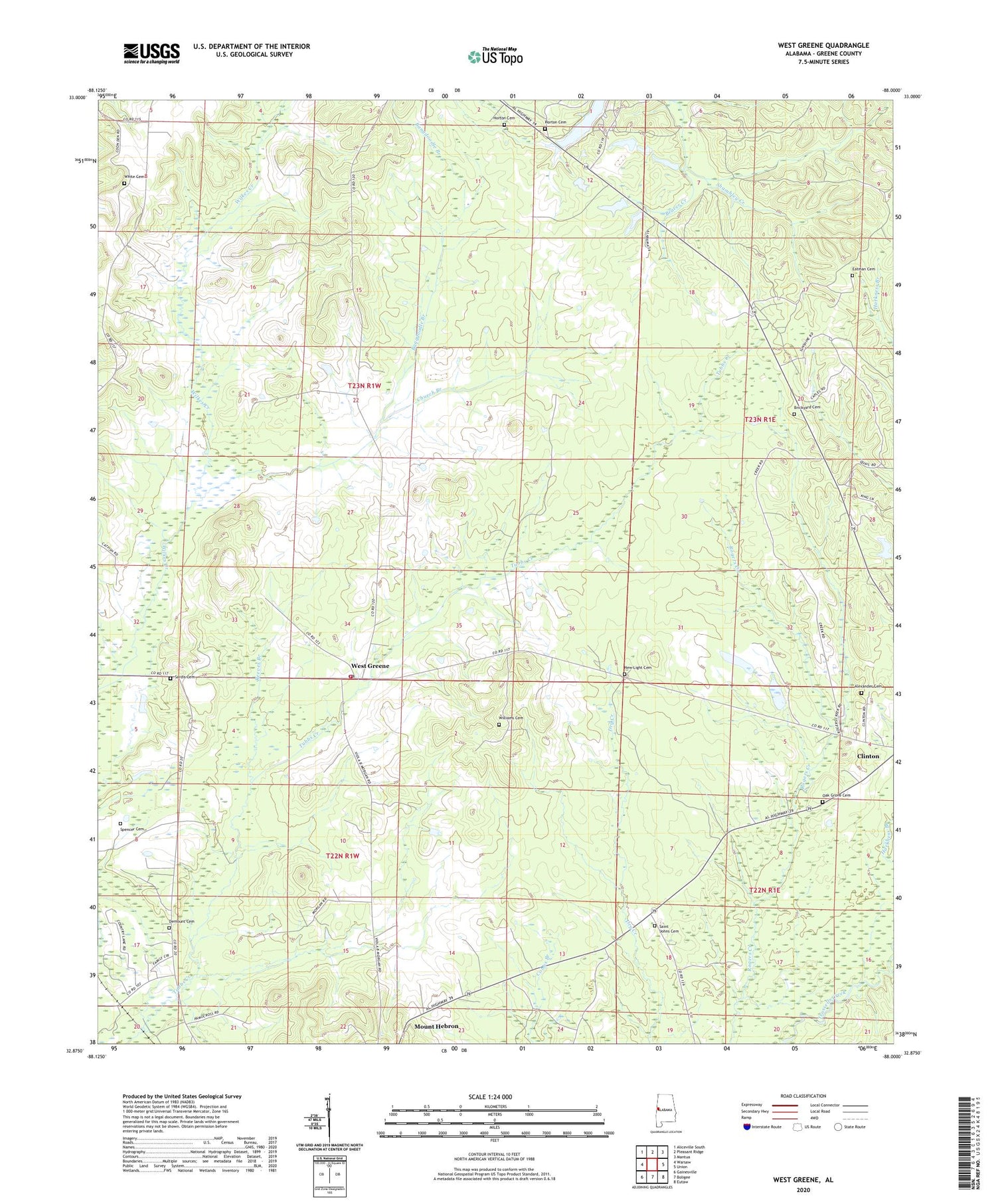
2024 topographic map quadrangle West Greene in the state of Alabama. Scale: 1:24000. Based on the newly updated USGS 7.5' US Topo map series, this map is in the following counties: Greene. The map contains contour data, water features, and other items you are used to seeing on USGS maps, but also has updated roads and other features. This is the next generation of topographic maps. Printed on high-quality waterproof paper with UV fade-resistant inks.
Quads adjacent to this one:
West: Warsaw
Northwest: Aliceville South
North: Pleasant Ridge
Northeast: Mantua
East: Union
Southeast: Eutaw
South: Boligee
Southwest: Gainesville
This map covers the same area as the classic USGS quad with code o32088h1.
Contains the following named places: Alexander Cemetery, Bangdoodle Branch, Beaver Creek, Brickyard Cemetery, Carpenters Lake, Church Branch, Demount Cemetery, Eatman Cemetery, Fairview School, Horton Cemetery, Little Vine Baptist Church, Mantua-West Greene Division, Mount Mariah Methodist Church, New Light Baptist Church, New Light Cemetery, New Light School, Oak Grove Cemetery, Oak Grove Methodist Church, Oak Grove School, Oak Hill School, Oakhill Church, Pleasant Grove Methodist Church, Reeves Branch, Saint Johns Cemetery, Saint Johns Church, Saint Johns School, Sardis Cemetery, Sardis Church, Spencer Cemetery, West Greene, West Greene Church, West Greene Post Office, West Greene Volunteer Fire Department, White Cemetery, Williams Cemetery, Zion Hill Baptist Church


