MyTopo
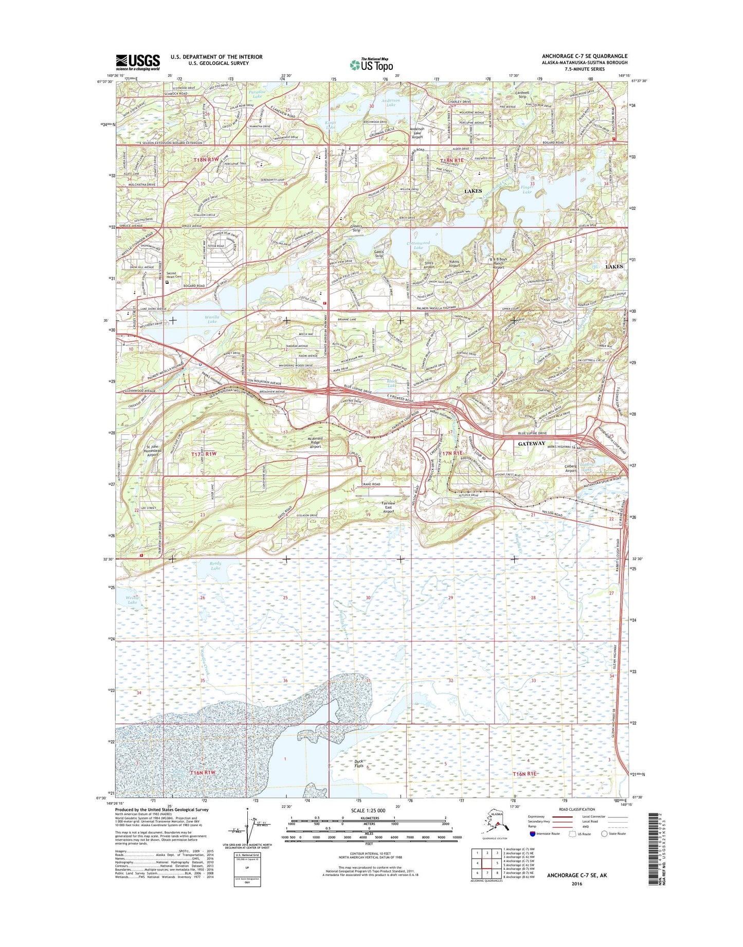
Anchorage C-7 SE Alaska US Topo Map
Couldn't load pickup availability
2016 topographic map quadrangle Anchorage C-7 SE in the state of Alaska. Scale: 1:25000. Print Size: 24" x 29"
Based on the newly updated USGS 7.5' US Topo series, this map has UTM / MGRS grids and is in the following counties: Matanuska-Susitna.
The map contains contour data, water features, and other items you are used to seeing on U.S. Geological Survey maps, but also has updated roads and other features. This is the next generation of topographic maps. Printed on high-quality waterproof paper with UV fade-resistant inks.
Contains the following named places: Black Lake, Cottonwood Lake, Duck Flats, Finger Lake, Palmer Slough, Paradise Lake, Reedy Lake, Wasilla Creek, Wasilla Lake, Weinie Lake, Kings Lake, Anderson Lake, Dinkel Lake, Loberg Lake, Mud Lake, University of Alaska Experimental Farm, Memory Lake Estates Dam Number 1, Cottonwood Creek, Spring Creek, Finger Lake State Recreation Site, Chuqilin Kaq'