MyTopo
Atka C-1 NE Alaska US Topo Map
Couldn't load pickup availability
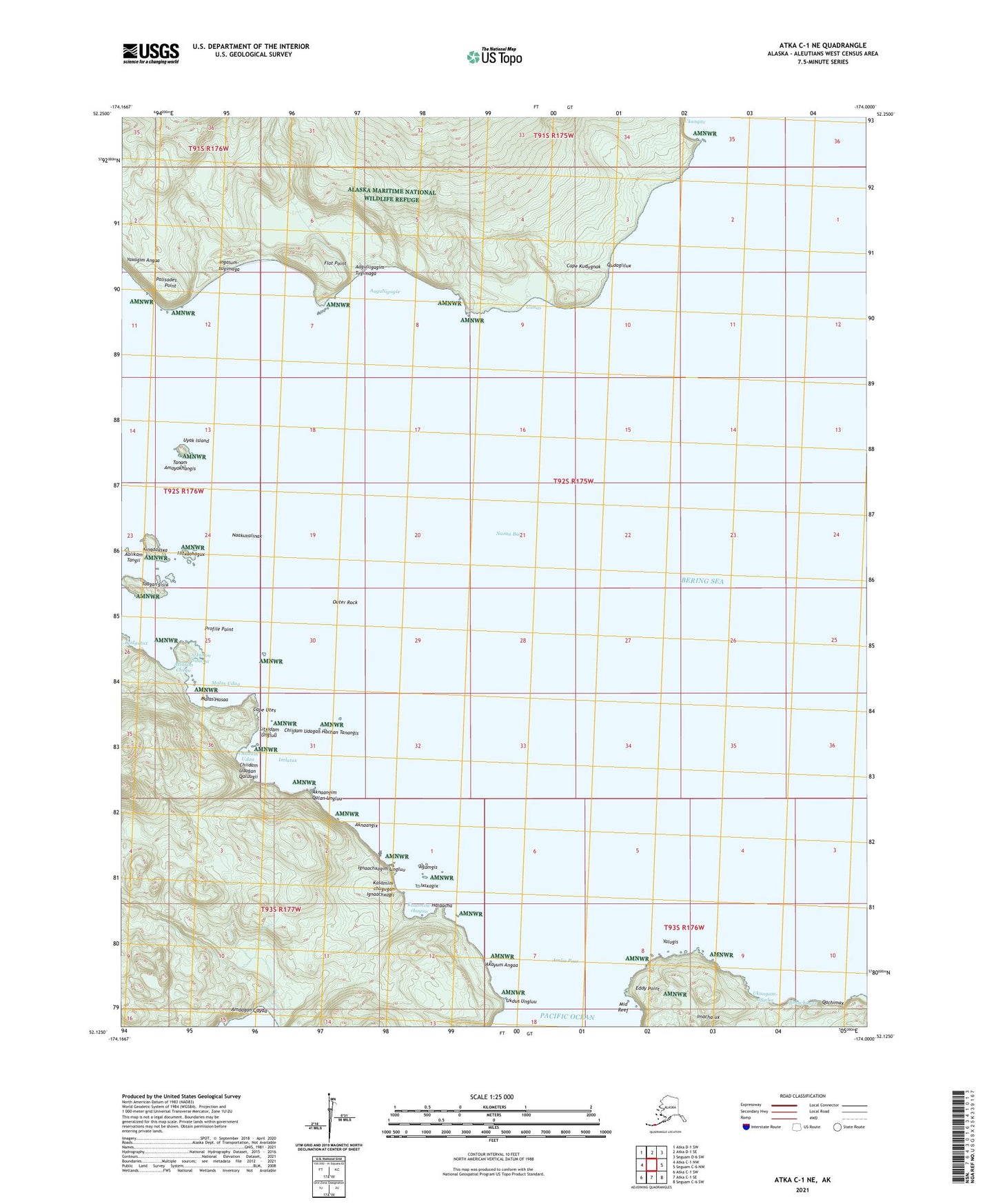
2021 topographic map quadrangle Atka C-1 NE in the state of Alaska. Scale: 1:25000. Print Size: 24" x 29"
Based on the newly updated USGS 7.5' US Topo series, this map has UTM / MGRS grids and is in the following counties: Aleutians West (CA).
The map contains contour data, water features, and other items you are used to seeing on U.S. Geological Survey maps, but also has updated roads and other features. This is the next generation of topographic maps. Printed on high-quality waterproof paper with UV fade-resistant inks.
Contains the following named places: Amlia Pass, Cape Kudugnak, Cape Utes, Eddy Point, Flat Point, Mid Reef, Nazan Bay, Palisades Point, Profile Point, Uyak Island, Outer Rock, Ukangax, Aalikam Tangii, Kingdaxsxa, Hitxachagux, Naakuvalinax, Tanam Amayaknangis, Yaxagim Angaa, Ingalum-tugimaga, Aaguliigagix, Aaguliigagim Tugimaga, Gunas, Gunas Hanii, Qudagiilux, Imachalux, Amlagim Angtaa, Yalugis, Ukungam-sitacha, Qanachagux, Qachimax, Amdaga, Amdagan Qayaa, Amdagan Sisxii, Ukdus Ungluu, Akayum Angaa, Halaacha, Kasamim-chuguu, Ixsxagix, Agamgis, Kasamim-chugugan Ignaachxagii, Ignaachxagim Ungluu, Aknaangix, Aknaangim Qalan Ungluu, Imlatux, Chiidam Udaa, Chiidam Udagan Qaluugii, Chiidam Udagan Hachan Tanangis, Sitxidam Ungluu, Malas Udaa, Malas Hasaa, Atxalam Chuqii, Atxalam Sitacha, Igidgutux, Taagan'gisix