MyTopo
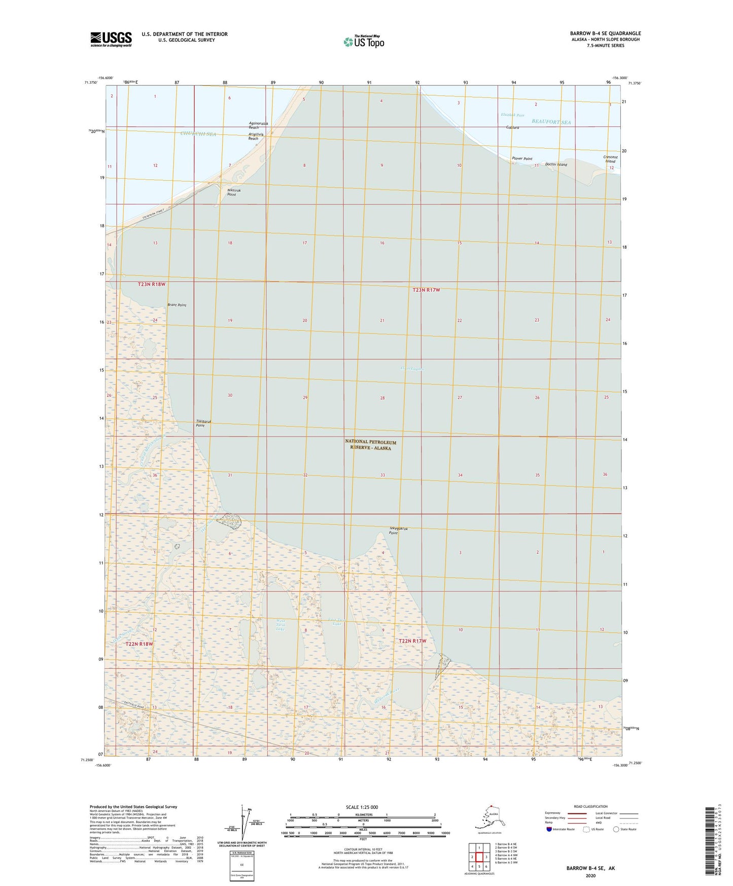
Barrow B-4 SE Alaska US Topo Map
Couldn't load pickup availability
2020 topographic map quadrangle Barrow B-4 SE in the state of Alaska. Scale: 1:25000. Print Size: 24" x 29"
Based on the newly updated USGS 7.5' US Topo series, this map has UTM / MGRS grids and is in the following counties: North Slope.
The map contains contour data, water features, and other items you are used to seeing on U.S. Geological Survey maps, but also has updated roads and other features. This is the next generation of topographic maps. Printed on high-quality waterproof paper with UV fade-resistant inks.
Contains the following named places: Brant Point, Central Marsh Slough, Doctor Island, East Twin Lake, Eluitkak Pass, Ikpik Slough, Mayoeak River, Plover Point, Tekegakrok Point, West Twin Lake, Agsinoralak Beach, Arigilivik Beach, Coblura, Niksirok Point, Tikigaruk Point