MyTopo
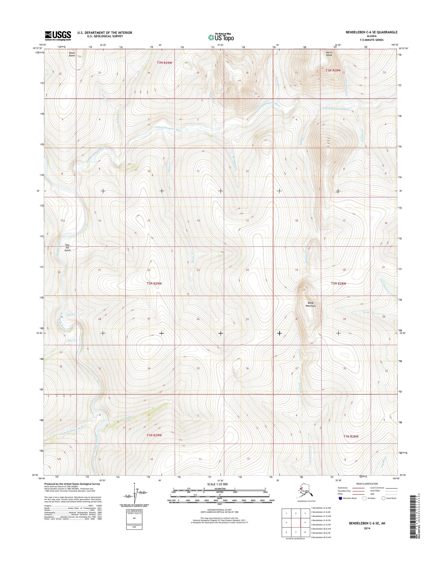
Bendeleben C-6 SE Alaska US Topo Map
Couldn't load pickup availability
2014 topographic map quadrangle Bendeleben C-6 SE in the state of Alaska. Scale: 1:25000. Print Size: 24" x 29"
Based on the newly updated USGS 7.5' US Topo series, this map has UTM / MGRS grids and is in the following counties: Nome (CA).
The map contains contour data, water features, and other items you are used to seeing on U.S. Geological Survey maps, but also has updated roads and other features. This is the next generation of topographic maps. Printed on high-quality waterproof paper with UV fade-resistant inks.
Contains the following named places: Baldy Creek, Baldy Mountain, Camp Creek, Dan Creek, Eureka Creek, Galvin Creek, Harris Creek, Harris Dome, Left Fork Kougarok River, Little Harris Creek, Louisa Creek, Magnet Creek, Maryland Creek, Monument Creek, North Fork Kougarok River, Portage Creek, Queen Creek, Horseshoe Creek, Lizzie Creek, Snow Gulch, Trail Creek, Two-bit Gulch