MyTopo
Big Delta A-4 SE Alaska US Topo Map
Couldn't load pickup availability
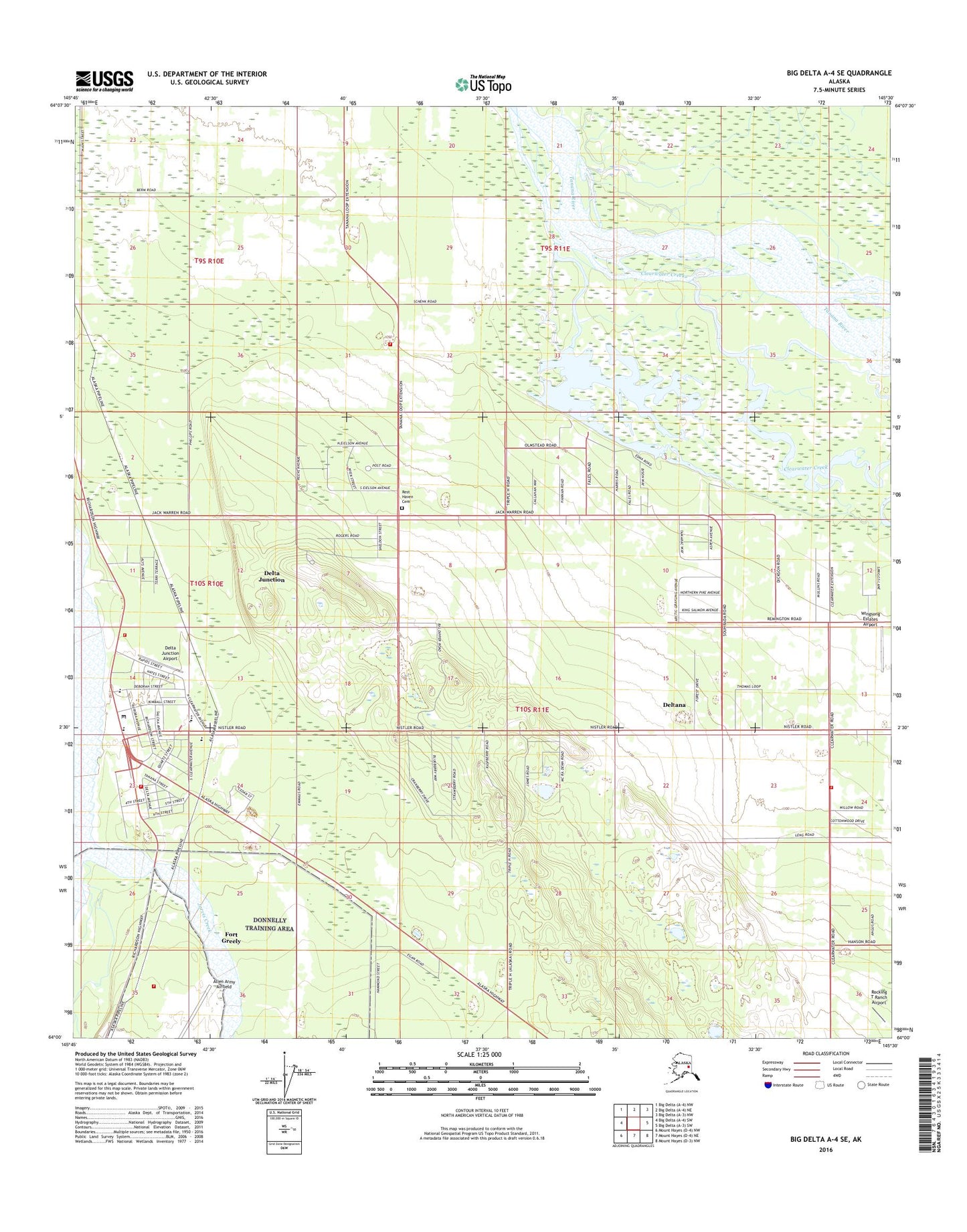
2016 topographic map quadrangle Big Delta A-4 SE in the state of Alaska. Scale: 1:25000. Print Size: 24" x 29"
Based on the newly updated USGS 7.5' US Topo series, this map has UTM / MGRS grids and is in the following counties: Southeast Fairbanks (CA).
The map contains contour data, water features, and other items you are used to seeing on U.S. Geological Survey maps, but also has updated roads and other features. This is the next generation of topographic maps. Printed on high-quality waterproof paper with UV fade-resistant inks.
Contains the following named places: Clearwater Creek, Clearwater Lake, Delta Junction, Jarvis Creek, KDCZ-FM (Delta Junction), Rocking T Ranch Airport, Delta Junction Airport, Wingsong Estates Airport, City of Delta Junction, Trophy Lodge Heliport, Delta Junction Volunteer Fire Department, Alaska Division of Forestry Delta Area Office, Rural Deltana Volunteer Fire Department Station 1, Rural Deltana Volunteer Fire Department Station 8, Buffalo Row Heliport, Delta Junction Family Medical Center, Delta Junction Public Health Center - Interior Region, Delta Rescue Squad, Delta Junction Post Office, Alaska State Troopers Delta Junction, Rest Haven Cemetery