MyTopo
Circle C-1 NW Alaska US Topo Map
Couldn't load pickup availability
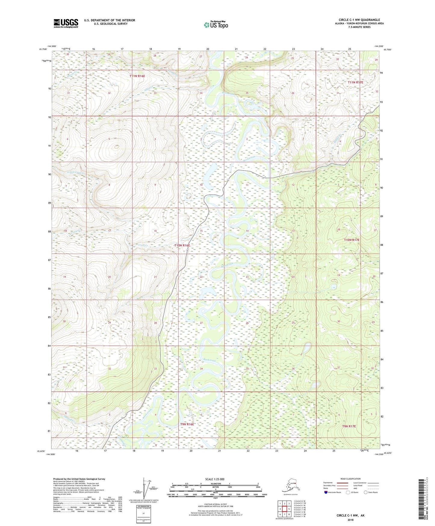
2018 topographic map quadrangle Circle C-1 NW in the state of Alaska. Scale: 1:25000. Print Size: 24" x 29"
Based on the newly updated USGS 7.5' US Topo series, this map has UTM / MGRS grids and is in the following counties: Yukon-Koyukuk (CA).
The map contains contour data, water features, and other items you are used to seeing on U.S. Geological Survey maps, but also has updated roads and other features. This is the next generation of topographic maps. Printed on high-quality waterproof paper with UV fade-resistant inks.
Contains the following named places: Bolgen Creek, Chert Creek, Crazy Creek, Crooked Creek, George Creek, Jumpoff Creek, North Fork Crazy Creek, Twelvemile House, Ferry Road House (historical), Fourteenmile House (historical), Jumpoff Roadhouse