MyTopo
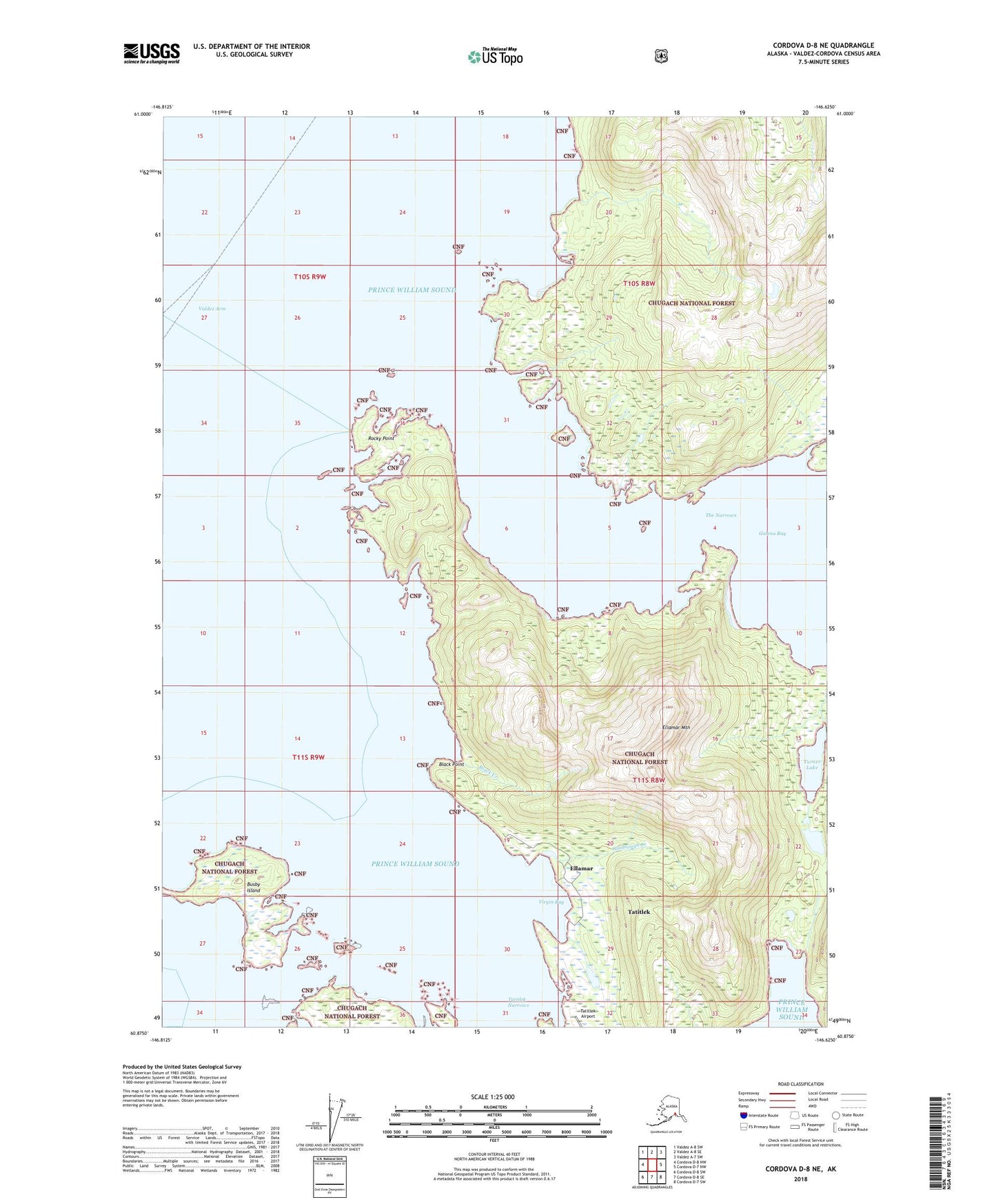
Cordova D-8 NE Alaska US Topo Map
Couldn't load pickup availability
2018 topographic map quadrangle Cordova D-8 NE in the state of Alaska. Scale: 1:25000. Print Size: 24" x 29"
Based on the newly updated USGS 7.5' US Topo series, this map has UTM / MGRS grids and is in the following counties: Valdez-Cordova (CA).
The map contains contour data, water features, and other items you are used to seeing on U.S. Geological Survey maps, but also has updated roads and other features. This is the next generation of topographic maps. Printed on high-quality waterproof paper with UV fade-resistant inks.
Contains the following named places: Tatitlek Narrows, The Narrows, Turner Lake, Valdez Arm, Virgin Bay, Wagner Mine, Ellamar Dam Number 1, Ellamar Dam Number 2, Ellamar Seaplane Base, Ellamar Seaplane Base, Black Creek, Black Point, Busby Island, Ellamar, Ellamar Mountain, Galena Bay, Gladhaugh Creek, Indian Creek, Rocky Point, Rua Mine, Tatitlek Alaska Native Village Statistical Area, Tatitlek Alaska Native Village Statistical Area, Tatitlek Census Designated Place, Tatitlek Census Designated Place