MyTopo
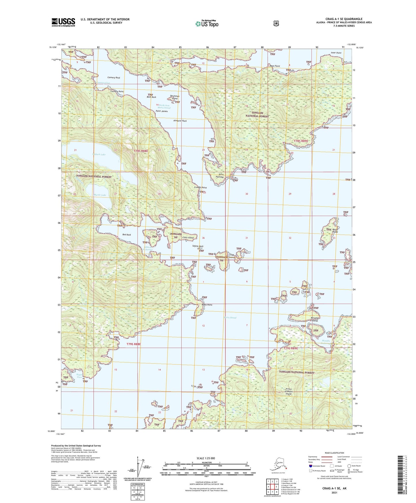
Craig A-1 SE Alaska US Topo Map
Couldn't load pickup availability
2021 topographic map quadrangle Craig A-1 SE in the state of Alaska. Scale: 1:25000. Print Size: 24" x 29"
Based on the newly updated USGS 7.5' US Topo series, this map has UTM / MGRS grids and is in the following counties: Prince of Wales-Hyder (CA).
The map contains contour data, water features, and other items you are used to seeing on U.S. Geological Survey maps, but also has updated roads and other features. This is the next generation of topographic maps. Printed on high-quality waterproof paper with UV fade-resistant inks.
Contains the following named places: Safety Rock, Beck Rock, Black Point, Cannery Cove, Cannery Point, Cannery Rock, Clare Island, Crowell Point, Deichman Island, Egg Islands, Kegan Cove, Menefee Anchorage, Menefee Islands, Moira Sound, Moira Island, Moss Point, Myrtle Creek, Myrtle Lake, Niblack (historical), Niblack Anchorage, Niblack Lake, North Arm Moira Sound, Nowiskay Cove, Point Halliday, Point Jansen, Almguist Rock, Inner Point, Red Rock