MyTopo
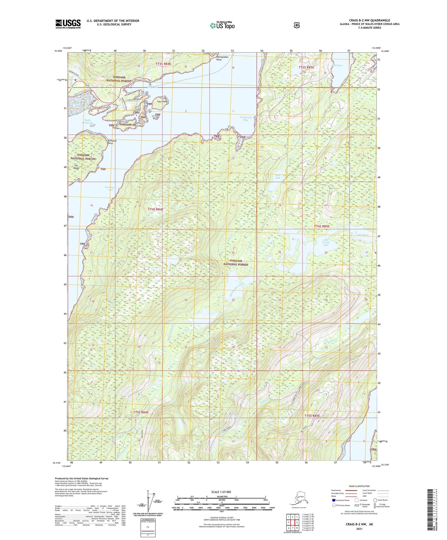
Craig B-2 NW Alaska US Topo Map
Couldn't load pickup availability
2021 topographic map quadrangle Craig B-2 NW in the state of Alaska. Scale: 1:25000. Print Size: 24" x 29"
Based on the newly updated USGS 7.5' US Topo series, this map has UTM / MGRS grids and is in the following counties: Prince of Wales-Hyder (CA).
The map contains contour data, water features, and other items you are used to seeing on U.S. Geological Survey maps, but also has updated roads and other features. This is the next generation of topographic maps. Printed on high-quality waterproof paper with UV fade-resistant inks.
Contains the following named places: Halfmile Creek, Twelvemile Arm, Hollis Clark Bay Seaplane Base, Althouse Point, Cat Island, Clark Bay, Hollis Anchorage, Kina Creek, Kina Lake, Loy Island, Lake Mary, Maybeso Creek, Old Franks Lake, Kajusgidnas Point, Hollis Volunteer Fire Department, Hollis Emergency Medical Services, Twelvemile Bay