MyTopo
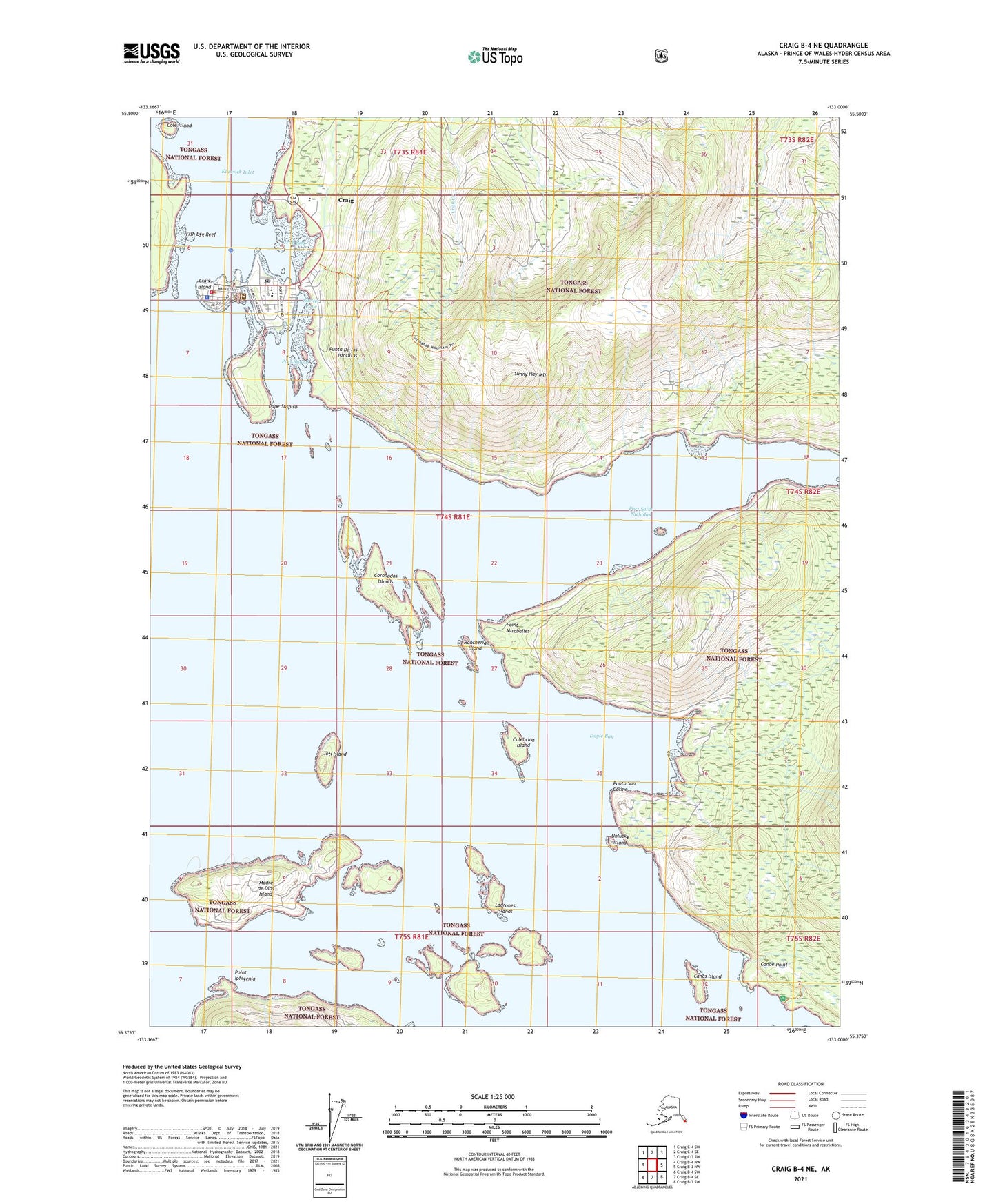
Craig B-4 NE Alaska US Topo Map
Couldn't load pickup availability
2021 topographic map quadrangle Craig B-4 NE in the state of Alaska. Scale: 1:25000. Print Size: 24" x 29"
Based on the newly updated USGS 7.5' US Topo series, this map has UTM / MGRS grids and is in the following counties: Prince of Wales-Hyder (CA).
The map contains contour data, water features, and other items you are used to seeing on U.S. Geological Survey maps, but also has updated roads and other features. This is the next generation of topographic maps. Printed on high-quality waterproof paper with UV fade-resistant inks.
Contains the following named places: Cape Suspiro, Sunny Hay Mountain, Toti Island, Unlucky Island, Craig Water Supply Dam, Craig Seaplane Base, Craig Coast Guard Heliport, Shelter Cove, Canas Island, Canoe Point, Cole Island, Coronados Islands, Crab Bay, Crab Creek, Craig, Culebrina Island, Doyle Bay, Fish Egg Reef, Ladrones Islands, Madre de Dios Island, Point Iphigenia, Point Miraballes, Port Bagial, Port Saint Nicholas, Rancheria Island, Craig Island, Punta De los Islotillos, Punta San Cosme, Craig Alaska Native Village Statistical Area, City of Craig, Craig Volunteer Fire Department, Craig Clinic, PeaceHealth Prince of Wales Medical Center, Craig Public Health Center - Southeast Region, Craig Emergency Medical Services, Craig Post Office, Craig Police Department