MyTopo
Craig B-4 NW Alaska US Topo Map
Couldn't load pickup availability
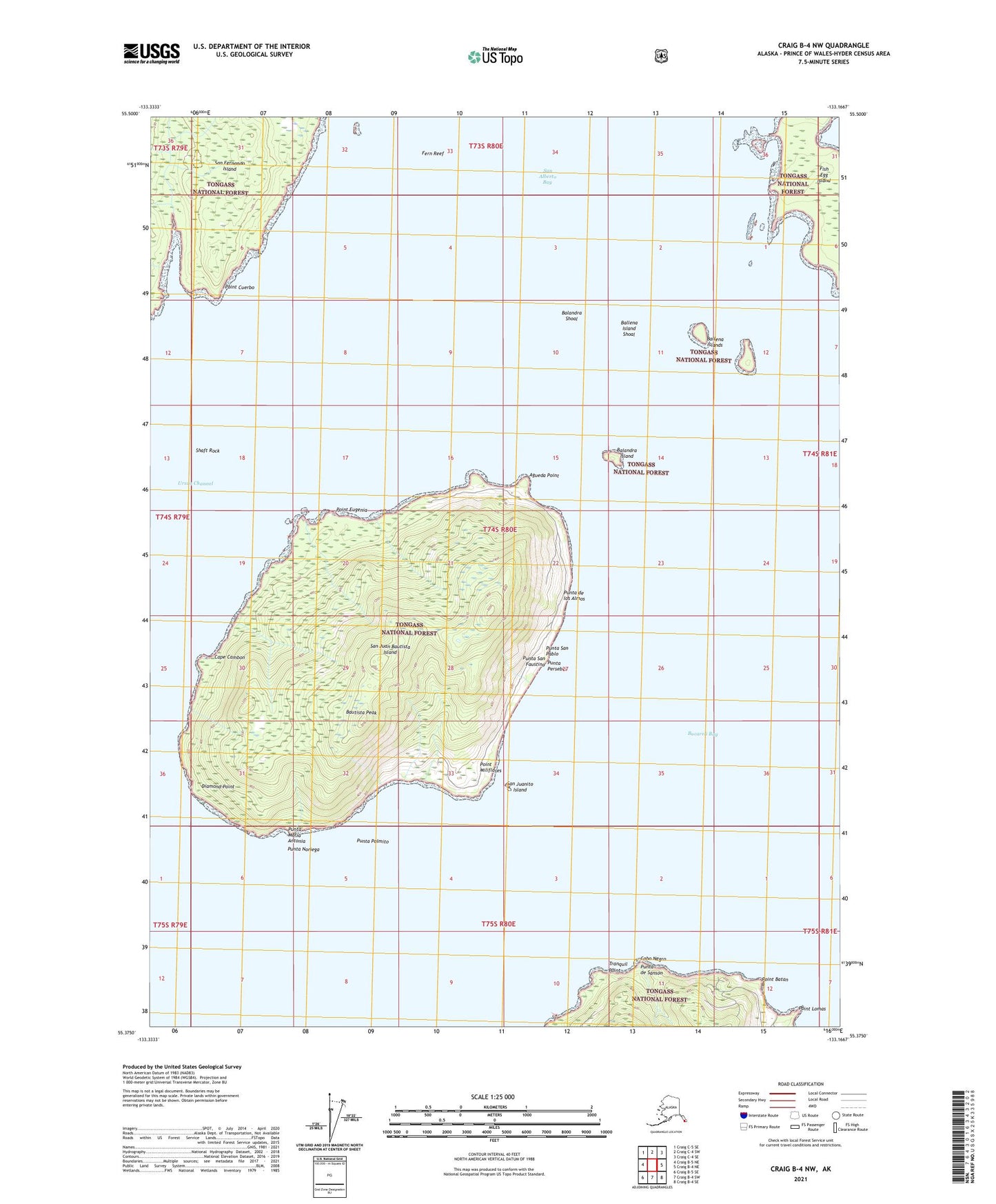
2021 topographic map quadrangle Craig B-4 NW in the state of Alaska. Scale: 1:25000. Print Size: 24" x 29"
Based on the newly updated USGS 7.5' US Topo series, this map has UTM / MGRS grids and is in the following counties: Prince of Wales-Hyder (CA).
The map contains contour data, water features, and other items you are used to seeing on U.S. Geological Survey maps, but also has updated roads and other features. This is the next generation of topographic maps. Printed on high-quality waterproof paper with UV fade-resistant inks.
Contains the following named places: San Juan Bautista Island, San Juanito Island, Tranquil Point, Ursua Channel, Agueda Point, Balandra Island, Balandra Shoal, Ballena Island Shoal, Ballena Islands, Bautista Peak, Cape Cambon, Diamond Point, Fern Reef, Fish Egg Island, Point Batan, Point Cuerbo, Point Eugenia, Point Lomas, Point Miliflores, Punta de los Almos, Punta Maria Antonia, Cabo Negro, Punta Noriega, Punta Palmito, Punta Persebes, Punta San Faustino, Punta San Pablo, Punta de Sanson, Shaft Rock