MyTopo
Craig B-5 NE Alaska US Topo Map
Couldn't load pickup availability
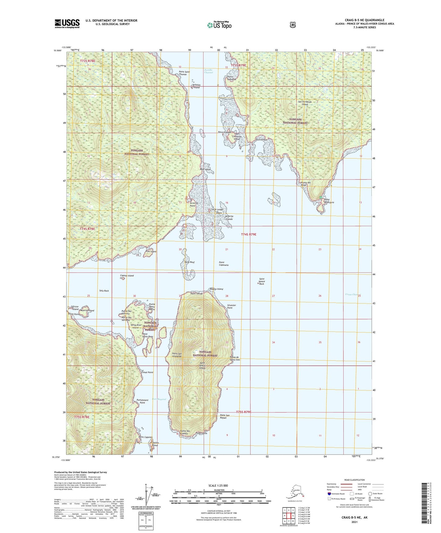
2021 topographic map quadrangle Craig B-5 NE in the state of Alaska. Scale: 1:25000. Print Size: 24" x 29"
Based on the newly updated USGS 7.5' US Topo series, this map has UTM / MGRS grids and is in the following counties: Prince of Wales-Hyder (CA).
The map contains contour data, water features, and other items you are used to seeing on U.S. Geological Survey maps, but also has updated roads and other features. This is the next generation of topographic maps. Printed on high-quality waterproof paper with UV fade-resistant inks.
Contains the following named places: Sword Point, Saint Ignace Island, Saint Ignace Rock, San Clemente Island, Santa Rita Island, Silvester Point, Sola Rock, Sucia Ledge, Triste Island, Triste Point, Arboles Island, Arrecife Islands, Bibora Island, Canal Point, Coposo Island, Cristina Island, Muerta Island, Pine Island, Point Amargura, Point Capones, Point Cocos, Point Espada, Point Gorda, Point Saint Thomas, Point San Leonardo, Point San Rafael, Point Santa Rosa, Port Mayoral, Portillo Channel, Punishment Point, Rana Reef, Reef Point, Arrecife Point, Point Caponeta, Isleta, Punta del Pinal, Punta San Dionisio, Punta San Eusebio, Punta San Salvador, Punta de Santa Ines, Punta Santa Maria, Punta Sudueste