MyTopo
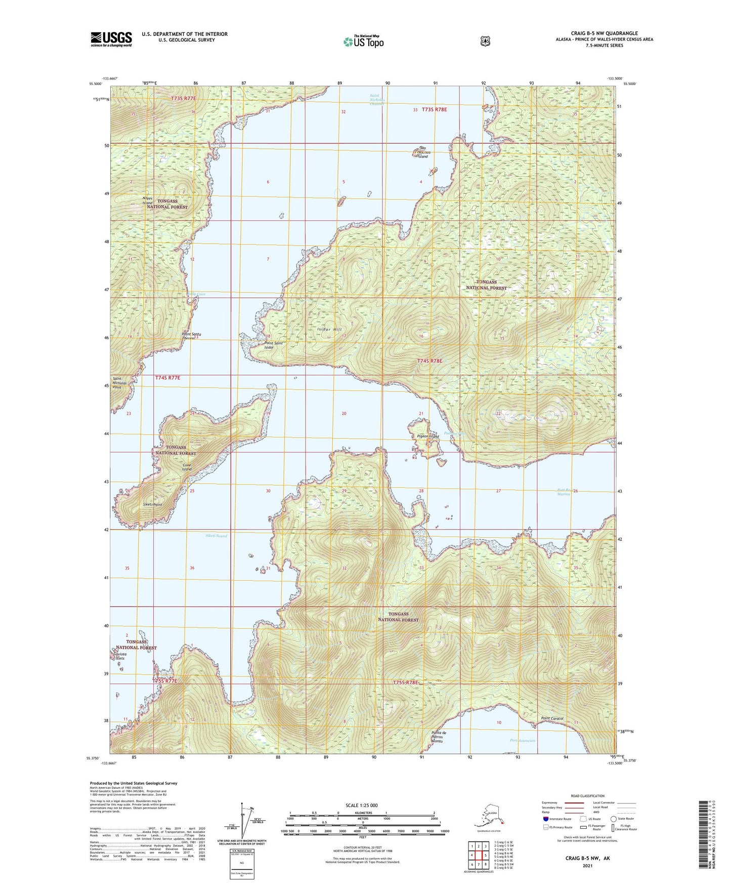
Craig B-5 NW Alaska US Topo Map
Couldn't load pickup availability
2021 topographic map quadrangle Craig B-5 NW in the state of Alaska. Scale: 1:25000. Print Size: 24" x 29"
Based on the newly updated USGS 7.5' US Topo series, this map has UTM / MGRS grids and is in the following counties: Prince of Wales-Hyder (CA).
The map contains contour data, water features, and other items you are used to seeing on U.S. Geological Survey maps, but also has updated roads and other features. This is the next generation of topographic maps. Printed on high-quality waterproof paper with UV fade-resistant inks.
Contains the following named places: Saint Nicholas Channel, Saint Nicholas Point, San Francisco Island, Siketi Point, Siketi Sound, Twin Rocks, Gaviota Rock, Cone Island, Gaviota Islets, Isidor Hill, Kelly Cove, Lulu Island, Paloma Pass, Pigeon Island, Point Caracol, Point Saint Isidor, Point Santa Theresa, Port Asumcion, Port Real Marina, Punta de Patron Alonzo