MyTopo
Craig C-4 SE Alaska US Topo Map
Couldn't load pickup availability
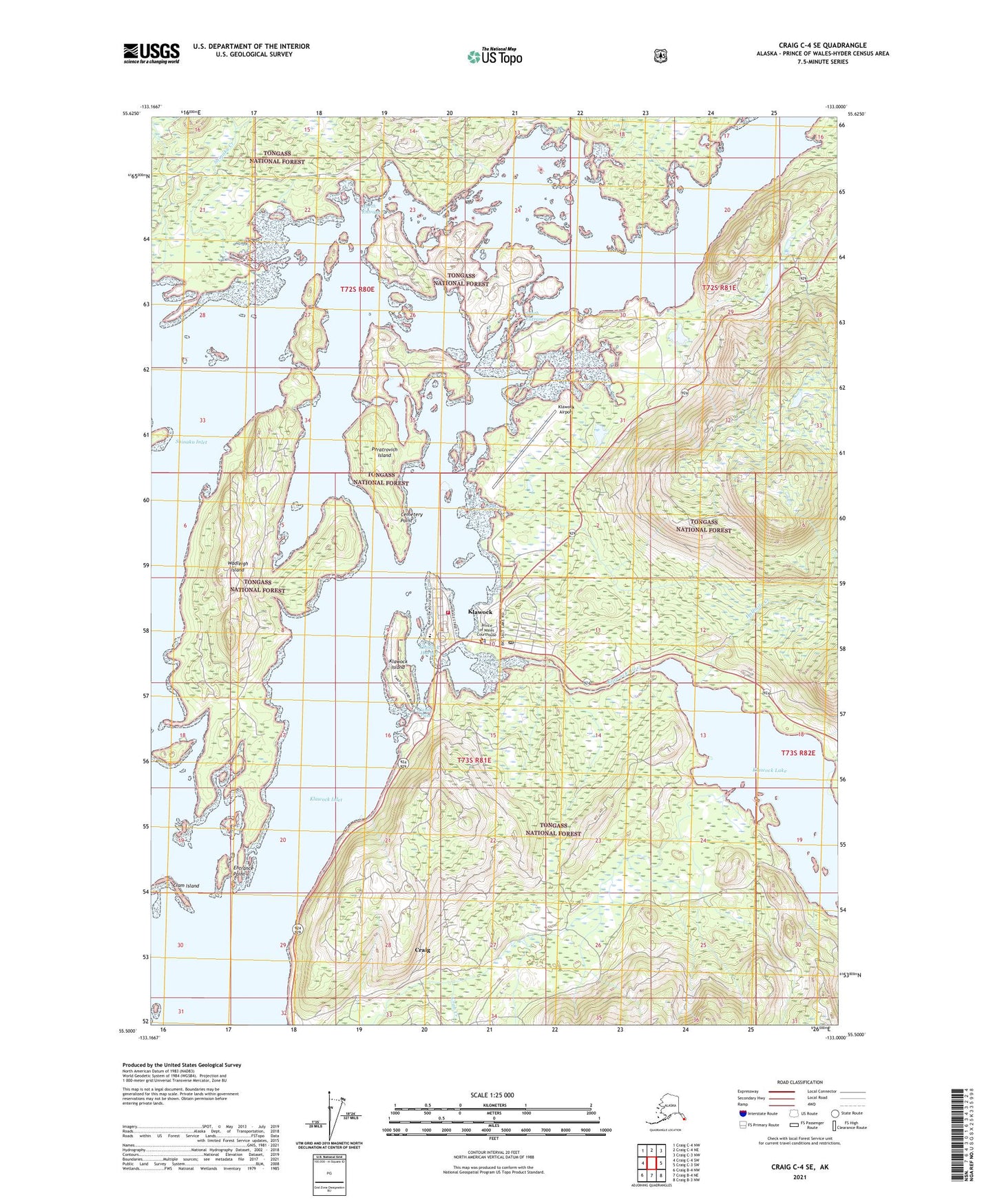
2021 topographic map quadrangle Craig C-4 SE in the state of Alaska. Scale: 1:25000. Print Size: 24" x 29"
Based on the newly updated USGS 7.5' US Topo series, this map has UTM / MGRS grids and is in the following counties: Prince of Wales-Hyder (CA).
The map contains contour data, water features, and other items you are used to seeing on U.S. Geological Survey maps, but also has updated roads and other features. This is the next generation of topographic maps. Printed on high-quality waterproof paper with UV fade-resistant inks.
Contains the following named places: Shinaku Creek, Shinaku Inlet, South Entrance, Wadleigh Island, Klawock Seaplane Base, Klawock Airport, Cemetery Point, Clam Island, Entrance Point, Halfmile Creek, Klawock, Klawock Harbor, Klawock Inlet, Klawock Island, North Entrance, Peratrovich Island, Canoe Pass, Klawock Alaska Native Village Statistical Area, City of Klawock, Klawock Volunteer Fire Department, Southeast Alaska Regional Health Consortium Alicia Roberts Medical Center, Klawock Emergency Medical Services, Alaska State Troopers Klawock, Klawock Police Department, Klawock Post Office