MyTopo
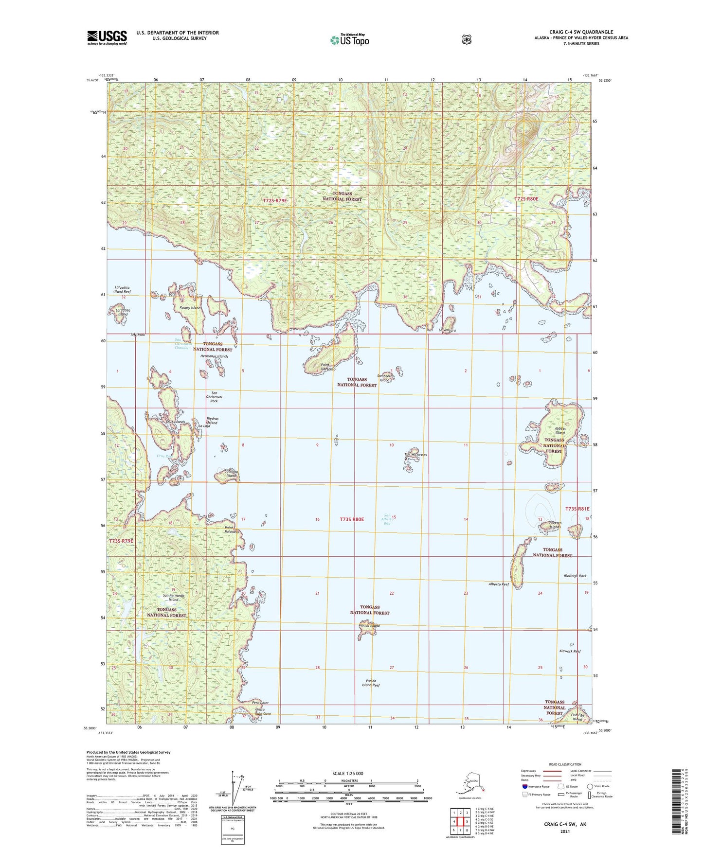
Craig C-4 SW Alaska US Topo Map
Couldn't load pickup availability
2021 topographic map quadrangle Craig C-4 SW in the state of Alaska. Scale: 1:25000. Print Size: 24" x 29"
Based on the newly updated USGS 7.5' US Topo series, this map has UTM / MGRS grids and is in the following counties: Prince of Wales-Hyder (CA).
The map contains contour data, water features, and other items you are used to seeing on U.S. Geological Survey maps, but also has updated roads and other features. This is the next generation of topographic maps. Printed on high-quality waterproof paper with UV fade-resistant inks.
Contains the following named places: San Christoval Rock, San Alberto Bay, Sombrero Island, The Witnesses, Tuft Rock, Wadleigh Rock, Witness Rocks, Abbess Island, Alberto Islands, Alberto Reef, Catalina Island, Cruz Islands, Cruz Pass, Fern Point, Hermanos Islands, Klawock Reef, Larzatita Island, Larzatita Island Reef, Parida Island, Parida Island Reef, Piedras Island, Point Ildefonso, Point Polocano, Rosary Island, La Laja, Punta Palo Cano, La Ventura