MyTopo
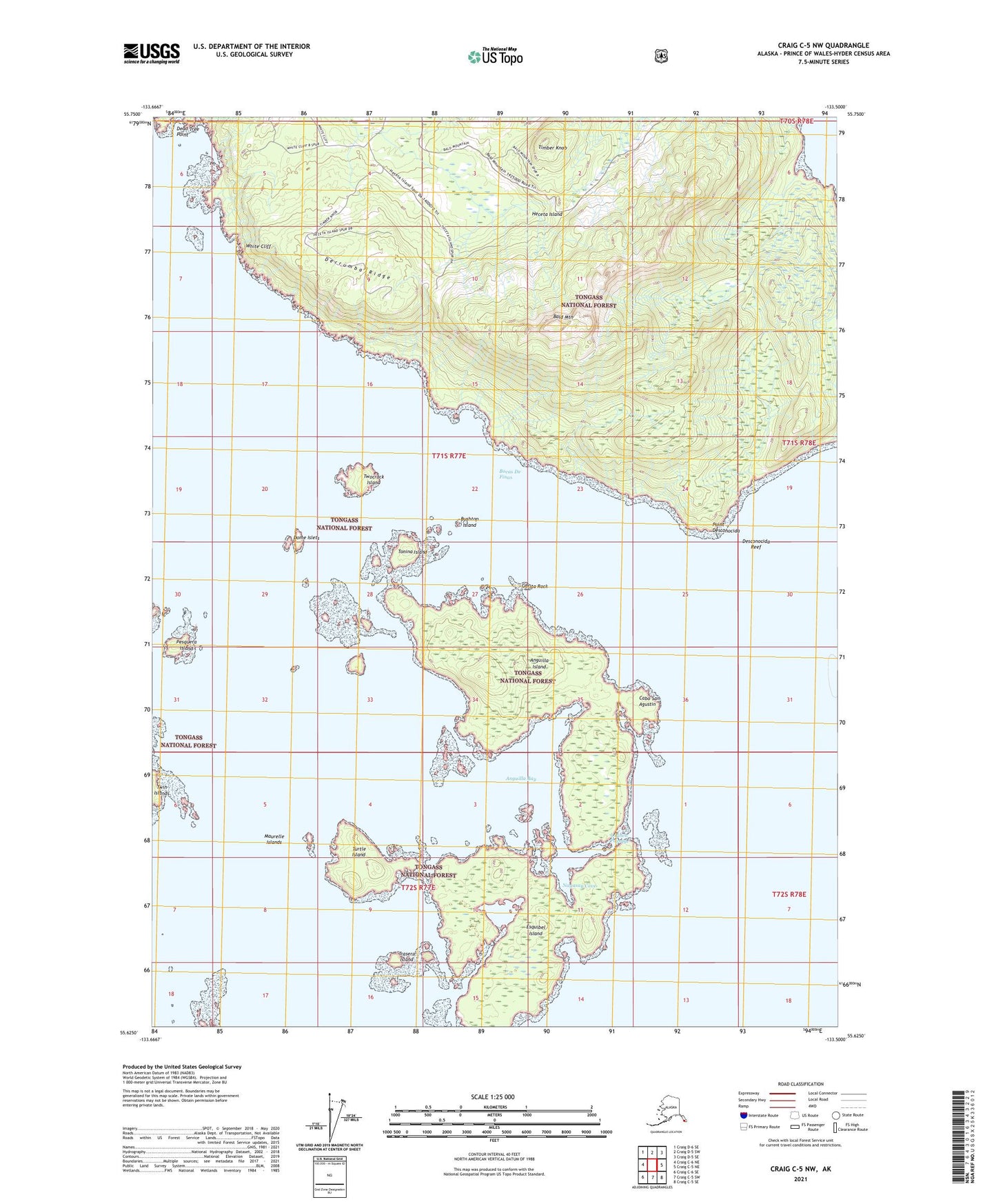
Craig C-5 NW Alaska US Topo Map
Couldn't load pickup availability
2021 topographic map quadrangle Craig C-5 NW in the state of Alaska. Scale: 1:25000. Print Size: 24" x 29"
Based on the newly updated USGS 7.5' US Topo series, this map has UTM / MGRS grids and is in the following counties: Prince of Wales-Hyder (CA).
The map contains contour data, water features, and other items you are used to seeing on U.S. Geological Survey maps, but also has updated roads and other features. This is the next generation of topographic maps. Printed on high-quality waterproof paper with UV fade-resistant inks.
Contains the following named places: Timber Knob, Tonina Island, Trasera Island, Turtle Island, Twocrack Island, White Cliff, Maurelle Islands Wilderness, Anguilla Bay, Anguilla Island, Bocas De Finas, Bushtop Island, Dead Tree Point, Derrumba Ridge, Desconocida Reef, Dome Islets, Esquibel Island, Garita Rock, Lambda Rock, Launch Passage, Maurelle Islands, Nagasay Cove, Pesquera Island, Point Desconocida, Princesa Island, Bald Mountain, Cabo San Agustin