MyTopo
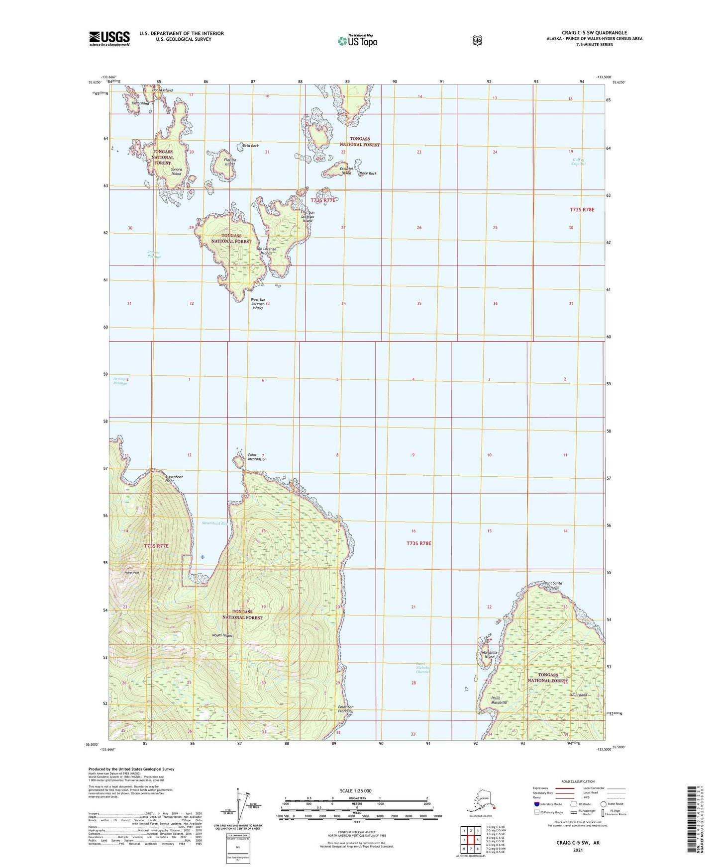
Craig C-5 SW Alaska US Topo Map
Couldn't load pickup availability
2021 topographic map quadrangle Craig C-5 SW in the state of Alaska. Scale: 1:25000. Print Size: 24" x 29"
Based on the newly updated USGS 7.5' US Topo series, this map has UTM / MGRS grids and is in the following counties: Prince of Wales-Hyder (CA).
The map contains contour data, water features, and other items you are used to seeing on U.S. Geological Survey maps, but also has updated roads and other features. This is the next generation of topographic maps. Printed on high-quality waterproof paper with UV fade-resistant inks.
Contains the following named places: Sonora Island, Sonora Passage, Steamboat Bay, Steamboat Point, Toza Island, San Lorenzo Islands, Steamboat Bay Seaplane Base, Arriaga Passage, Beta Rock, Escurial Island, Flotilla Island, Gulf of Esquibel, Hacha Island, Hole in the Wall, Marabilla Island, Moke Rock, Noyes Island Cannery, Noyes Peak, Point Incarnation, Point Marabilla, Point San Francisco, Point Santa Gertrudis, East San Lorenzo Island, West San Lorenzo Island