MyTopo
Craig D-4 NW Alaska US Topo Map
Couldn't load pickup availability
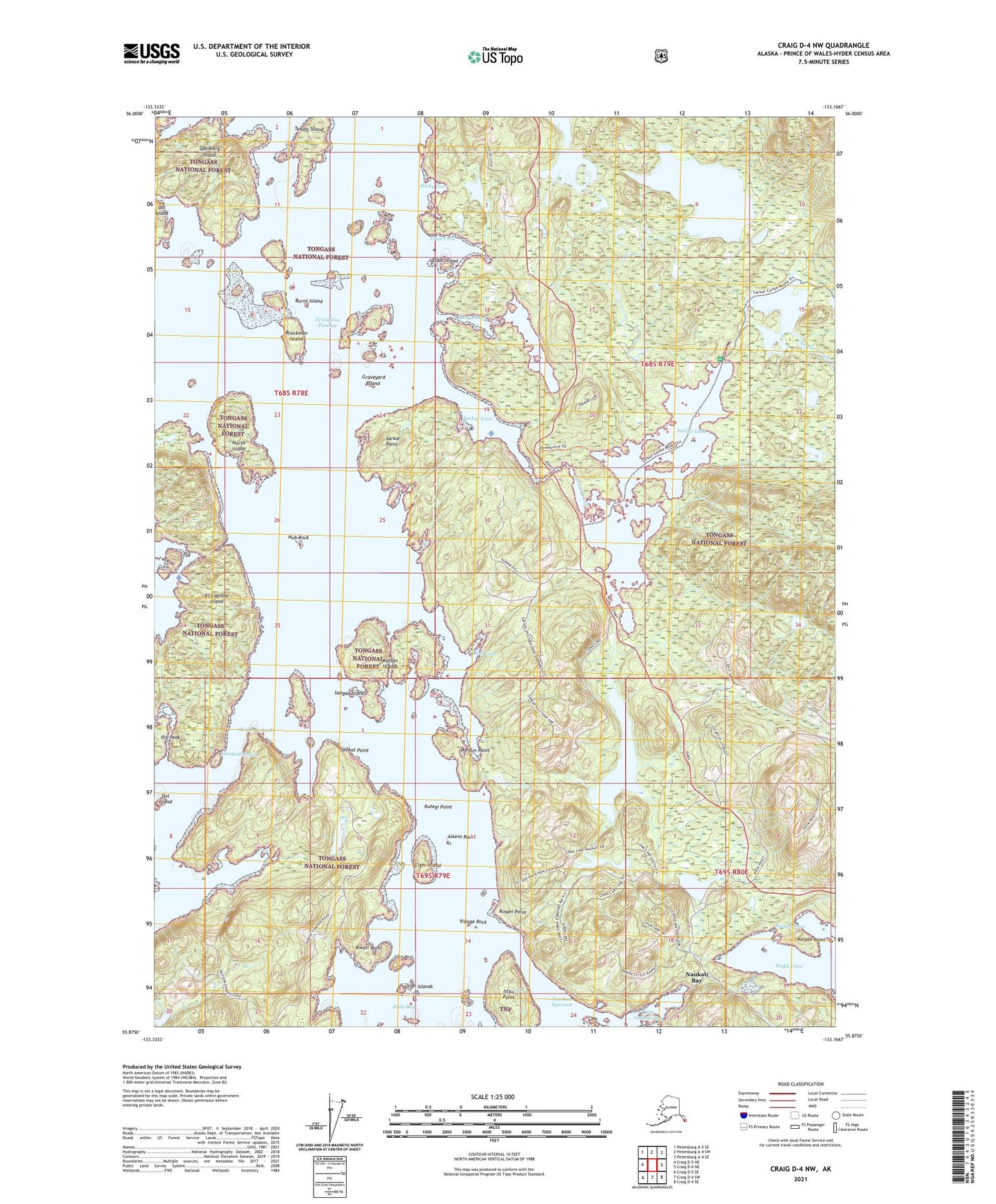
2021 topographic map quadrangle Craig D-4 NW in the state of Alaska. Scale: 1:25000. Print Size: 24" x 29"
Based on the newly updated USGS 7.5' US Topo series, this map has UTM / MGRS grids and is in the following counties: Prince of Wales-Hyder (CA).
The map contains contour data, water features, and other items you are used to seeing on U.S. Geological Survey maps, but also has updated roads and other features. This is the next generation of topographic maps. Printed on high-quality waterproof paper with UV fade-resistant inks.
Contains the following named places: Salt Water Lagoon, Sarkar Cove, Sarkar Creek, Sarkar Lake, Sarkar Point, Skookumchuck, Spanberg Island, Tenass Island, Tunga Inlet, Tuxekan (historical), Tuxekan Narrows, Tokeen Seaplane Base, Kinani Point, Istku Point, Jinhi Bay, Kwati Point, Elghi Island, Kaigao Point, Kaigao Cove, Shikat Point, Dargun Point, Kassan Islands, North Island, Kahli Cove, Brockman Island, Burnt Island, Cap Island, Clam Cove, Clam Island, Deweyville (historical), Dot Island, El Capitan Island, Graveyard Island, Hub Rock, Kaikli Cove, Little Naukati Bay, New Tokeen, Rocky Cove, Sigh Islands, Village Rock, Aikens Rock, Kutegi Point, Sangao Island, Sarkar Lake Cabin, Pin Peak, Skookumschuck, Naukati Bay Census Designated Place, El Capitan Lodge Seaplane Base