MyTopo
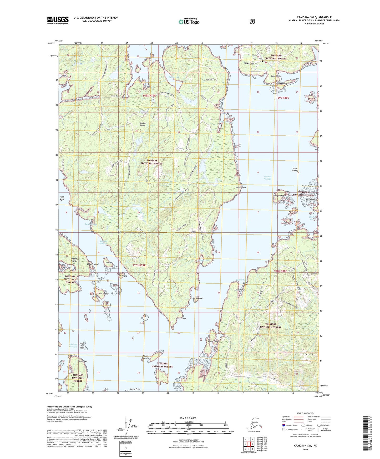
Craig D-4 SW Alaska US Topo Map
Couldn't load pickup availability
2021 topographic map quadrangle Craig D-4 SW in the state of Alaska. Scale: 1:25000. Print Size: 24" x 29"
Based on the newly updated USGS 7.5' US Topo series, this map has UTM / MGRS grids and is in the following counties: Prince of Wales-Hyder (CA).
The map contains contour data, water features, and other items you are used to seeing on U.S. Geological Survey maps, but also has updated roads and other features. This is the next generation of topographic maps. Printed on high-quality waterproof paper with UV fade-resistant inks.
Contains the following named places: Scott Lagoon, Staney Island, Tonowek Narrows, Trim Island, Tuxekan Island, Tuxekan Passage, Nichin Cove, Naukati Bay Seaplane Base, Nundei Cove, Ahtun Point, Winter Harbor, Chusini Cove, Kleiti Islands, Yahku Cove, Klinau Island, Guhao Inlet, Kladein Flats, Suhti Island, Gaohi Islands, Dasani Islands, Chapin Island, Cob Island, Ham Islands, Kaishi Point, Karheen (historical), Karheen Cove, Karheen Lakes, Karheen Passage, Kauda Point, Kugun Point, Peep Rock, Point Swift, Point Swift Rock, Guktu Point, Tahka Point, Kussu Islands, Naukati Bay, Karheen Creek, Naukati Volunteer Fire Department, Alaska Island Community Services Naukati Clinic