MyTopo
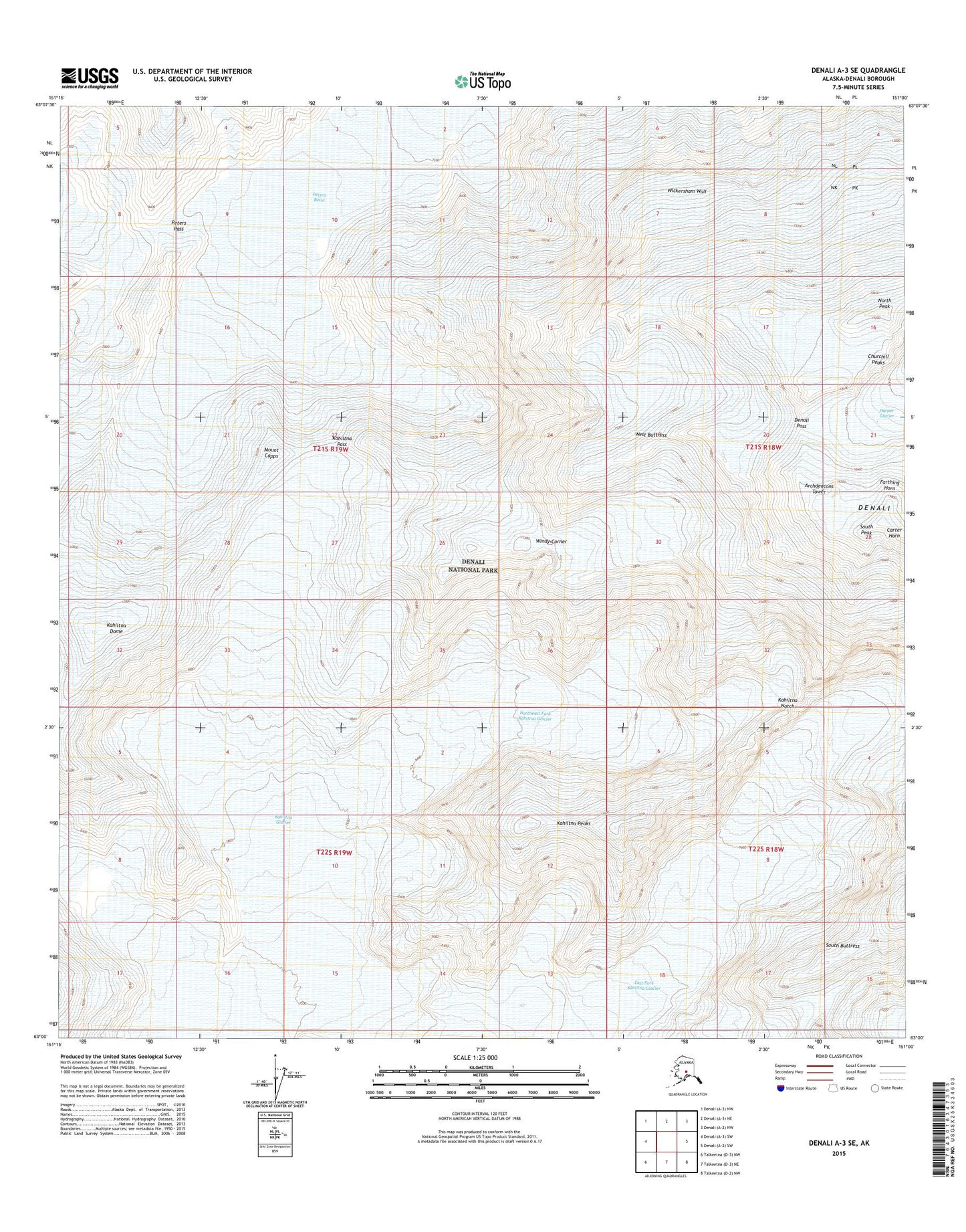
Denali A-3 SE Alaska US Topo Map
Couldn't load pickup availability
2015 topographic map quadrangle Denali A-3 SE in the state of Alaska. Scale: 1:25000. Print Size: 24" x 29"
Based on the newly updated USGS 7.5' US Topo series, this map has UTM / MGRS grids and is in the following counties: Denali.
The map contains contour data, water features, and other items you are used to seeing on U.S. Geological Survey maps, but also has updated roads and other features. This is the next generation of topographic maps. Printed on high-quality waterproof paper with UV fade-resistant inks.
Contains the following named places: Archdeacons Tower, Mount Capps, Churchill Peaks, Denali Pass, East Fork Kahiltna Glacier, Farthing Horn, Kahiltna Dome, Kahiltna Notch, Kahiltna Pass, Kahiltna Peaks, Northeast Fork Kahiltna Glacier, Peters Basin, Peters Glacier, Peters Pass, West Buttress, Wickersham Wall, Windy Corner, Denali, South Peak, North Peak