MyTopo
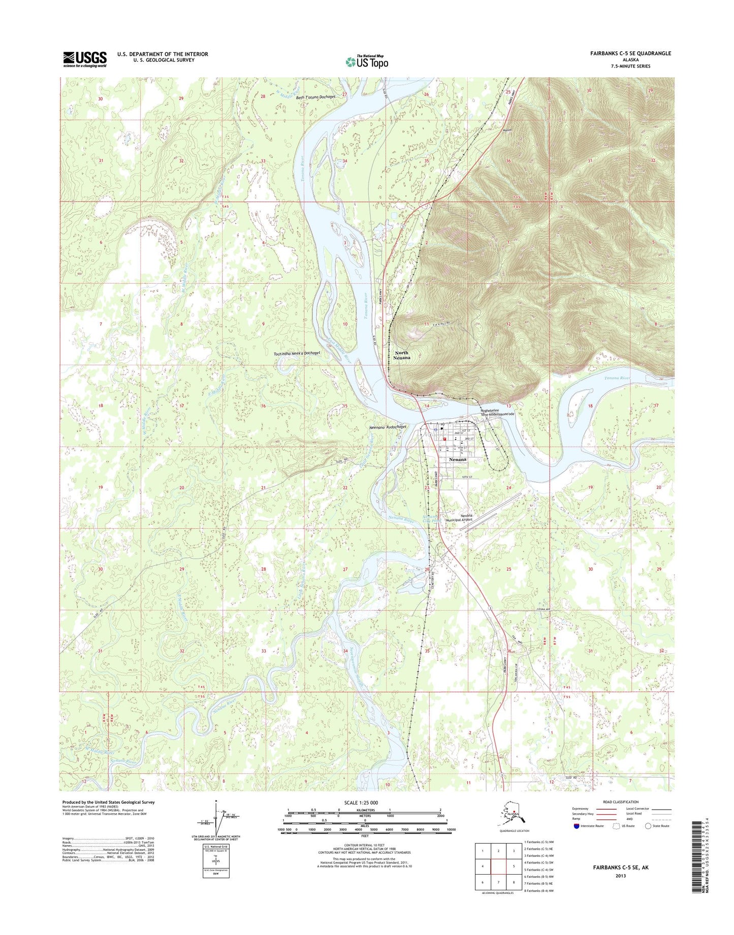
Fairbanks C-5 SE Alaska US Topo Map
Couldn't load pickup availability
2013 topographic map quadrangle Fairbanks C-5 SE in the state of Alaska. Scale: 1:25000. Print Size: 24" x 29"
Based on the newly updated USGS 7.5' US Topo series, this map has UTM / MGRS grids and is in the following counties: Yukon-Koyukuk (CA).
The map contains contour data, water features, and other items you are used to seeing on U.S. Geological Survey maps, but also has updated roads and other features. This is the next generation of topographic maps. Printed on high-quality waterproof paper with UV fade-resistant inks.
Contains the following named places: East Middle River, Fish Creek, Little Nenana River, Nenana, Nenana River, North Nenana, West Middle River, Seventeenmile Slough, Nenana Municipal Airport, Mahon, Tortella (historical), Wood Spur, Four Mile Road Census Designated Place, Nenana Alaska Native Village Statistical Area, City of Nenana, Nenana Volunteer Fire Department and Emergency Medical Services, Nenana City Pond, Neenano' Xudochaget, Beth T'otono Dochaget, Toch'edha Neek'a Dochaget, Noghebelee Tene Nodenaanee'ode, Valley Family Health Services, Tanana Chiefs Conference Nenana Clinic, Nenana Post Office, Nenana Police Department, Alaska State Troopers Nenana, Nenana North Cemetery, Nenana South Cemetery