MyTopo
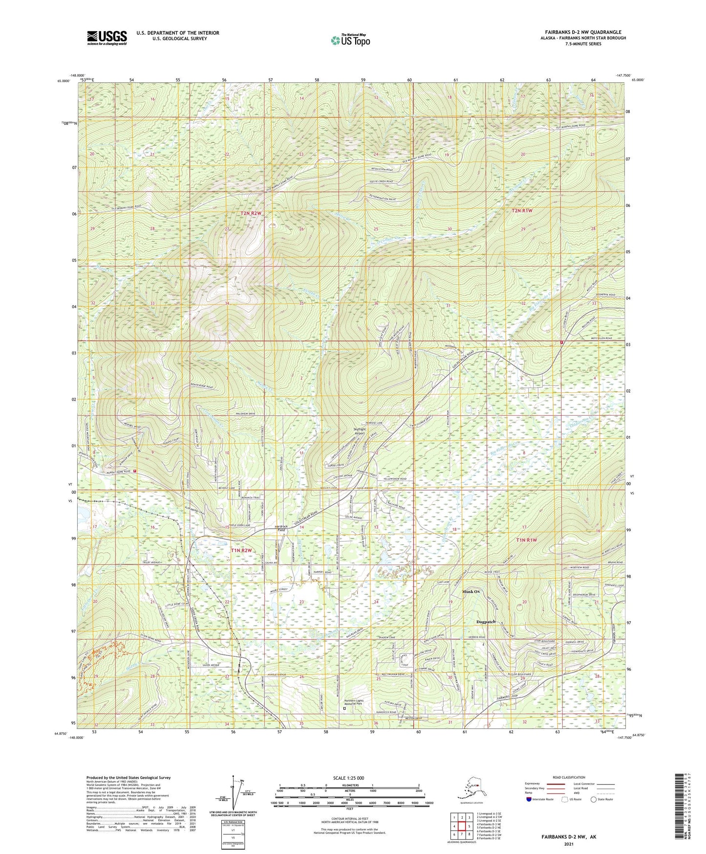
Fairbanks D-2 NW Alaska US Topo Map
Couldn't load pickup availability
2021 topographic map quadrangle Fairbanks D-2 NW in the state of Alaska. Scale: 1:25000. Print Size: 24" x 29"
Based on the newly updated USGS 7.5' US Topo series, this map has UTM / MGRS grids and is in the following counties: Fairbanks North Star.
The map contains contour data, water features, and other items you are used to seeing on U.S. Geological Survey maps, but also has updated roads and other features. This is the next generation of topographic maps. Printed on high-quality waterproof paper with UV fade-resistant inks.
Contains the following named places: Fairbanks Golf Course, Big Eldorado Creek, Caribou Lake, Dogpatch, Eureka Creek, Frenchman Creek, Gold Mine, Gold Mine, Happy, Hattie Creek, Little Dome Creek, Little Nugget Creek, Middle Lake, Monte Cristo Creek, Musk Ox, Northern Lights Memorial Park, O'Connor Creek, Lake Paul, Reindeer Lake, Sheep Creek, Star Lake, West Fork Moose Creek, Windy Creek, KFAR-AM (Fairbanks), KUAC-FM (Fairbanks), KWLF-FM (Fairbanks), KUAC-TV (Fairbanks), Skyflight Airport, McNears, Chena - Goldstream Fire and Rescue Station 43, Chena - Goldstream Fire and Rescue Station 41 Vail, Eielson Alaska Long Period Array Research Site, O'Brien Field (historical), Hardrock Field