MyTopo
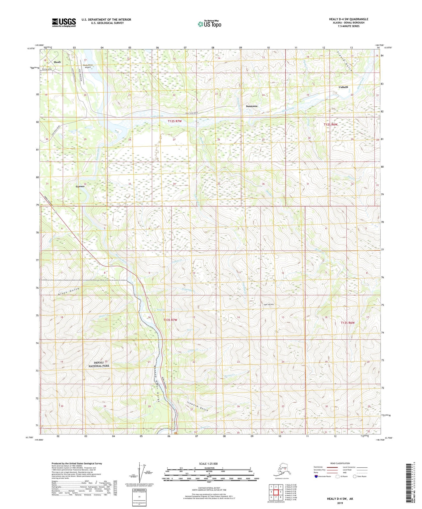
Healy D-4 SW Alaska US Topo Map
Couldn't load pickup availability
2019 topographic map quadrangle Healy D-4 SW in the state of Alaska. Scale: 1:25000. Print Size: 24" x 29"
Based on the newly updated USGS 7.5' US Topo series, this map has UTM / MGRS grids and is in the following counties: Denali.
The map contains contour data, water features, and other items you are used to seeing on U.S. Geological Survey maps, but also has updated roads and other features. This is the next generation of topographic maps. Printed on high-quality waterproof paper with UV fade-resistant inks.
Contains the following named places: Alaska Creek, Antler Creek, Bison Gulch, Copeland Creek, Coyote Creek, Dragonfly Creek, Eagle Creek, Fox Creek, French Gulch, Garner, Grizzly Creek, Healy, Healy Creek, Hornet Creek, Iceworm Gulch, Junco Creek, Moody, Moody Creek, Nenana River Gorge, Sheep Creek, Sugar Loaf Mountain, Suntrana, Suntrana Creek, Usibelli, Usibelli Mine, Dora Creek, Healy River Airport