MyTopo
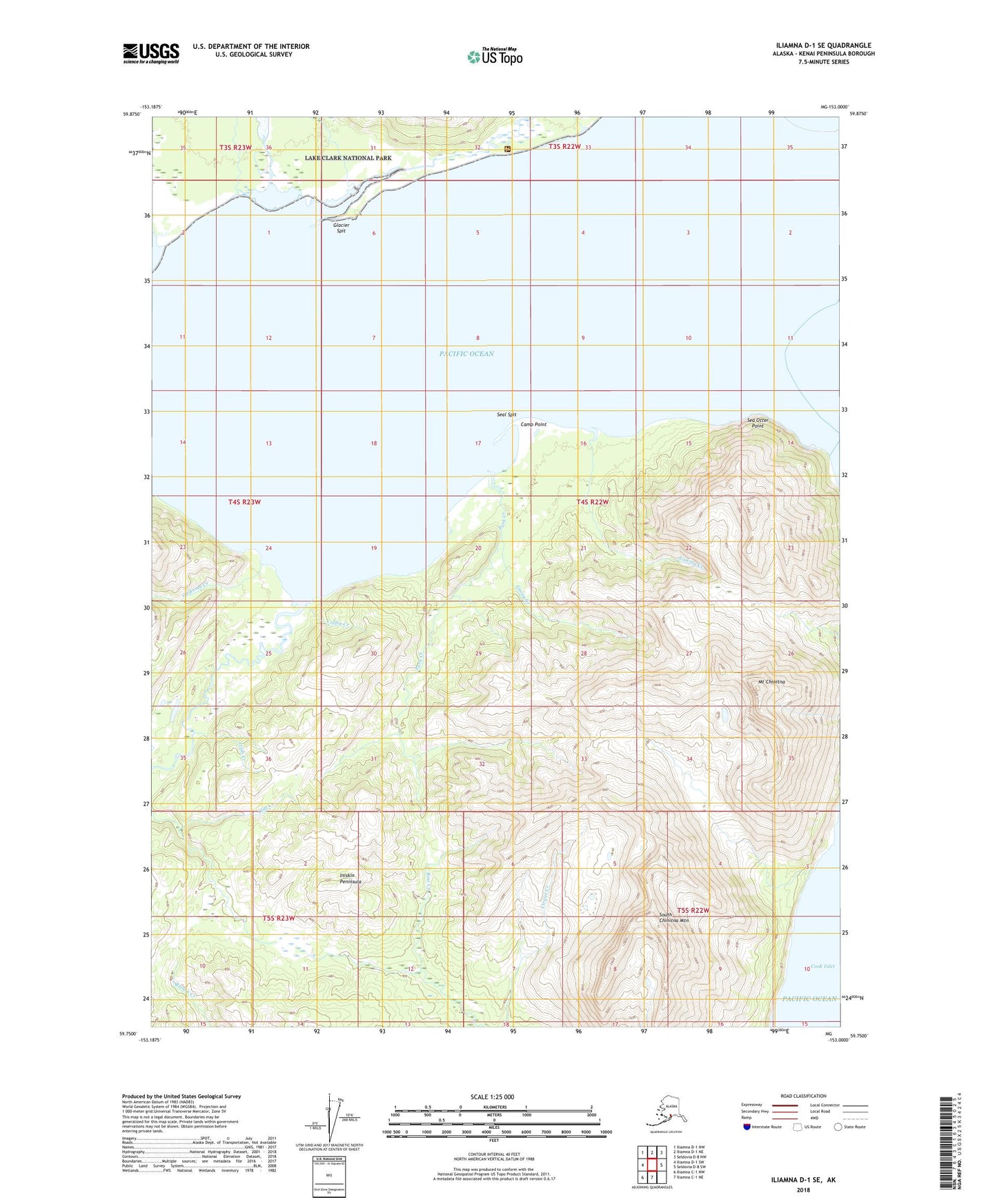
Iliamna D-1 SE Alaska US Topo Map
Couldn't load pickup availability
2018 topographic map quadrangle Iliamna D-1 SE in the state of Alaska. Scale: 1:25000. Print Size: 24" x 29"
Based on the newly updated USGS 7.5' US Topo series, this map has UTM / MGRS grids and is in the following counties: Kenai Peninsula.
The map contains contour data, water features, and other items you are used to seeing on U.S. Geological Survey maps, but also has updated roads and other features. This is the next generation of topographic maps. Printed on high-quality waterproof paper with UV fade-resistant inks.
Contains the following named places: Camp Point, Chinitna Bay, Mount Chinitna, Cliff Creek, Coffin Creek, Covey Creek, Fitz Creek, Gaikema Creek, Glacier Spit, Horn Creek, Irish Creek, Middle Glacier Creek, Park Creek, Sea Otter Point, Seal Spit, Sinking Creek, South Chinitna Mountain, Camp Point Airport (historical)