MyTopo
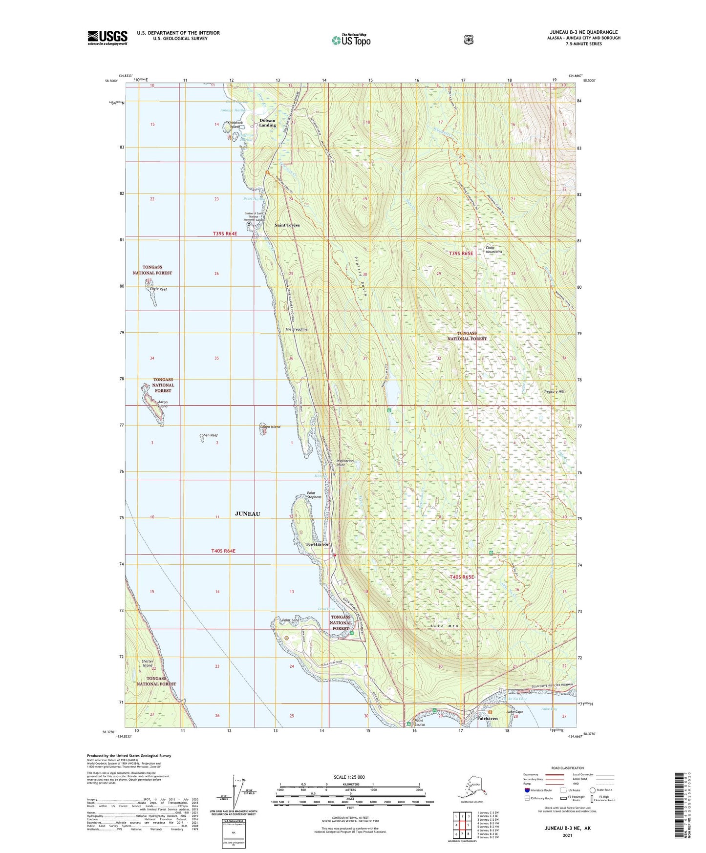
Juneau B-3 NE Alaska US Topo Map
Couldn't load pickup availability
2021 topographic map quadrangle Juneau B-3 NE in the state of Alaska. Scale: 1:25000. Print Size: 24" x 29"
Based on the newly updated USGS 7.5' US Topo series, this map has UTM / MGRS grids and is in the following counties: Juneau.
The map contains contour data, water features, and other items you are used to seeing on U.S. Geological Survey maps, but also has updated roads and other features. This is the next generation of topographic maps. Printed on high-quality waterproof paper with UV fade-resistant inks.
Contains the following named places: Aaron Island, Amalga Harbor, Auke Cape, Auke Mountain, Auke Nu Cove, Auke Recreation Area, Cohen Island, Cohen Reef, Dobson Landing, Eagle Harbor, Eagle Reef, Fairhaven, Huffman Harbor, Inspiration Point, Kishbrock Island, Lena Beach Recreation Area, Lena Cove, Lena Creek, Montana Creek Trail, Pearl Harbor, Peterson Creek, Peterson Lake, Point Lena, Point Stephens, Saint Terese, Salt Lake, Shrine of Saint Terese, Shrine Creek, Slate Creek, Spaulding Trail, Tee Creek, Tee Harbor, The Breadline, Tee Harbor, Dotsons Landing, Amalga Landing, Goose Creek, Lena Beach, Prairie Basin, Tenk Creek, Treasury Hill, Tusta Creek, Saint Terese Post Office (historical), Alascom/Coastal Lena Point Heliport, Capital City Fire and Rescue Lynn Canal Station, Windfall Creek Mine, Peterson Mine, Greens Creek Emergency Medical Services, Shrine of Saint Therese - Memorial Garden