MyTopo
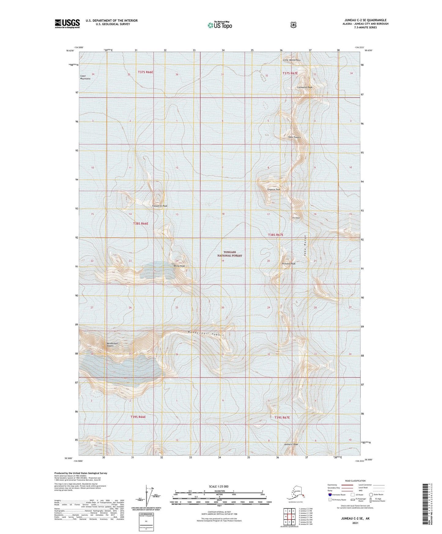
Juneau C-2 SE Alaska US Topo Map
Couldn't load pickup availability
2021 topographic map quadrangle Juneau C-2 SE in the state of Alaska. Scale: 1:25000. Print Size: 24" x 29"
Based on the newly updated USGS 7.5' US Topo series, this map has UTM / MGRS grids and is in the following counties: Juneau.
The map contains contour data, water features, and other items you are used to seeing on U.S. Geological Survey maps, but also has updated roads and other features. This is the next generation of topographic maps. Printed on high-quality waterproof paper with UV fade-resistant inks.
Contains the following named places: Mendenhall Glacier, Snowdrift Peak, Taku Towers, The Dukes, Taku Range, Amherst Peak, Cathedral Peak, Emperor Peak, Little Matterhorn, Mendenhall Towers, Princess Peak, Rhino Peak