MyTopo
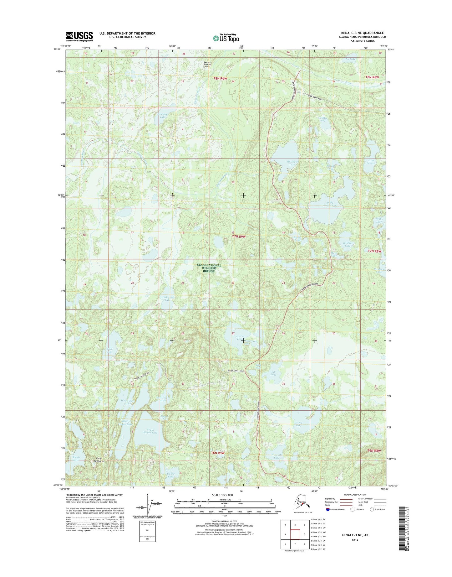
Kenai C-3 NE Alaska US Topo Map
Couldn't load pickup availability
2014 topographic map quadrangle Kenai C-3 NE in the state of Alaska. Scale: 1:25000. Print Size: 24" x 29"
Based on the newly updated USGS 7.5' US Topo series, this map has UTM / MGRS grids and is in the following counties: Kenai Peninsula.
The map contains contour data, water features, and other items you are used to seeing on U.S. Geological Survey maps, but also has updated roads and other features. This is the next generation of topographic maps. Printed on high-quality waterproof paper with UV fade-resistant inks.
Contains the following named places: Anertz Lake, Breeze Lake, Cashka Lake, Dabbler Lake, Dolly Varden Lake, Finger Lake, Forest Lake, Hungry Lake, Kit Lake, Lili Lake, Mink Creek Lake, Mosquito Lake, Quake Lake, Rainbow Lake, Rhode Lake, Lake Sabaka, Silver Lake, Weed Lake, West Lake, Wolf Lake, Swanson River Oil Field, Skookum Lake, East Finger Lake, Finger Lakes, Middle Finger Lake, South Finger Lake, West Finger Lake, West Forest Lake, West Lili Lake