MyTopo
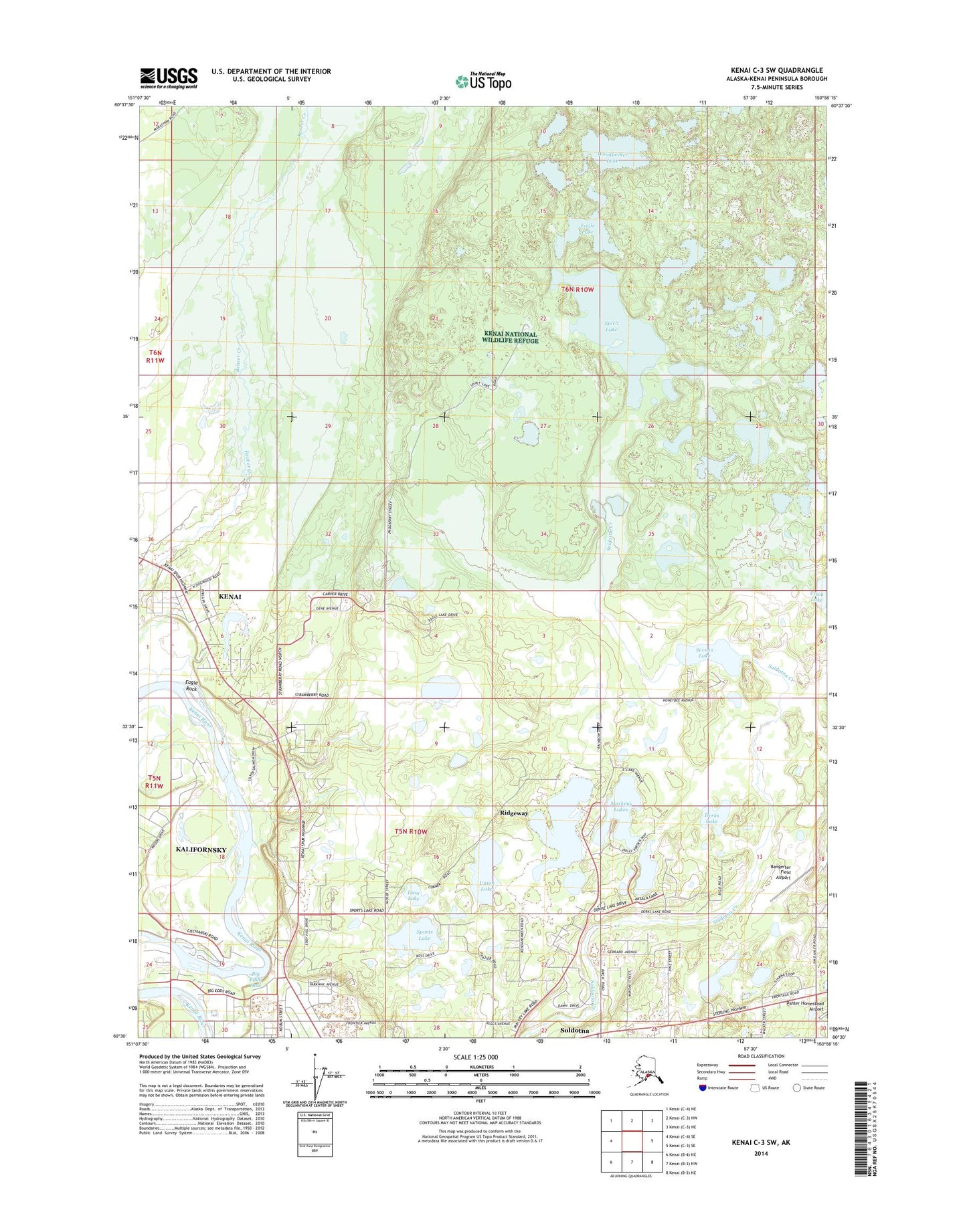
Kenai C-3 SW Alaska US Topo Map
Couldn't load pickup availability
2014 topographic map quadrangle Kenai C-3 SW in the state of Alaska. Scale: 1:25000. Print Size: 24" x 29"
Based on the newly updated USGS 7.5' US Topo series, this map has UTM / MGRS grids and is in the following counties: Kenai Peninsula.
The map contains contour data, water features, and other items you are used to seeing on U.S. Geological Survey maps, but also has updated roads and other features. This is the next generation of topographic maps. Printed on high-quality waterproof paper with UV fade-resistant inks.
Contains the following named places: Eagle Lake, Spirit Lake, Mackeys Lakes, Sports Lake, Woodpecker Lake, Eagle Rock, Derks Lake, Big Eddy Hole, Sevena Lake, Union Lake, KCSY-AM (Soldotna), KCZP-FM (Kenai), KUHK-FM (Soldotna), Dahler Homestead Airport, Mackeys Lakes Seaplane Base, Ridgeway, Ridgeway Census Designated Place, Ridgeway Farms Stables, Central Emergency Services Station 2 Training Center, Loon Lake, Bangerter Field