MyTopo
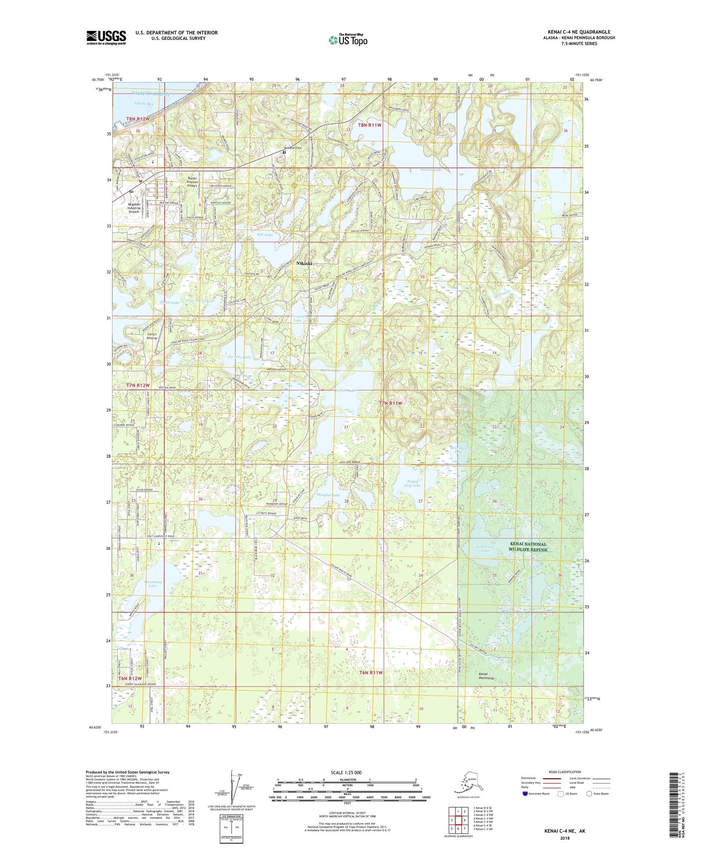
Kenai C-4 NE Alaska US Topo Map
Couldn't load pickup availability
2018 topographic map quadrangle Kenai C-4 NE in the state of Alaska. Scale: 1:25000. Print Size: 24" x 29"
Based on the newly updated USGS 7.5' US Topo series, this map has UTM / MGRS grids and is in the following counties: Kenai Peninsula.
The map contains contour data, water features, and other items you are used to seeing on U.S. Geological Survey maps, but also has updated roads and other features. This is the next generation of topographic maps. Printed on high-quality waterproof paper with UV fade-resistant inks.
Contains the following named places: Boundary Lake, Daniels Lake, Dogbone Lake, Island Lake, Nikiski Bay, Salamatof Lake, Timberlost Lake, Nikiski, Georgina Lake, Kivi Lake, Wik Lake, Puppy Dog Lake, Char-Vic Lake, Parsons Lake, Bishop Lake, Douglas Lake, Konovalof Lake, Chickadee Lake, Lake Ivanoff, Carty's Airstrip, Island Lake Seaplane Base, Arness Lake Airport (historical), Butler Aviation Airport, McGahan Industrial Airpark, Marie Lake, Nikiski Census Designated Place, Joe Clouds Seaplane Base, Offshore Systems-Kenai Heliport, Nikiski Fire Department Station 2, Thetis Lake, Tirmore Lake, Total Safety Emergency Response Services, Nikiski Post Office, McGahan Cemetery