MyTopo
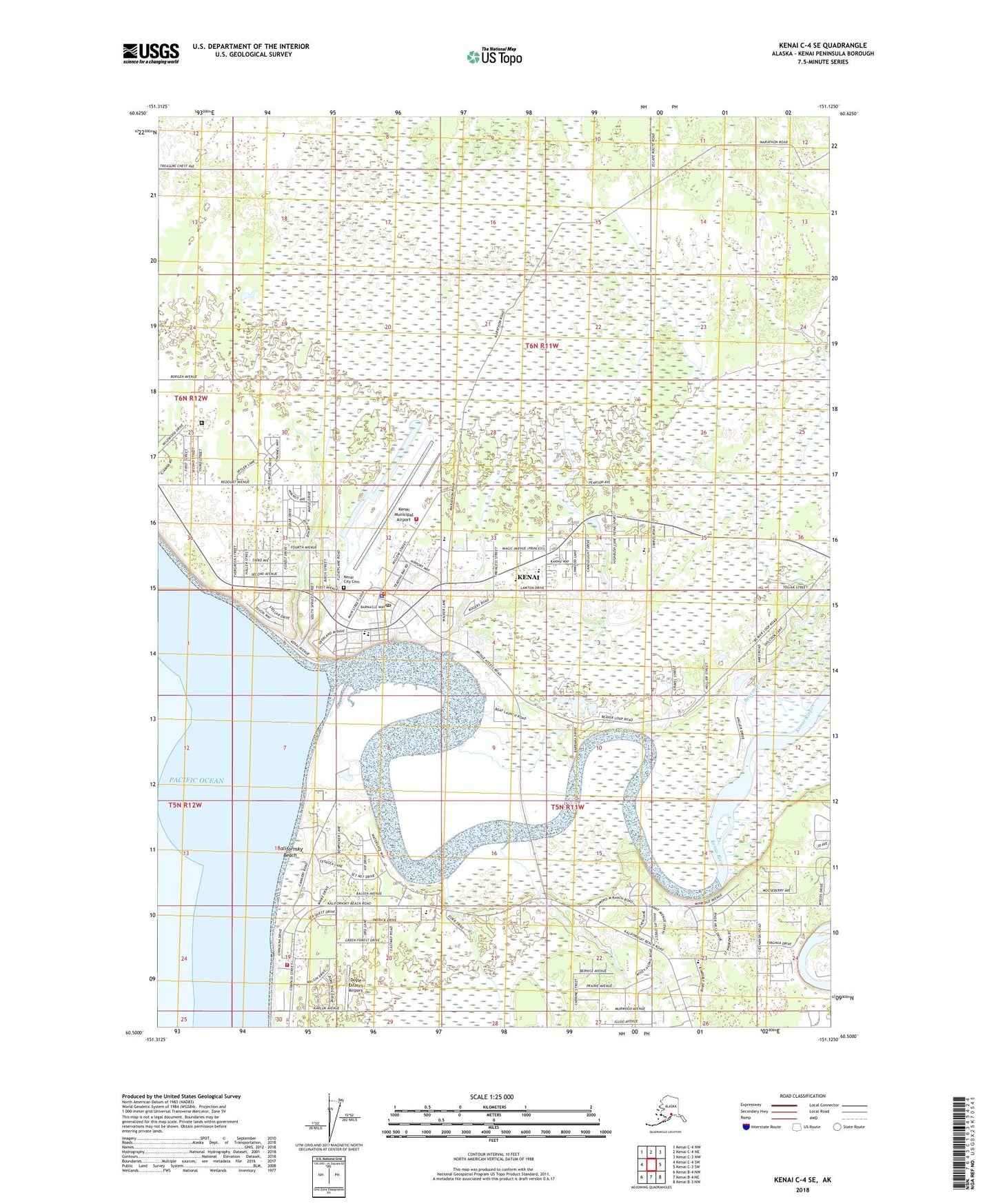
Kenai C-4 SE Alaska US Topo Map
Couldn't load pickup availability
2018 topographic map quadrangle Kenai C-4 SE in the state of Alaska. Scale: 1:25000. Print Size: 24" x 29"
Based on the newly updated USGS 7.5' US Topo series, this map has UTM / MGRS grids and is in the following counties: Kenai Peninsula.
The map contains contour data, water features, and other items you are used to seeing on U.S. Geological Survey maps, but also has updated roads and other features. This is the next generation of topographic maps. Printed on high-quality waterproof paper with UV fade-resistant inks.
Contains the following named places: Beaver Creek, Kenai, Kenai River, Wildwood, KZXX-AM (Kenai), KSRM-AM (Soldotna), KWHQ-FM (Kenai), KPEN-FM (Soldotna), Kenai Municipal Airport, Doyle Estates Airport, Chinila (historical), Skittok (historical), City of Kenai, Holy Assumption Orthodox Church, Kenai River Nursery, Kenai Fire Department, Central Emergency Services Station 4 Kalifornsky Beach, Kenai Public Health Center - South Central Region, Department of Veterans Affairs Kenai Community Based Outpatient Clinic, Kenaitze Indian Tribe Dena'ina Health Clinic, Kenai Post Office, Kenai Police Department, Wildwood Correctional Complex, Kenai Peninsula Youth Facility, Kenai City Cemetery, Treasure Chest Airport